Barlow / Barleie / Barley / Great Barlow
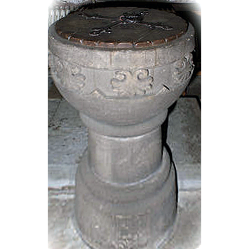
Image copyright © Barlow Parish, 2011
No known copyright restriction / Fair Dealing
Results: 6 records
view of font and cover
Scene Description: the modern font
Copyright Statement: Image copyright © Barlow Parish, 2011
Image Source: digital photograph in the Parish web site [www.barlow-church.org.uk/images/Font300.jpg] [accesed 15 September 2011]
Copyright Instructions: No known copyright restriction / Fair Dealing
view of church exterior - south portal
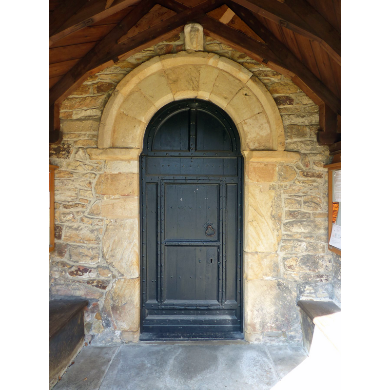
Copyright Statement: Image copyright © Dave Dunford, 2017
Image Source: digital photograph taken 23 March 2017 by Dave Dunford [www.geograph.org.uk/photo/5609877] [accessed 2 October 2018]
Copyright Instructions: CC-BY-SA-2.0
view of church exterior - south porch
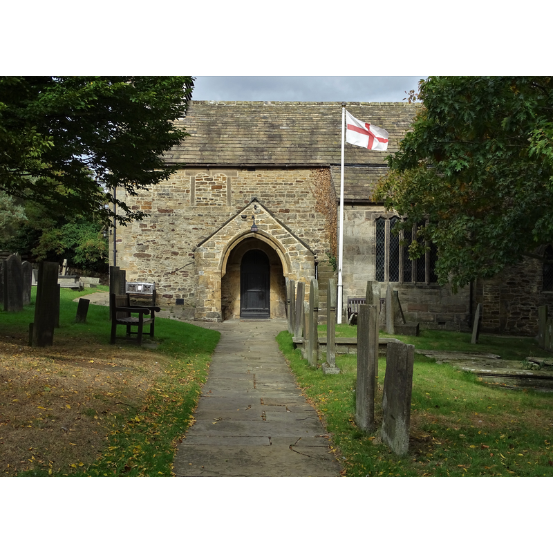
Copyright Statement: Image copyright © Neal Theasby, 2018
Image Source: digital photograph taken 1 October 2018 by Neal Theasby [www.geograph.org.uk/photo/5925835] [accessed 2 October 2018]
Copyright Instructions: CC-BY-SA-2.0
view of church exterior - southwest end
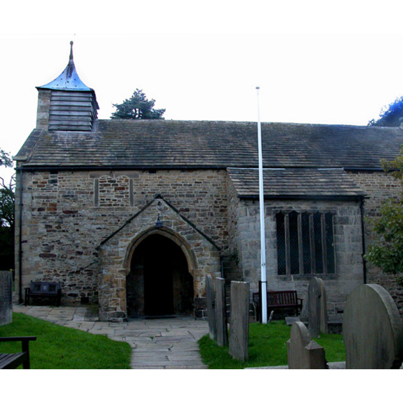
Copyright Statement: Image copyright © Roger Temple, 2006
Image Source: digital photograph taken 1 October 2006 by Roger Temple [www.geograph.org.uk/photo/251935] [accessed 11 October 2011]
Copyright Instructions: CC-BY-SA-2.0
view of object
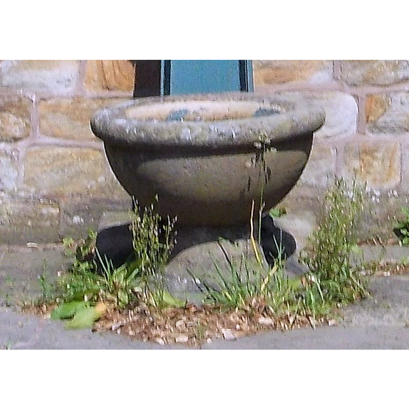
Scene Description: Source caption: "Victorian water pump in Barlow" -- seen here is the trough, looking suspiciously like a modern baptismal font
Copyright Statement: Image copyright © Neal Theasby, 2013
Image Source: edited detail of a digital photograph taken 4 July 2013 by Neal Theasby [www.geograph.org.uk/photo/3540232] [accessed 2 October 2018]
Copyright Instructions: CC-BY-SA-2.0
view of object in context
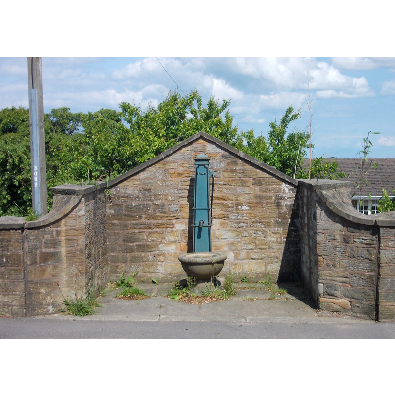
Scene Description: Source caption: "Victorian water pump in Barlow"
Copyright Statement: Image copyright © Neal Theasby, 2013
Image Source: digital photograph taken 4 July 2013 by Neal Theasby [www.geograph.org.uk/photo/3540232] [accessed 2 October 2018]
Copyright Instructions: CC-BY-SA-2.0
INFORMATION
Font ID: 11538BAR
Object Type: Baptismal Font1?
Font Century and Period/Style: 11th - 12th century?, Norman
Church / Chapel Name: Parish Church of St. Laurence [aka St. Lawrence]
Church Patron Saint(s): St. Lawrence [aka Laurence]
Church Address: Hackney Lane, Great Barlow, Derbyshire, S18 7TQ, UK -- Tel.: +44 1246 558112
Site Location: Derbyshire, East Midlands, England, United Kingdom
Directions to Site: Located off (W) the B6051, 6-7 km NW of Chesterfield, 15-20 km SSW of Sheffield
Ecclesiastic Region: Diocese of Derby
Historical Region: Hundred of Scarsdale
Additional Comments: disappeared font? (the one from the original 11th-12thC church here)
Font Notes:
Click to view
There is an entry for this Barlow [variant spelling] in the Domesday survey [http://opendomesday.org/place/XX0000/barlow/] [accessed 2 October 2018] but it mentions neither cleric nor church in it. The present font in this church is modern, consisting of a hemispherical basin decorated with foliage motif, raised on a round moulded pedestal base. The wooden cover is flat and round, with metal decoration and ring handle; also modern. The entry for this church in Historic England [Listing NGR: SK3441974698] reports "a C19 font, with a circular bowl with foliage decoration, standing on a moulded stem" in it. [NB: the Norman church here may have been sponsored by Hascoit Muscaard from Honfleur [cf. www.peakdistrictonline.co.uk/barlow-c2224.html [accessed 16 September 2011], a Norman baron who received the land from William the Conqueror; we have no information on the earlier font [Norman?] of this church] [NB: there is a water pump of the Victorian period that uses a water trough suspiciously looking like a modern stone font].
COORDINATES
UTM: 30U 600998 5903179
Latitude & Longitude (Decimal): 53.26823, -1.4856
Latitude & Longitude (DMS): 53° 16′ 5.63″ N, 1° 29′ 8.16″ W