Northaw / Northag / Northaga / Northall / Northauge
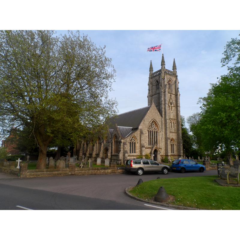
Image copyright © Bikeboy, 2015
CC-BY-SA-2.0
Results: 3 records
view of church exterior - northeast view
Scene Description: Source caption: "St Thomas a Becket church, Northaw. Built in 1881 replacing a church built in 1809. Nothing remains of the earlier church which stood on this site except the C15 octagonal font in the churchyard by the south door to the nave. There are several C15 documentary references to the earlier church (mainly regarding bequests to the church) in the St Albans wills."
Copyright Statement: Image copyright © Bikeboy, 2015
Image Source: digital photograph taken 10 May 2015 by Bikeboy [www.geograph.org.uk/photo/4476770] [accessed 27 September 2016]
Copyright Instructions: CC-BY-SA-2.0
view of church exterior - south view
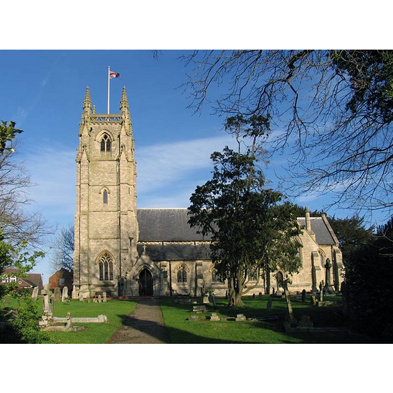
Copyright Statement: Image copyright © John Salmon, 2012
Image Source: digital photograph taken 24 January 2006 by John Salmon [www.geograph.org.uk/photo/367964] [accessed 27 September 2016]
Copyright Instructions: CC-BY-SA-2.0
view of church interior - nave - looking east
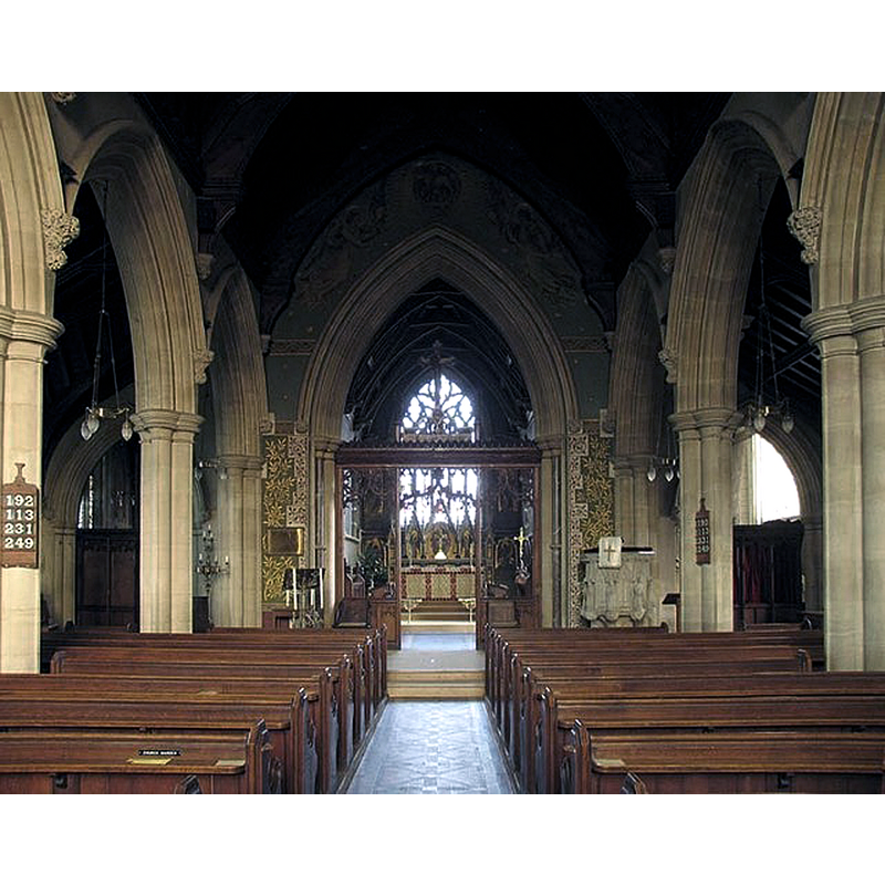
Copyright Statement: Image copyright © John Salmon, 2012
Image Source: digital photograph taken 24 January 2006 by John Salmon [www.geograph.org.uk/photo/367970] [accessed 27 September 2016]
Copyright Instructions: CC-BY-SA-2.0
INFORMATION
Font ID: 11526NOR
Object Type: Baptismal Font1
Font Century and Period/Style: 15th century, Perpendicular
Church / Chapel Name: Parish Church of St. Tomas the Martyr [aka St. Thomas of Canterbury]
Font Location in Church: Reported in the churchyard ca. 1911 [cf. FontNotes]
Church Patron Saint(s): St. Thomas of Canterbury [aka St. Thomas à Becket]
Church Address: 1 Vineyards Road, Northaw EN6 4NW, UK
Site Location: Hertfordshire, East, England, United Kingdom
Directions to Site: Located off the B156, just E of Potters Bar, N of London
Ecclesiastic Region: Diocese of St. Albans
Historical Region: Hundred of Cashio
Additional Comments: damaged font / disused font (part of it in the churchyard / replaced font)
Font Notes:
Click to view
No entry found for Northaw in the Domesday survey. The Victoria County History (Hertfordshire, vol. 2, 1908) notes: "Northaw was a chapelry of St. Peter's in St. Albans […] till the middle of the sixteenth century, […] and all tithes and oblations were held by the sacristan of the monastery of St. Albans in the fourteenth century […] The church of ST. THOMAS THE MARTYR has been entirely rebuilt, and no vestige of the former building remains except the fifteenth-century octagonal font, which is set in the churchyard near the south door of the nave. It has on its bowl floral patterns alternating with shields bearing a plain St. George's cross." The font is noted in the Royal Commission on Historical Monuments, Hertfordshire (1911): "in the churchyard is part of a 15th-century font". [NB: the modern, 19th-century Victorian font in use is noted in Gough (1792): "octagon, with shields of arms, &c.", and described in Tompkins (1922): "finely carved font of Ancaster stone, on marble pillars, presented by the children of the parish."]
COORDINATES
UTM: 30U 696887 5732088
Latitude & Longitude (Decimal): 51.705141, -0.150457
Latitude & Longitude (DMS): 51° 42′ 18.51″ N, 0° 9′ 1.64″ W
MEDIUM AND MEASUREMENTS
Material: stone
Font Shape: octagonal
Basin Interior Shape: round
Basin Exterior Shape: octagonal
REFERENCES
- Victoria County History [online], University of London, 1993-. URL: https://www.british-history.ac.uk.
- Great Britain. Royal Commission on Historical Monuments (England), An Inventory of the Historical Monuments in Hertfordshire, London: Printed for His Majesty's Stationary Office by J. Truscott, 1911, p. 156
- Lucot, P., "L'ancienne cuve de la cathédrale de Châlons-sur-Marne", 1901-1902, Mémoires de la Société d'agriculture, commerce, sciences et arts du Département de la Marne, 1901-1902, pp. 65-71; p. 195
- Tompkins, Herbert Winckworth, Hertfordshire, London: Methuen & Co., 1922, [www.guttenberg.org/files/18252/18252-8.txt]