Winfrith Newburgh / Winfrith / Winfrode
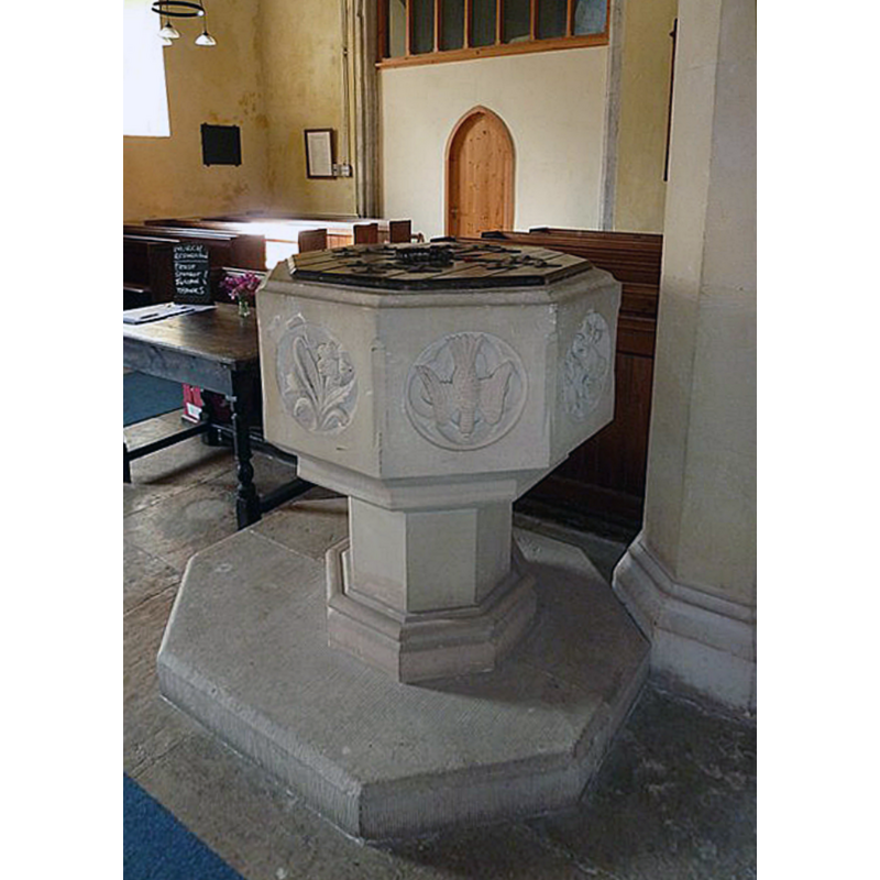
Image copyright © Basher Eyre, 2012
CC-BY-SA-2.0
Results: 3 records
view of font and cover in context
Scene Description: the modern font
Copyright Statement: Image copyright © Basher Eyre, 2012
Image Source: edited detail of a digital photograph taken 3 September 2012 by Basher Eyre [www.geograph.org.uk/photo/3260170] [accessed 4 October 2019]
Copyright Instructions: CC-BY-SA-2.0
view of font
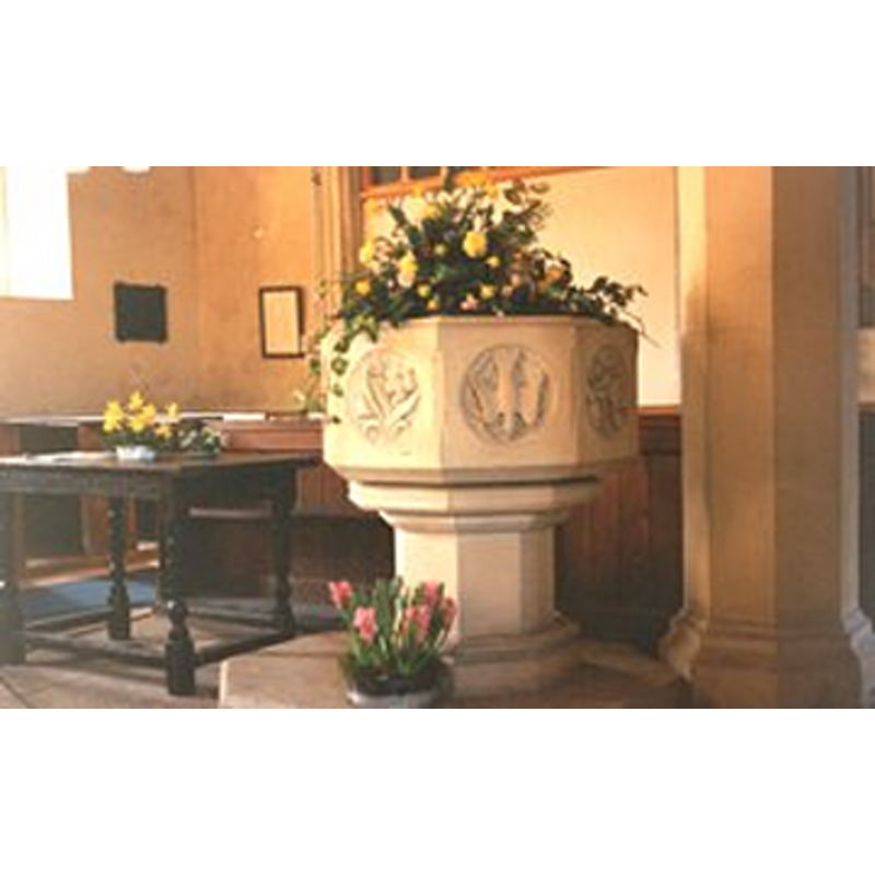
Copyright Statement: Image copyright © The Dorset Historic Churches Trust, 2003
Image Source: digital photograph in The Dorset Historic Churches Trust [http://dorsethistoricchurchestrust.co.uk]
Copyright Instructions: Standing permission
view of church exterior - south view
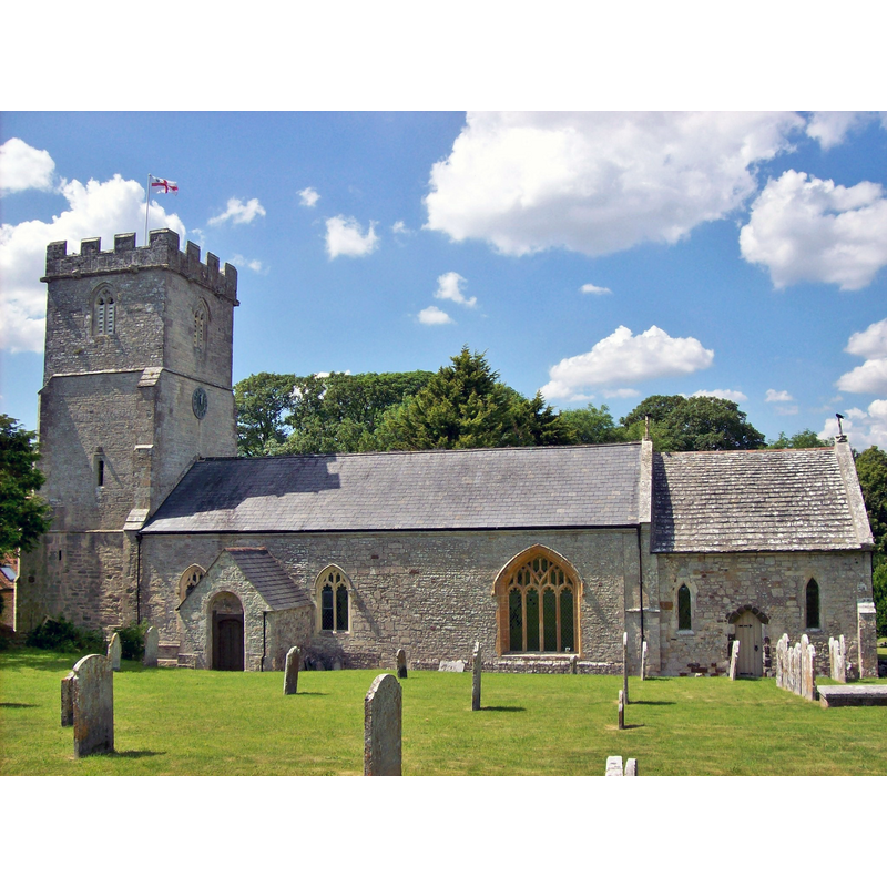
Copyright Statement: Image copyright © [in the public domain]
Image Source: digital photograph taken 16 June 2014 by Poliphilo [https://commons.wikimedia.org/wiki/File:St_Christopher,_Winfrith_Newburgh.JPG] [accessed 4 October 2019]
Copyright Instructions: CC-Zero
INFORMATION
Font ID: 11439WIN
Object Type: Baptismal Font1?
Font Century and Period/Style: 12th - 13th century, Transitional / Early English
Church / Chapel Name: Parish Church of St. Christopher
Church Patron Saint(s): St. Christopher
Church Notes: original 13thC (?) church; modifed mid-19thC
Church Address: 3 Fields Barn, Winfrith Newburgh, Dorchester DT2 8HB, UK
Site Location: Dorset, South West, England, United Kingdom
Directions to Site: Located off (S) the A352, 13 km W of Wareham, 16 km E of Dorchester
Ecclesiastic Region: Diocese of Salisbury
Historical Region: Hundred of Winfrith [Newburgh]
Additional Comments: disappeared font? (only the Victorian one survives in this 13th-century church or the earlier one at Domesday)
Font Notes:
Click to view
There are two entries for Winfrith [Newburgh] [variant spelling] in the Domesday survey [https://opendomesday.org/place/SY8084/winfrith-newburgh/] [accessed 4 October 2019], neither of which mentions a church in it; the second entry is for the land of Bolla [Bollo?], who is identified as 'Bolla the priest' [presbiter [...] ecclesiam de Wintrode], lord and tenant in 1086. The Dorset Historic Churches Trust [http://dorsethistoricchurchestrust.co.uk] ^accessed 9 January 2006 notes an octagonal font of the time of the Victorian renovation of this church in 1852. The modern font consists of an octagonal basin with large symbols [dove, etc.] inscribed in circles on the sides, and a graded chamfer; raised on a polygonal stem and lower base. [NB: the fabric of this church date back to the 13th century, but we have no information of the earlier font(s) of this church]
Credit and Acknowledgements: ¸
COORDINATES
UTM: 30U 551125 5612084
Latitude & Longitude (Decimal): 50.65836, -2.2767
Latitude & Longitude (DMS): 50° 39′ 30.1″ N, 2° 16′ 36.12″ W