Hinton St. Mary / Haintone
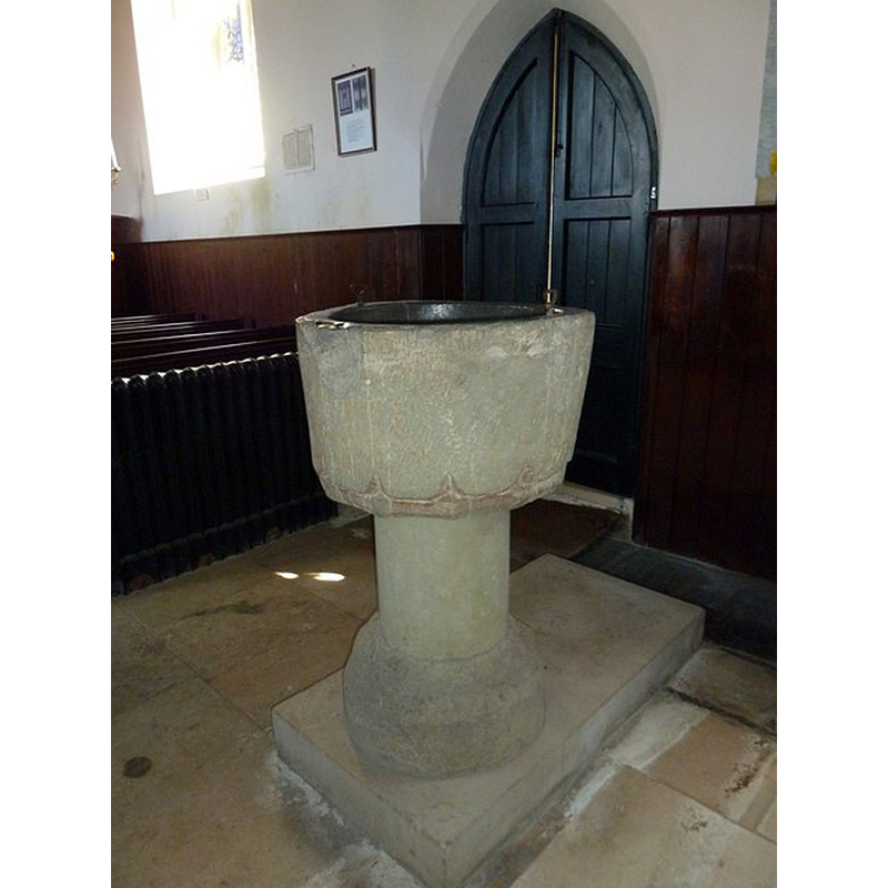
Image copyright © Basher Eyre, 2013
CC-BY-SA-2.0
Results: 4 records
view of font in context
Copyright Statement: Image copyright © Basher Eyre, 2013
Image Source: digital photograph taken 31 August 2013 by Basher Eyre [www.geograph.org.uk/photo/3678137] [accessed 13 February 2018]
Copyright Instructions: CC-BY-SA-2.0
design element - motifs
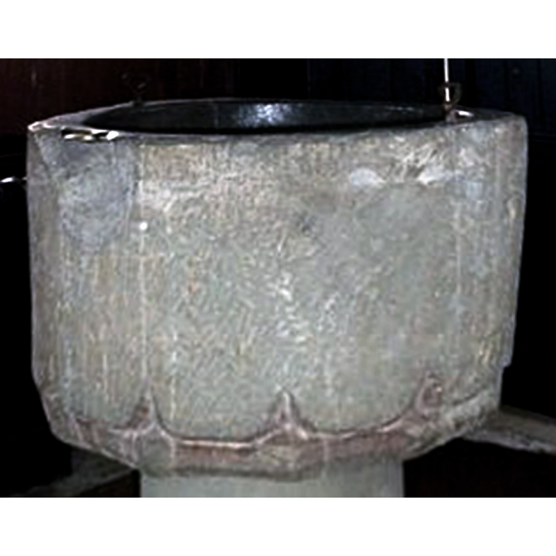
Scene Description: a later alteration of the Early English basin -- notice also the metal staples and the lead lining
Copyright Statement: Image copyright © Basher Eyre, 2013
Image Source: edited detail of a digital photograph taken 31 August 2013 by Basher Eyre [www.geograph.org.uk/photo/3678137] [accessed 13 February 2018]
Copyright Instructions: CC-BY-SA-2.0
view of church exterior - northwest view
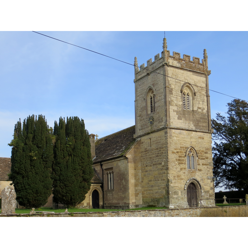
Copyright Statement: Image copyright © Peter Wood, 2014
Image Source: digital photograph taken 29 March 2014 by Peter Wood [www.geograph.org.uk/photo/3923477] [accessed 13 February 2018]
Copyright Instructions: CC-BY-SA-2.0
view of church exterior in context - northwest view
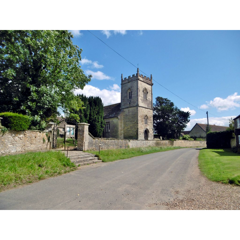
Copyright Statement: Image copyright © Mike Faherty, 2017
Image Source: digital photograph taken 19 August 2017 by Mike Faherty [www.geograph.org.uk/photo/5503858] [accessed 13 February 2018]
Copyright Instructions: CC-BY-SA-2.0
INFORMATION
Font ID: 11367HIN
Object Type: Baptismal Font1
Font Century and Period/Style: 13th century, Early English
Cognate Fonts: Similar basins of the same period at Stratton and Margaret Marsh, both in Dorset
Church / Chapel Name: Parish Church of St. Peter
Font Location in Church: Inside the church, W end of the nave, by the S entranceway
Church Patron Saint(s): St. Peter
Church Address: Hinton St Mary, Sturminster Newton DT101NA, UK -- Tel.: 01258 471276
Site Location: Dorset, South West, England, United Kingdom
Directions to Site: Located off the B3092, 2 km N of Sturminster Newton, 12-13 km SW of Shaftesbury
Ecclesiastic Region: Diocese of Salisbury
Historical Region: Hundred of [Sturminster] Newton
Additional Comments: altered font (re-cut?)
Font Notes:
Click to view
There is an entry for Hinton [St Mary] [variant spelling] in the Domesday survey [http://opendomesday.org/place/ST7816/hinton-st-mary/] [accessed 13 February 2018], but it mentions neither cleric nor church in it. Long (1923) mentions a baptismal font of the Early English period with a plain round bowl in this church. The Inventory of the Historical Monuments (Dorset, vol. 3, 1970) notes: "The West Tower dates from the second half of the 15th century but the rest of the church, consisting of Chancel, Nave, North Vestry and South Porch, was rebuilt in 1846 [...] Font: of Purbeck marble, coarsely tooled; round bowl with tapering sides and lobed twelve-sided moulding underneath, stem cylindrical, base circular, coarsely moulded and much worn; bowl and base probably 13th century, bowl with later mediaeval recutting; stem modern". There are two metal staples in the upper rim, and the north end has considerable damage; the font is lead-lined..
COORDINATES
UTM: 30U 548862 5643787
Latitude & Longitude (Decimal): 50.94363, -2.3045
Latitude & Longitude (DMS): 50° 56′ 37.07″ N, 2° 18′ 16.2″ W
MEDIUM AND MEASUREMENTS
Material: stone
Font Shape: bucket-shaped, mounted
Basin Interior Shape: round
Basin Exterior Shape: round
Drainage Notes: lead-lined
LID INFORMATION
Notes: [cf. FontNotes]
REFERENCES
- Long, E.T., "Dorset church fonts", 44, Proceedings of the Dorset Natural History and Antiquarian Field Club, 1923, pp. 62-76; p. 69, 76