Langton Long Blandford / Blaneford / Bleneford / Langton Long
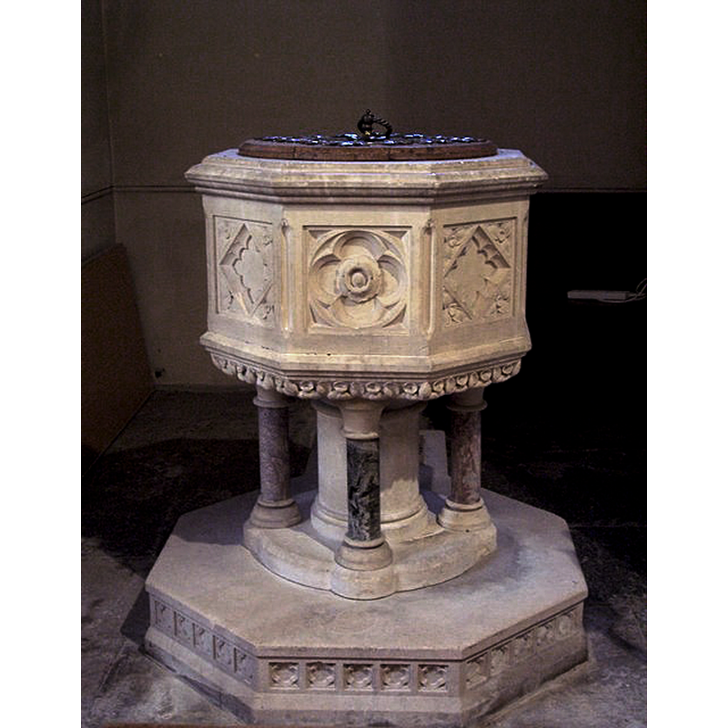
Image copyright © Maigheach-gheal, 2007
CC-BY-SA-2.0
Results: 4 records
view of font and cover
Scene Description: Source caption: "All Saints Church, Langton Long [...] The font dates from the 19th century."
Copyright Statement: Image copyright © Maigheach-gheal, 2007
Image Source: digital photograph taken 29 May 2007 by Maigheach-gheal [www.geograph.org.uk/photo/452440] [accessed 2 December 2018]
Copyright Instructions: CC-BY-SA-2.0
view of font
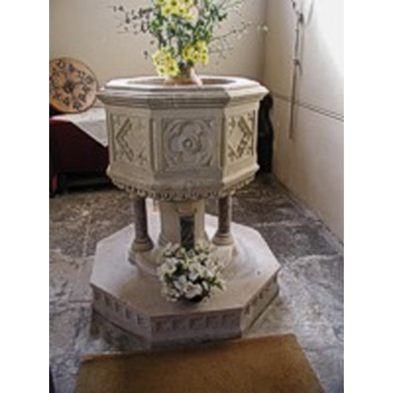
Scene Description: the Victorian font
Copyright Statement: Image copyright © The Dorset Historic Churches Trust, 2005
Image Source: digital image in The Dorset Historic Churches Trust, 2005 [http://dorsethistoricchurchestrust.co.uk]
Copyright Instructions: Standing permission
view of church exterior in context
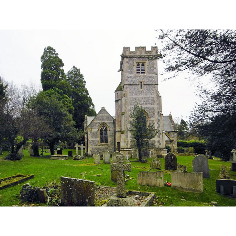
Scene Description: the mid-19thC church
Copyright Statement: Image copyright © Mike Faherty 2015
Image Source: digital photograph taken 16 December 2015 by Mike Faherty [www.geograph.org.uk/photo/4766217] [accessed 2 December 2018]
Copyright Instructions: CC-BY-SA-2.0
view of church interior - nave - looking east
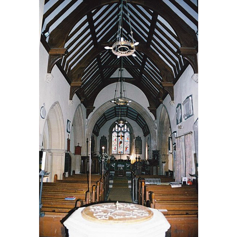
Scene Description: the top of the modern font seen here in the foreground of the mid-19thC nave
Copyright Statement: Image copyright © Chris Downer, 2005
Image Source: digital photograph taken in November 2005 by Chris Downer [www.geograph.org.uk/photo/500491] [accessed 2 December 2018]
Copyright Instructions: CC-BY-SA-2.0
INFORMATION
Font ID: 11327LAN
Object Type: Baptismal Font1?
Font Century and Period/Style: Medieval
Church / Chapel Name: Parish Church of All Saints, Langton Long Blandford
Church Patron Saint(s): All Saints
Church Address: 25, Langton Long Blandford, Blandford Forum DT11 9HS, UK -- Tel.: (01258) 489340
Site Location: Dorset, South West, England, United Kingdom
Directions to Site: Located off (E) the A354, 1-2 km SE of Blandford Forum, 22 km NW of Poole
Ecclesiastic Region: Diocese of Salisbury
Historical Region: Hundred of Pimperne
Additional Comments: disappeared font? (the one from the possible medieval church here?)
Font Notes:
Click to view
There are three entries for [Langton Long] Blandford [variant spellings] in the Domesday survey [https://opendomesday.org/place/ST8905/langton-long-blandford/] [accessed 2 December 2018] none of which mentions cleric or church in it. The entry for this partish in the Inventory of the Historical Monuments in Dorset (vol. 4, North, 1972) notes: "The Parish Church of All Saints, in the E. of the village, was rebuilt in 1861 to designs by T. H. Wyatt (Sarum Dioc. Regy.); the former church, built c. 1740, appears to have incorporated some part of a mediaeval structure (Hutchins I, 284), but nothing of this remains today. Some fittings from the two earlier churches are reset in the present building"; no font mentioned in it. The entry for this church in Historic England [Listing NGR: ST8987505916] notes: "Anglican rural parish church, built in 1861 to a design by Thomas Henry Wyatt (1807-1880). [...] octagonal stone font with carved panelled sides, set on a cylindrical pier with four marble sub-shafts. [...] It has been suggested that the church was built on the site of a former parish church of uncertain date and that the brass memorial of 1457 to John Whitewood situated in the current church, may be of this former parish church, however there is no firm evidence to support this. The Dorset Historic Churches Trust [http://dorsethistoricchurchestrust.co.uk/langton_long.htm] reports: "beautiful font, supported on a central pillar and four marble shafts." The font consists of an octagonal basin the sides of which are decorated with square and quatrefoil motifs, rosettes, etc., the underbowl ornamented as well; the base as indicated above, but raised on an octagonal lower base or plinth. It must belong to the rebuilding of the church in the 1860s [NB: although there must have been a font in the old church, we have no information on the earlier font(s) of this church]
Credit and Acknowledgements: We are grateful to Robin Adeney and The Dorset Historic Churches Trust [www.dorsethistoricchurchestrust.co.uk], for the photograph of this font
COORDINATES
UTM: 30U 560121 5633788
Latitude & Longitude (Decimal): 50.85266, -2.1459
Latitude & Longitude (DMS): 50° 51′ 10″ N, 2° 08′ 45″ W