Burstock / Bureuuinestoch / Bvrevvinestoch
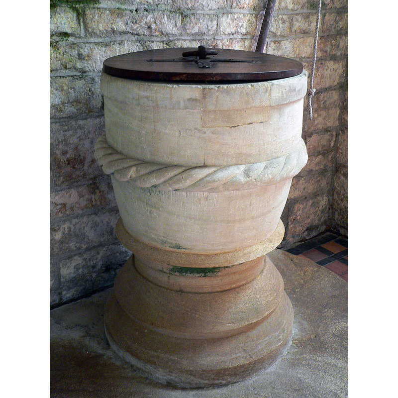
Image copyright © Ray Jennings, 2022
CC-BY-SA-2.5
Results: 5 records
view of font and cover
Scene Description: Source caption: "St. Andrew's, Burstock, Somerset [sic] The font"
Copyright Statement: Image copyright © Ray Jennings, 2022
Image Source: digital photograph 7 July 2009 by Ray Jennings [https://www.geograph.org.uk/photo/7366019] [accessed 27 June 2024]
Copyright Instructions: CC-BY-SA-2.5
view of font and cover
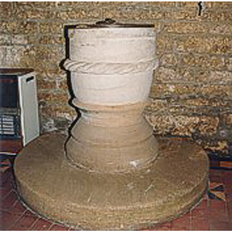
Copyright Statement: Image copyright © The Dorset Historic Churches Trust, 2005
Image Source: digital image in The Dorset Historic Churches Trust web site [http://dorsethistoricchurchestrust.co.uk]
Copyright Instructions: Standing permission
design element - motifs - rope moulding
Scene Description: all around the middle of the basin
Copyright Statement: Image copyright © Ray Jennings, 2022
Image Source: digital photograph 7 July 2009 by Ray Jennings [https://www.geograph.org.uk/photo/7366019] [accessed 27 June 2024]
Copyright Instructions: CC-BY-SA-2.5
view of church exterior - southeast view
![Source caption: "St Andrew's, Burstock, Somerset" [sic]](/static-50478a99ec6f36a15d6234548c59f63da52304e5/compressed/1240627001_compressed.png)
Scene Description: Source caption: "St Andrew's, Burstock, Somerset" [sic]
Copyright Statement: Image copyright © Ray Jennings, 2022
Image Source: digital photograph 7 July 2009 by Ray Jennings [https://www.geograph.org.uk/photo/7356549] [accessed 27 June 2024]
Copyright Instructions: CC-BY-SA-2.5
view of church interior - looking east
![Source caption: "St Andrew's, Burstock, Somerset" [sic]](/static-50478a99ec6f36a15d6234548c59f63da52304e5/compressed/1240627003_compressed.png)
Scene Description: Source caption: "St Andrew's, Burstock, Somerset" [sic]
Copyright Statement: Image copyright © Ray Jennings, 2022
Image Source: digital photograph 7 July 2009 by Ray Jennings [https://www.geograph.org.uk/photo/7356552] [accessed 27 June 2024]
Copyright Instructions: CC-BY-SA-2.5
INFORMATION
Font ID: 11289BUR
Object Type: Baptismal Font1
Font Century and Period/Style: 12th century [basin only], Norman [altered]
Church / Chapel Name: Parish Church of St. Andrew
Font Location in Church: Inside the church
Church Patron Saint(s): St. Andrew
Church Address: Burstock, Beaminster, UK
Site Location: Dorset, South West, England, United Kingdom
Directions to Site: Located off road B3162 and B3164, about 15 km NNW of Bridport
Ecclesiastic Region: Diocese of Salisbury
Historical Region: Hundred of Whitchurch [Canonicorum] [in Domesday]
Additional Comments: altered font? (a Norman basin on a later base?)
Font Notes:
Click to view
There is an entry for Burstock [variant spelling] in the Domesday survey [https://opendomesday.org/place/ST4202/burstock/] [accessed 26 June 2024]; it mentions neither cleric nor church in it. In Newman & Pevsner (1972): "Font. Norman, tub-shaped, with a rope moulding." Illustrated in The Dorset Historic Churches Trust web site [http://dorsethistoricchurchestrust.co.uk]. The entry for this church in Historic England [Listing NGR: ST4222602914] notes: "Parish Church. Nave, possibly C12 core [...] Font: cylindrical stone bowl, with large rope-moulding round the centre, lead-lined, C12."
COORDINATES
UTM: 30U 512608 5630174
Latitude & Longitude (Decimal): 50.82315, -2.821
Latitude & Longitude (DMS): 50° 49′ 23.34″ N, 2° 49′ 15.6″ W
MEDIUM AND MEASUREMENTS
Material: stone
Font Shape: round
Basin Interior Shape: round
Basin Exterior Shape: round
Drainage Notes: lead lined
LID INFORMATION
Date: modern
Material: wood, oak?
Apparatus: no
Notes: round and flat, with metal decoration and ring moulding
REFERENCES
- Pevsner, Nikolaus, Dorset, Harmondsworth: Penguin, 1972, p. 123