Hartlepool / Hartinpooell / Herterpol / Hertilpol / Hertlepole / Hertylpull / Hiartapoll
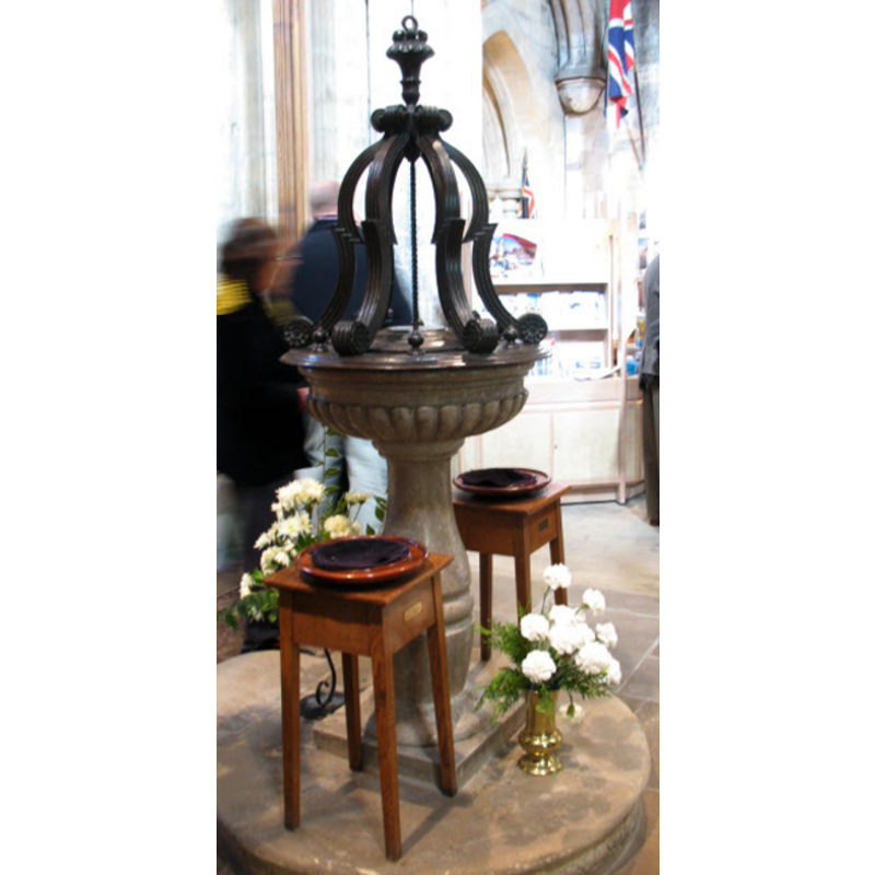
Image copyright © Stephen Craven, 2008
CC-BY-SA-3.0
Results: 2 records
view of font and cover
Scene Description: the modern font [cf. FontNotes]
Copyright Statement: Image copyright © Stephen Craven, 2008
Image Source: digital photograph taken 23 September 2008 by Stephen Craven [www.geograph.org.uk/photo/979785] [accessed 14 March 2012]
Copyright Instructions: CC-BY-SA-3.0
view of church exterior - southwest view
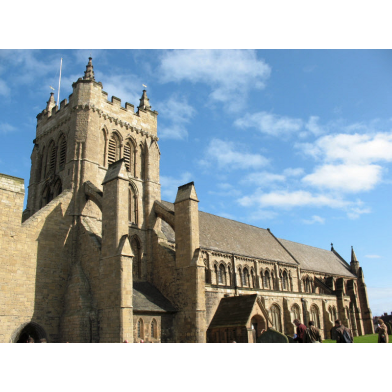
Copyright Statement: Image copyright © Stephen Craven, 2008
Image Source: digital photograph taken 23 September 2008 by Stephen Craven [www.geograph.org.uk/photo/979761] [accessed 14 March 2012]
Copyright Instructions: CC-BY-SA-3.0
INFORMATION
Font ID: 11276HAR
Object Type: Baptismal Font1?
Font Century and Period/Style: 12th century (late?), Late Norman? / Transitional?
Church / Chapel Name: Parish Church [formerly a chapel] of St. Hilda
Church Patron Saint(s): St. Hilda of Whitby [aka Hilde]
Church Address: Church Close, Hartlepool, County Durham, TS24 0PW, United Kingdom
Site Location: Durham, North East, England, United Kingdom
Directions to Site: Located off the A179, by the sea
Ecclesiastic Region: Diocese of Durham
Historical Region: Stockton Ward
Additional Comments: disappeared font? (the original or earlier font?)
Font Notes:
Click to view
Noted in Mackenzie (1834): "The font is an elegant bason of Yorkshire marble, 'the gift of George Bowes, Esq., 1728'". Billings (1846) reports "a font of late date, which, though it is richly sculptured, has little to recommend it as a work of art." The Victoria County History (Durham, vol. 3, 1928) notes: "With the exception of an earlier south doorway, the church was erected about 1189 to 1215, and completed probably in 1237. [...] The earlier building, to which the south doorway belonged, was probably the first church on the present site, and may have been erected during the lifetime of Robert Brus I, the founder of Guisborough Priory, who died in 1141. [...] The font was 'the gift of Geo. Bowes, Esq., 1728,' and consists of a circular scalloped marble basin and shaft, with contemporary wooden cover." In Pevsner (1983): "Font. Of baluster type; 1728." [NB: we have no information on a possible earlier font in this church, formerly a chapel, which existed already in 1195 -- the churches of St. Andrew and Holy Trinity are both 19th-century].
COORDINATES
UTM: 30U 617183 6062411
Latitude & Longitude (Decimal): 54.69537, -1.18177
Latitude & Longitude (DMS): 54° 41′ 43.33″ N, 1° 10′ 54.37″ W
REFERENCES
- Victoria County History [online], University of London, 1993-. URL: https://www.british-history.ac.uk.
- Billings, Robert William, Illustrations of the architectural antiquities of the County of Durham: ecclesiastical, castellated, and domestic, Durham; London: Published by George Andrews, and the author; and also by T. and W. Boone [...], 1846, p. 42
- Mackenzie, Eneas, An historical, topographical, and descriptive view of the county palatine of Durham: comprehending the various subjects of natural, civil, and ecclesiastical geography, agriculture, mines, manufactures […], Newcastle-upon-Tyne: Mackenzie & Dent, 1834, vol. 2: 474
- Pevsner, Nikolaus, County Durham, Harmondsworth: Penguin Books, 1983, p. 308