Chester-le-Street / Conceastre / Cuncacestre / Cunecaster
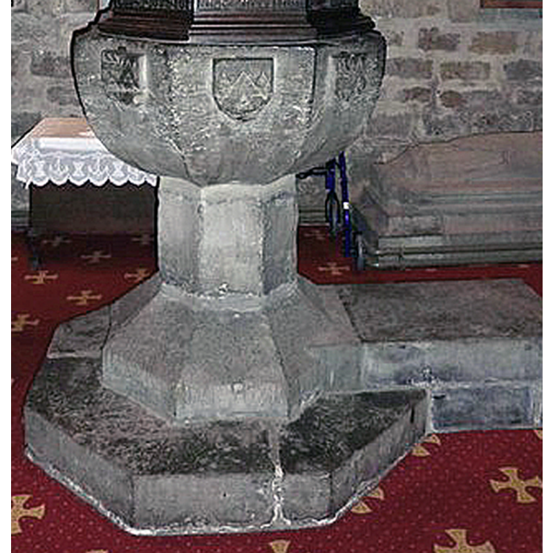
Image copyright © Alexander P Kapp, 2011
CC-BY-SA-3.0
Results: 7 records
view of font - north side
Copyright Statement: Image copyright © Alexander P Kapp, 2011
Image Source: edited detail of a digital photograph taken 25 August 2011 by Alexander P Kapp [www.geograph.org.uk/photo/2605640] [accessed 29 November 2019]
Copyright Instructions: CC-BY-SA-3.0
view of font and cover
Copyright Statement: Image copyright © Alexander P Kapp, 2011
Image Source: digital photograph taken 25 August 2011 by Alexander P Kapp [www.geograph.org.uk/photo/2605640] [accessed 29 November 2019]
Copyright Instructions: CC-BY-SA-3.0
symbol - shield - coat of arms
Scene Description: several [eight?] -- unidentified
Copyright Statement: Image copyright © Alexander P Kapp, 2011
Image Source: edited detail of a digital photograph taken 25 August 2011 by Alexander P Kapp [www.geograph.org.uk/photo/2605640] [accessed 29 November 2019]
Copyright Instructions: CC-BY-SA-3.0
view of church exterior - west view
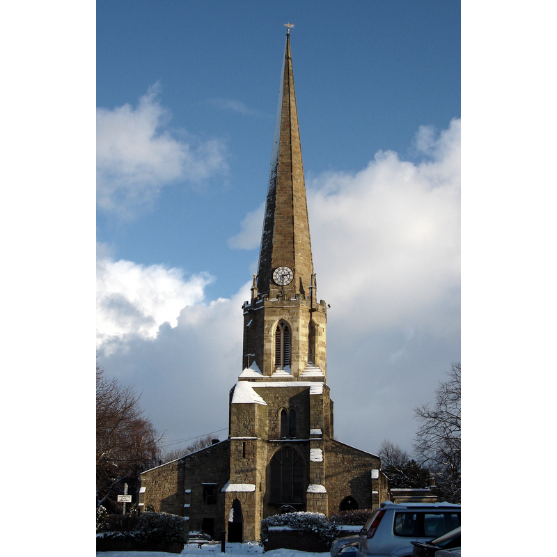
Scene Description: Source caption: "Parish church of St Mary and St Cuthbert, Chester-le-Street, County Durham, seen from the west in snow. The wider left side of the church is The Ankers House. The black shape in front of the church is the war memorial."
Copyright Statement: Image copyright © JohnBlackburne, 2010
Image Source: digital photograph taken 6 January 2010 by JohnBlackburne [https://commons.wikimedia.org/wiki/File:St_Mary_and_St_Cuthbert's_Church,_Chester-le-Street,_County_Durham.jpg] [accessed 29 November 2019]
Copyright Instructions: GFDL / CC-BY-SA-3.0
view of church interior - looking west
Copyright Statement: Image copyright © Alexander P Kapp, 2011
Image Source: digital photograph taken 25 August 2011 by Alexander P Kapp [www.geograph.org.uk/photo/2605637] [accessed 29 November 2019]
Copyright Instructions: CC-BY-SA-3.0
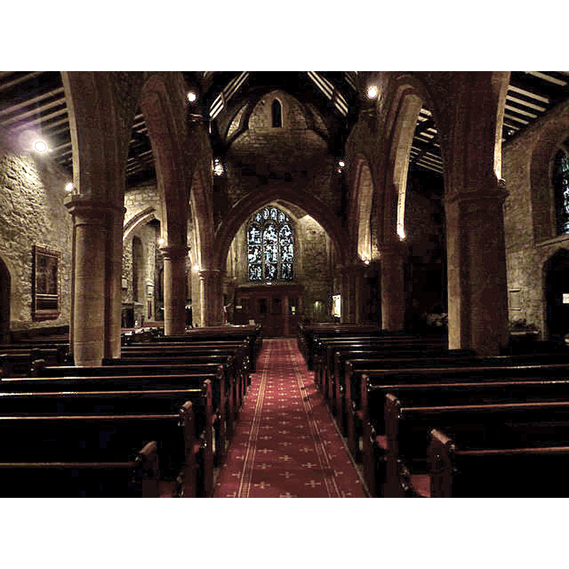
view of church interior - looking east
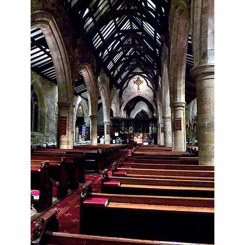
Copyright Statement: Image copyright © Alexander P Kapp, 2011
Image Source: digital photograph taken 25 August 2011 by Alexander P Kapp [www.geograph.org.uk/photo/2605661] [accessed 29 November 2019]
Copyright Instructions: CC-BY-SA-3.0
view of font cover
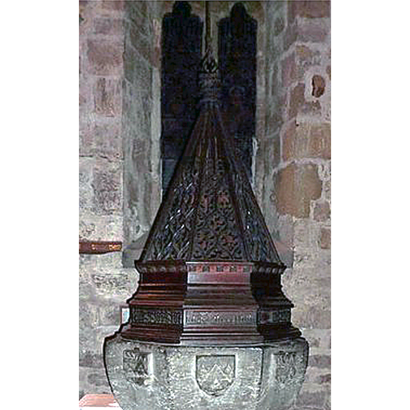
Scene Description: probably from the Victorian restoration of the church
Copyright Statement: Image copyright © Alexander P Kapp, 2011
Image Source: edited detail of a digital photograph taken 25 August 2011 by Alexander P Kapp [www.geograph.org.uk/photo/2605640] [accessed 29 November 2019]
Copyright Instructions: CC-BY-SA-3.0
INFORMATION
Font ID: 11268CHE
Object Type: Baptismal Font1
Font Century and Period/Style: 15th century, Perpendicular
Workshop/Group/Artisan: heraldic font
Cognate Fonts: font at Staindrop
Church / Chapel Name: Parish Church of St. Mary and St. Cuthbert
Font Location in Church: Inside the church
Church Patron Saint(s): St. Mary the Virgin & St. Cuthbert [aka Cubertus]
Church Notes: original church here late-9thC
Church Address: Church Chare, Chester-le-Street DH3 3QB, UK -- Tel.: +44 191 388 3295
Site Location: Durham, North East, England, United Kingdom
Directions to Site: Located off (W) the A167, 10 km N of Durham city, 13 km S of Newcastle
Ecclesiastic Region: Diocese of Durham
Additional Comments: disappeared font? (the one from the late-9thC and mid-11thC church(es) here)
Font Notes:
Click to view
No individual entry found for Chester-le-Street in the Domesday survey. Hutchinson (1823) notes "a handsome white marble font" in the west ned of the nave [NB: probably a later font than the one now in use]. In Pevsner (1983): "Font. Octagonal, C15, with heraldic shields as the sole decoration of the bowl (cf. Staindrop)." The entry for this church in Historic England [Listing NGR: NZ2760051315] notes: "Large parish church. Mid C13 chancel, nave arcade, lower stage of tower and possibly vestry; c.1383 anchorage extended in mid C16; c.1400 belfry and spire; mid C16 east section of north aisle; 1742 porch; 1829 Lambton pew (chapel) by Ignatius Bonomi; 1862 restorations [...] west end Baptistery with C15 font". [NB: this church goes back to the time the monks of Lindisfarne settled in this site in the late-9thC supposedly carrying the body of St. Cuthbert; the old wooden church being replaced by a stone church in the time of Egelric, bishop of Durham 1042-1056 [source: Whellan's Directory of 1894, in the 2005 transcription by Paul R. Joiner [www.pjoiner.demon.co.uk/genuki/DUR/CheterleStreet] -- we have no information on the earlier font(s) of this church]
COORDINATES
UTM: 30U 591673 6079695
Latitude & Longitude (Decimal): 54.855944, -1.571972
Latitude & Longitude (DMS): 54° 51′ 21.4″ N, 1° 34′ 19.1″ W
MEDIUM AND MEASUREMENTS
Material: stone, limestone?
Font Shape: octagonal, mounted
Basin Interior Shape: round
Basin Exterior Shape: octagonal
LID INFORMATION
Material: wood, oak?
Apparatus: yes; pulley
Notes: octagonal pyramid with open-work sides; fleuron finial with attachment to the pulley; probably 19thC
REFERENCES
- Hutchinson, William, The History and Antiquities of the county palatine of Durham, Durham: Printed and published by G. Walker, Sadler Street, 1823, p. 495
- Pevsner, Nikolaus, County Durham, Harmondsworth: Penguin Books, 1983, p. 127