Lead nr. Saxton / Lead Hall / Lede
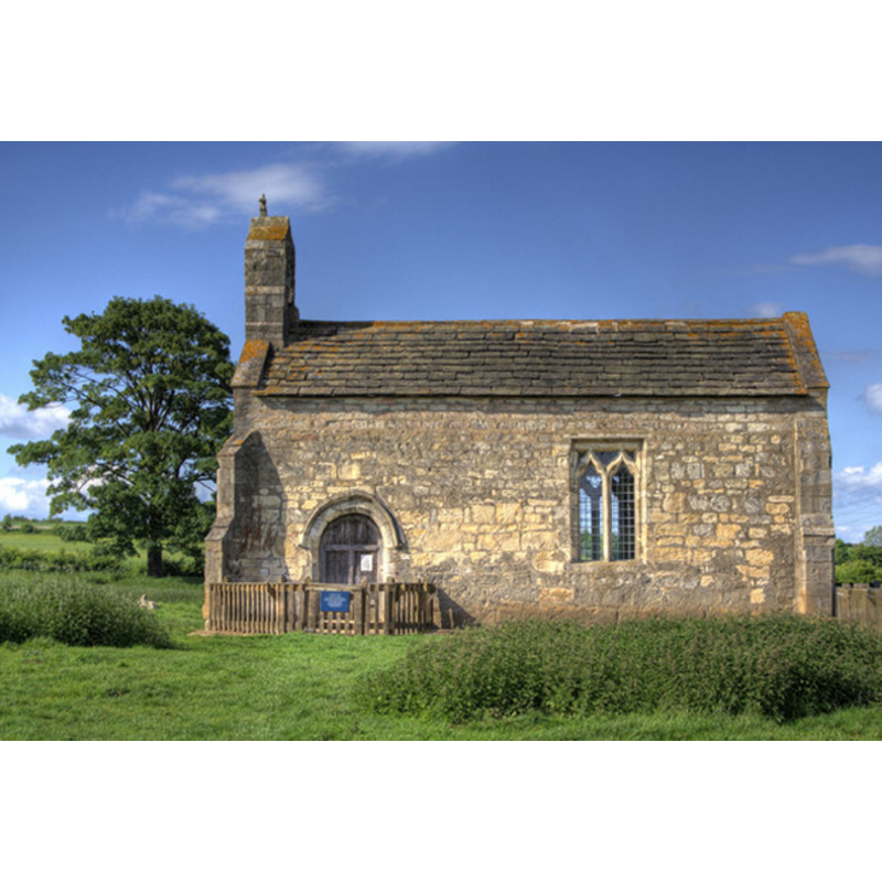
Image copyright © Andrew Whale, 2007
CC-BY-SA-3.0
Results: 4 records
view of church exterior - south view
Copyright Statement: Image copyright © Andrew Whale, 2007
Image Source: digital photograph taken 20 July 2007 by Andrew Whale [www.geograph.org.uk/photo/499712] [accessed 3 June 2012]
Copyright Instructions: CC-BY-SA-3.0
view of church interior - nave - looking east
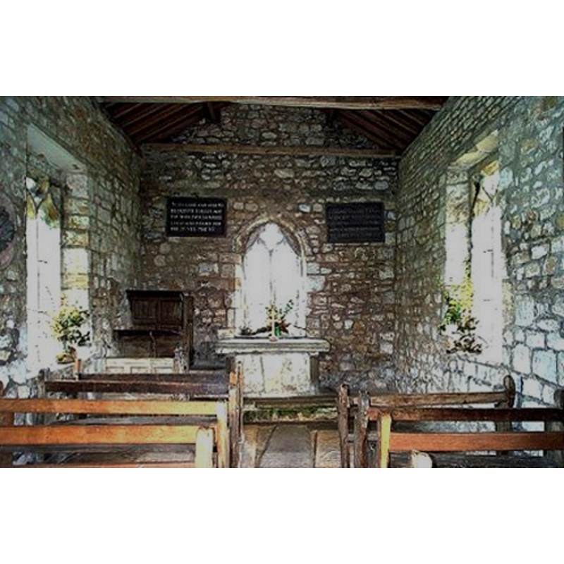
Copyright Statement: Image copyright © Bill Henderson, 2006
Image Source: digital photograph taken 21 August 2006 by Bill Henderson [www.geograph.org.uk/photo/222959] [accessed 3 June 2012]
Copyright Instructions: CC-BY-SA-3.0
view of font and cover in context

Scene Description: the old font and cover by the south doorway
Copyright Statement: Image copyright © Geoffrey Richardson, 2003
Image Source: digital photograph by Geoffrey Richardson [www.trivium.net/realrichard3/gems/leadchurch.html] [accessed 3 June 2012]
Copyright Instructions: PERMISSION NOT AVAILABLE -- IMAGE NOT FOR PUBLIC USE
view of church interior - nave - looking west
Copyright Statement: Image copyright © The Churches Conservation Trust, 2012
Image Source: digital photograph in The Churches Conservation Trust [www.visitchurches.org.uk/Assets/ChurchimagesNorthregion/NYorkshireLeadStMaryint2.jpg] [accessed 3 June 2012]
Copyright Instructions: PERMISSION NOT AVAILABLE -- IMAGE NOT FOR PUBLIC USE
INFORMATION
Font ID: 11228LEA
Object Type: Baptismal Font1
Font Century and Period/Style: 11th - 13th century, Medieval
Church / Chapel Name: St. Mary's Chapel / Chapel of St. Mary [redundant]
Font Location in Church: Inside the church, at the W end of the nave, by the S doorway
Church Patron Saint(s): St. Mary the Virgin
Church Notes: redundant; in the care of the Churches Conservation Trust since 1980 -- an earlier church here may have existed since the 9th century
Church Address: Chapel of St. Mary, Chantry Lane (Bridle Path), Lead, North Yorkshire / Lead, Saxton, Tadcaster, North Yorkshire, LS24 9QN
Site Location: North Yorkshire, Yorkshire and the Humber, England, United Kingdom
Directions to Site: Located off the B1217, 1 km from Saxton, 2 km from Lotherton Hall, 7 km SW of Tadcaster, 16 km NE of Leeds
Font Notes:
Click to view
Bogg (1902) reports a baptismal font in this church, a building which he describes as having been "erected in the thirteenth century as a private chapel to Lead Hall" [NB: the Hall no longer exists]. Mee (1941) notes: "the font looks crude enough to be Norman." The 1967 listing notes in English Heritage read: "Medieval font with square base widening to circular rim." The chapel is said to have been built on the site of a much earlier church.
COORDINATES
UTM: 30U 612136 5965542
Latitude & Longitude (Decimal): 53.8263, -1.2963
Latitude & Longitude (DMS): 53° 49′ 34.68″ N, 1° 17′ 46.68″ W
MEDIUM AND MEASUREMENTS
Material: stone
Font Shape: tub-shaped, round-to-square
Basin Interior Shape: round
Basin Exterior Shape: round
LID INFORMATION
Material: wood
Apparatus: no
Notes: flat, round and plain
REFERENCES
- Bogg, Edmund, The old Kingdom of Elmet: York and the Ainsty district: a descriptive sketch [...], London; Manchester; [etc.]: John Heywood [etc.], 1902, p. 168-169
- Byrne, Matthew, Beautiful churches saved by The Churches Conservation Trust, London: Frances Lincoln, 2013, p. 132-134
- Mee, Arthur, The King's England, Yorkshire, West Riding, London: Hodder & Stoughton, 1941, p. 228