Market Weighton / Wicstun / Wicstvn
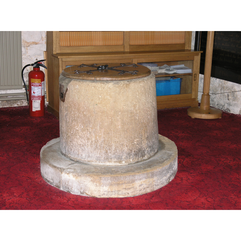
Image copyright © Colin Hinson, 2008
Standing permission
Results: 4 records
view of font and cover
Copyright Statement: Image copyright © Colin Hinson, 2008
Image Source: digital photograph taken August 2006 by Colin Hinson [www.yorkshireCDbooks.com]
Copyright Instructions: Standing permission
view of font - upper view
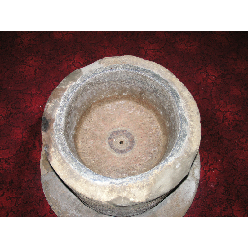
Copyright Statement: Image copyright © Colin Hinson, 2008
Image Source: digital photograph taken August 2006 by Colin Hinson [www.yorkshireCDbooks.com]
Copyright Instructions: Standing permission
view of church exterior - southeast view
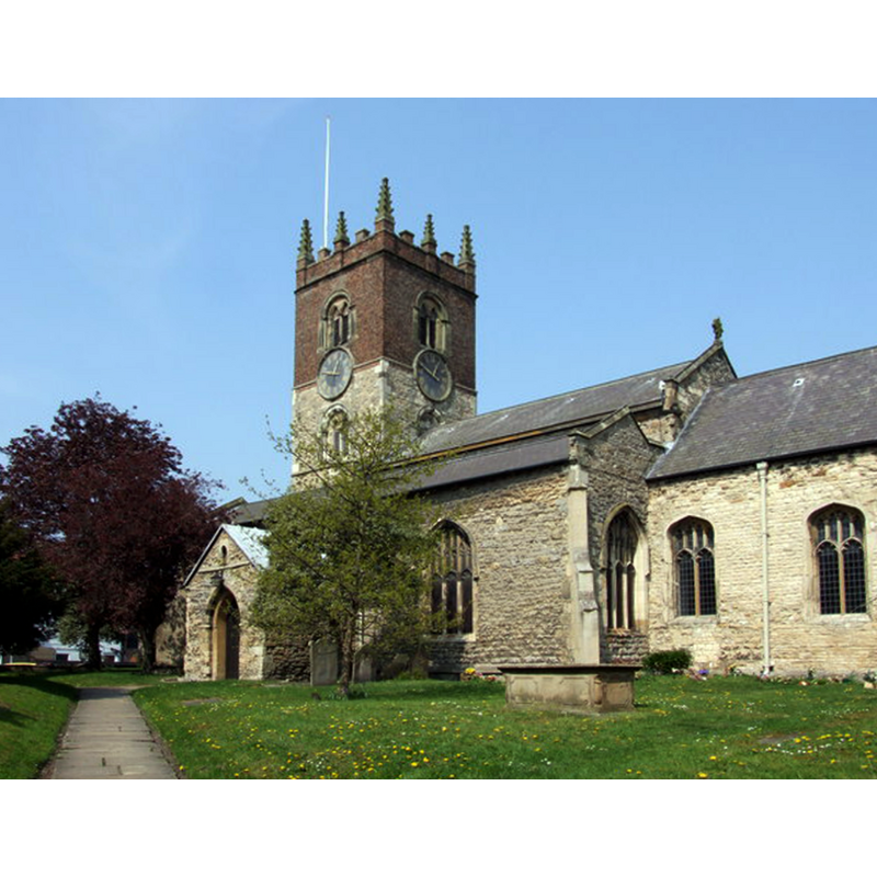
Copyright Statement: Image copyright © Leslie, 2011
Image Source: digital photograph taken 20 April 2011 by Leslie [www.geograph.org.uk/photo/2387712] [accessed 20 July 2014]
Copyright Instructions: CC-BY-SA-2.0
view of font and cover in context
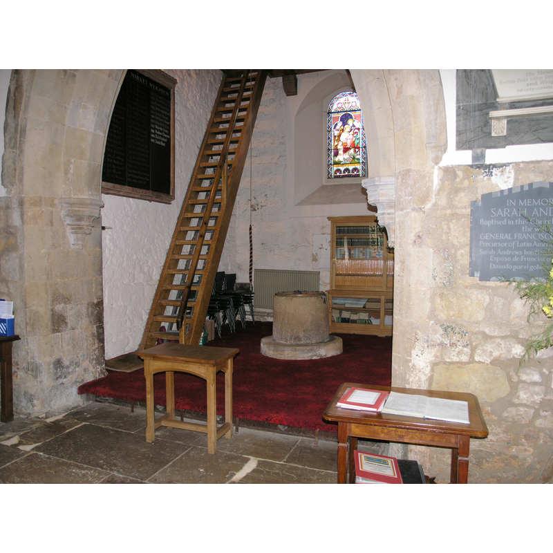
Copyright Statement: Image copyright © Colin Hinson, 2008
Image Source: digital photograph taken August 2006 by Colin Hinson [www.yorkshireCDbooks.com]
Copyright Instructions: Standing permission
INFORMATION
Font ID: 11215MAR
Object Type: Baptismal Font1
Font Century and Period/Style: 12th century, Late Norman
Church / Chapel Name: Parish Church of All Saints
Font Location in Church: Inside the church, in the W end, beneath the tower
Church Patron Saint(s): All Saints
Church Address: The Archway, Market Weighton, East Riding of Yorkshire YO43 3AP
Site Location: East Riding of Yorkshire, Yorkshire and the Humber, England, United Kingdom
Directions to Site: Located on the A1079, about 30 km ESE of York
Ecclesiastic Region: Diocese of York
Additional Comments: damaged font: upper rim damage
Font Notes:
Click to view
There is an entry for Market Weighton [variant spelling] in the Domesday survey [http://domesdaymap.co.uk/place/SE8741/market-weighton/] [accessed 20 July 2014], but it mentions neither church nor cleric in it. Bulmer's Directory of 1892 states: "The church (All Saints) was founded in Saxon times, but no part of the present building is older than the Norman era." Noted in Hobson (1924): "The font is Norm[an]." There is probably no reason to question Hobson's dating, as the circular tub-shaped font is totally plain, and in the general shape of such fonts of the Norman period; the inner well of the basin is lined with lead and has a central drain; damage to the upper rim sides is probably due to the forceful removal of the iron staples of the old cover. The flat round wooden cover now on the font is modern. [We are grateful to Colin Hinson, of www.yorkshireCDbooks.co.uk, for his photographs of this church and font]
Credit and Acknowledgements: We are grateful to Colin Hinson, of www.yorkshireCDbooks.com, for his photographs of this church and font.
COORDINATES
UTM: 30U 653390 5971045
Latitude & Longitude (Decimal): 53.865189, -0.667265
Latitude & Longitude (DMS): 53° 51′ 54.68″ N, 0° 40′ 2.15″ W
MEDIUM AND MEASUREMENTS
Material: stone
Font Shape: tub-shaped
Basin Interior Shape: round
Basin Exterior Shape: round
Drainage System: centre hole in basin
Drainage Notes: lead lining
LID INFORMATION
Date: modern
Material: wood
Apparatus: no
Notes: [cf. FontNotes]
REFERENCES
- Bulmer, T., History and Directory of East Yorkshire, 1892, [www.genuki.org.uk/big/eng/YKS/ERY/Marketwighton/Index.html] [accessed 8 October 2006]
- Hobson, Bernard, The East Riding of Yorkshire (with York), Cambridge: At the University Press, 1924, p. 167