Whitgift / Whitegift / Witegift
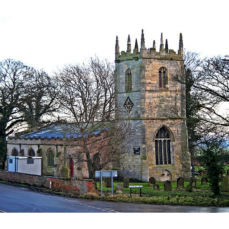
Image copyright © Gordon Kneale Brooke, 2005
CC-BY-SA-2.0
Results: 2 records
view of church exterior - northwest view
Scene Description: Source caption: "Whitgift Church on the banks of the River Ouse"
Copyright Statement: Image copyright © Gordon Kneale Brooke, 2005
Image Source: digital photograph taken 7 December 2005 by Gordon Kneale Brooke [www.geograph.org.uk/photo/88272] [accessed 4 December 2018]
Copyright Instructions: CC-BY-SA-2.0
view of church exterior - southwest view
![Source caption: "Church of St. Mary Magdalene at Whitgift. The S side of the church is seen here. The N side is unusual for having a clock with, in Roman numerals, thirteen at the top instead of twelve; explanations vary! Beyond the church, over a road, is the raised bank of the R[iver] Ouse".](/static-50478a99ec6f36a15d6234548c59f63da52304e5/compressed/1181204007_compressed.png)
Scene Description: Source caption: "Church of St. Mary Magdalene at Whitgift. The S side of the church is seen here. The N side is unusual for having a clock with, in Roman numerals, thirteen at the top instead of twelve; explanations vary! Beyond the church, over a road, is the raised bank of the R[iver] Ouse".
Copyright Statement: Image copyright © Trevor Littlewood, 2009
Image Source: digital photograph taken 26 December 2009 by Trevor Littlewood [www.geograph.org.uk/photo/2088143] [accessed 4 December 2018]
Copyright Instructions: CC-BY-SA-2.0
INFORMATION
Font ID: 11211WHI
Object Type: Baptismal Font1
Font Century and Period/Style: 14th century, Medieval
Church / Chapel Name: Parish Church of St. Mary Magdalene
Font Location in Church: Inside the church
Church Patron Saint(s): St. Mary Magdalene
Church Address: Church Ln and Main St, Whitgift, Goole DN14 8HJ, UK -- Tel.: 07708228472
Site Location: East Riding of Yorkshire, Yorkshire and the Humber, England, United Kingdom
Directions to Site: Located off (S) the banks of the River Ouse, 6-7 km E of Goole and the M62, 10 km SE of Howden, 13 km from Crowle (Lincs.)
Ecclesiastic Region: Diocese of Sheffield
Historical Region: Hundred of Osgoldcross
Font Notes:
Click to view
No entry found for Whitgift in the Domesday survey. Morris (1932) notes: "an octagonal font", which might well be of the date of the original church, the beginning of the 14th century. The entry for this church in Historic England [Listing NGR: SE8086922701] notes: "Parish church. C12 origins, largely demolished in mid C13, rebuilt in early C14. Early C14 arcades, chancel arch; C14 lower section to tower, with C15- C16 upper stages; aisles rebuilt 1582-3. Early C18 rebuilding, including reroofing nave. Restorations of 1898 included reroofing, new chancel. [...] 12-sided font with roll- moulded bowl on shaft with moulded base."
COORDINATES
UTM: 30U 646757 5951821
Latitude & Longitude (Decimal): 53.69445, -0.7772
Latitude & Longitude (DMS): 53° 41′ 40.02″ N, 0° 46′ 37.92″ W
MEDIUM AND MEASUREMENTS
Material: stone
Font Shape: octagonal, mounted
Basin Interior Shape: round
Basin Exterior Shape: octagonal
REFERENCES
- Morris, Joseph Ernest, The West Riding of Yorkshire, London: Methuen & Co., 1932, p. 535