Walton nr. Wetherby and Thorp Arch / Waletone / Walton-in-Ainsty
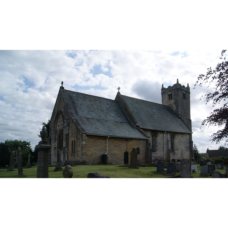
Image copyright © Mtaylor848, 2016
CC-BY-SA-4.0
Results: 2 records
view of church exterior - northeast view
Copyright Statement: Image copyright © Mtaylor848, 2016
Image Source: digital photograph taken 24 May 2016 by Mtaylor848 [https://commons.wikimedia.org/wiki/File:St._Peter's_Church,_Walton,_Leeds_(24th_May_2016)_007.jpg] [accessed 31 October 2018]
Copyright Instructions: CC-BY-SA-4.0
view of church exterior - southeast view
![EXT SE digital photograph taken 24 May 2016 by Mtaylor848 [https://commons.wikimedia.org/wiki/File:St._Peter's_Church,_Walton,_Leeds_(24th_May_2016)_011.jpg] [accessed 31 October 2018] CC-BY-SA-4.0
EXT NE digital photograph taken 24 May 2016 by Mtaylor848 [https://commons.wikimedia.org/wiki/File:St._Peter's_Church,_Walton,_Leeds_(24th_May_2016)_007.jpg] [accessed 31 October 2018] CC-BY-SA-4.0](/static-50478a99ec6f36a15d6234548c59f63da52304e5/compressed/1181031003_compressed.png)
Scene Description: EXT SE digital photograph taken 24 May 2016 by Mtaylor848 [https://commons.wikimedia.org/wiki/File:St._Peter's_Church,_Walton,_Leeds_(24th_May_2016)_011.jpg] [accessed 31 October 2018] CC-BY-SA-4.0
EXT NE digital photograph taken 24 May 2016 by Mtaylor848 [https://commons.wikimedia.org/wiki/File:St._Peter's_Church,_Walton,_Leeds_(24th_May_2016)_007.jpg] [accessed 31 October 2018] CC-BY-SA-4.0
Copyright Statement: Image copyright © Mtaylor848, 2016
Image Source: edited detail of a digital photograph taken 24 May 2016 by Mtaylor848 [https://commons.wikimedia.org/wiki/File:St._Peter's_Church,_Walton,_Leeds_(24th_May_2016)_011.jpg] [accessed 31 October 2018]
Copyright Instructions: CC-BY-SA-4.0
INFORMATION
Font ID: 11210WAL
Object Type: Baptismal Font1
Font Century and Period/Style: 13th - 14th century, Decorated
Church / Chapel Name: Parish Church of St. Peter
Font Location in Church: Inside the church
Church Patron Saint(s): St. Peter
Church Address: Main St, Walton, Wetherby LS23 7DJ, UK
Site Location: West Yorkshire, Yorkshire and the Humber, England, United Kingdom
Directions to Site: Located 1 km from Thorp Arch [aka Thorpe Arch, Thorparch], about 5 km E of Wetherby, in The Ainsty
Ecclesiastic Region: Diocese of Leeds
Historical Region: Hundred of Ainsty -- formerly WRYrks
Font Notes:
Click to view
There is an entry for this Walton [variant spelling] in the Domesday survey [http://opendomesday.org/place/SE4447/walton/] [accessed 19 October 2018] but it mentions neither cleric nor church in it. Morris (1908) writes: "(?) Dec[orated] font." Mee (1941) has "a medieval font". Ryder (1993) "a late medieval font" in this church. Not mentioned in Glynne (in Butler, 2007). The entry for this church in Historic England notes: "Church. C12 origin; mostly mid C14; restored 1890-91 by W. M. Fawcett. [...] Small, moulded octagonal stone font, C14."
COORDINATES
UTM: 30U 609675 5976428
Latitude & Longitude (Decimal): 53.92463, -1.32978
Latitude & Longitude (DMS): 53° 55′ 28.67″ N, 1° 19′ 47.21″ W
MEDIUM AND MEASUREMENTS
Material: stone
Font Shape: octagonal, mounted
Basin Exterior Shape: octagonal
REFERENCES
- Mee, Arthur, The King's England, Yorkshire, West Riding, London: Hodder & Stoughton, 1941, p. 407
- Morris, Joseph Ernest, The West Riding of Yorkshire, London: Methuen & Co., 1932, p. 525