Elland / Elant
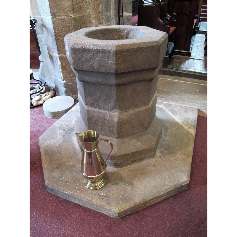
Image copyright © Stephen Craven, 2016
CC-BY-SA-2.0
Results: 3 records
view of font
Scene Description: Source caption: "St Mary, Elland: font. The stone font dates from 1662".
Copyright Statement: Image copyright © Stephen Craven, 2016
Image Source: digital photograph taken 23 July 2016 by Stephen Craven [www.geograph.org.uk/photo/5056561] [accessed 25 October 2018]
Copyright Instructions: CC-BY-SA-2.0
view of church exterior - northeast view
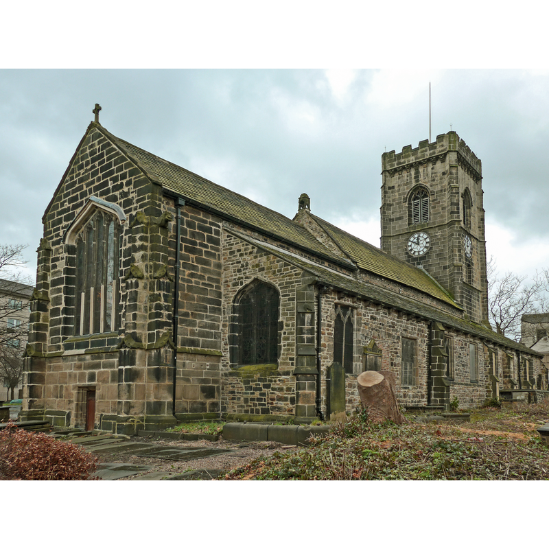
Copyright Statement: Image copyright © Tim Green, 2015
Image Source: digital photograph taken 11 January 2015 by Tim Green [www.flickr.com/photos/93416311@N00/16071912929] [accessed 25 October 2018]
Copyright Instructions: CC-BY-SA-2.0
view of church exterior - southeast view
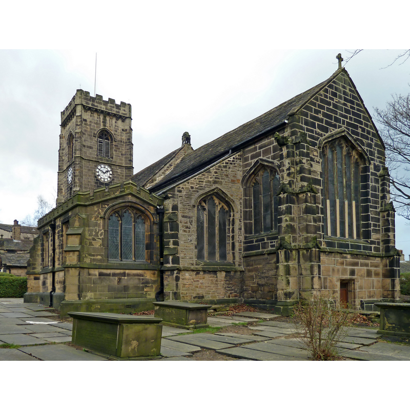
Copyright Statement: Image copyright © Tim Green, 2012
Image Source: digital photograph taken 21 January 2012 by Tim Green [www.flickr.com/photos/93416311@N00/6737890053] [accessed 25 October 2018]
Copyright Instructions: CC-BY-SA-2.0
INFORMATION
Font ID: 11168ELL
Object Type: Baptismal Font1
Font Date: 1662
Font Century and Period/Style: 17th century(mid), Restoration
Church / Chapel Name: Parish Church of St. Mary the Virgin
Font Location in Church: Inside the church
Church Patron Saint(s): St. Mary the Virgin
Church Address: Savile Road, Elland HX5 0NH, United Kingdom -- Tel.: +44 1422 373184
Site Location: West Yorkshire, Yorkshire and the Humber, England, United Kingdom
Directions to Site: Located off (S) the A629, across the Elland Bridge, 5 km NNW of Huddesrfield, SSE of Halifax
Ecclesiastic Region: Diocese of Leeds
Historical Region: Hundred of Morley -- formerly WRYrks
Additional Comments: disappeared font? (the one from the ca.1180 church here)
Font Notes:
Click to view
There is an entry for Elland [variant spelling] in the Domesday survey [http://opendomesday.org/place/SE1021/elland/] [accessed 25 October 2018] but it mentions neither cleric nor church in it. Glynne's July 1857 visit to this church (in Butler, 2007) reports: "The font [is] octagonal and plain"; but Butler adds in a footnote: "The font is dated 1662". Noted in Morris (1932) : "Old font -- probably 15th century." The entry for this church in Historic England [Listing NGR: SE1080521167] notes: "Church, mainly Cl3 and C14 with chancel arch c.118O, tower c.1490 and other additions and alterations [...] Otherwise [...] mainly dating from W. H. Crossland's restoration of 1856 [...] Plain octagonal font said to be of C17." Ryder (1993) reports "a '1662' font" here. Not mentioned in Harman & Pevsner (2017).
COORDINATES
UTM: 30U 576744 5949309
Latitude & Longitude (Decimal): 53.68685, -1.8379
Latitude & Longitude (DMS): 53° 41′ 12.66″ N, 1° 50′ 16.44″ W
MEDIUM AND MEASUREMENTS
Material: stone
Font Shape: octagonal, mounted
Basin Interior Shape: round
Basin Exterior Shape: octagonal
REFERENCES
- Glynne, Stephen Richard, The Yorkshire notes of Sir Stephen Glynne (1825-1874), Woodbridge: The Boydell Press; Yorkshire Archaeological Society, 2007, p. 173
- Morris, Joseph Ernest, The West Riding of Yorkshire, London: Methuen & Co., 1932, p. 185
- Ryder, Peter, Medieval churches of West Yorkshire, [Leeds?]: West Yorkshire Archaeology Service, 1993, p. 150