Darrington / Darnintone
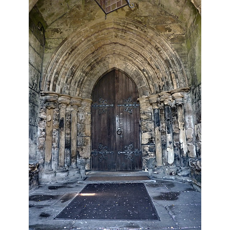
Image copyright © Alexander P Kapp, 2010
CC-BY-SA-2.0
Results: 3 records
view of church exterior - south portal
Copyright Statement: Image copyright © Alexander P Kapp, 2010
Image Source: digital photograph taken 13 May 2010 by Alexander P Kapp [https://commons.wikimedia.org/wiki/File:St_Luke,_Darrington_(28129898364).jpg] [accessed 25 October 218]
Copyright Instructions: CC-BY-SA-2.0
view of church exterior - southwest end
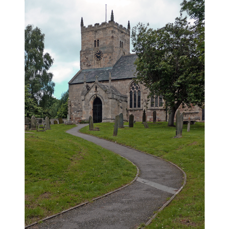
Copyright Statement: Image copyright © Tim Green, 2016
Image Source: digital photograph taken 20 June 2016 by Tim Green [https://commons.wikimedia.org/wiki/File:St_Luke,_Darrington_(28129898364).jpg] [accessed 25 October 2018]
Copyright Instructions: CC-BY-SA-2.0
symbol - cross
![[cf. Font notes]](/static-50478a99ec6f36a15d6234548c59f63da52304e5/others/image_not_available.jpg)
Scene Description: [cf. Font notes]
![[cf. Font notes]](/static-50478a99ec6f36a15d6234548c59f63da52304e5/bsi-testing-site/others/image_not_available.jpg)
INFORMATION
Font ID: 11167DAR
Object Type: Baptismal Font1
Font Century and Period/Style: 14th - 15th century, Decorated? / Perpendicular?
Church / Chapel Name: Parish Church of St. Luke and All Saints
Font Location in Church: Inside the church
Church Patron Saint(s): St. Luke & All Saints
Church Address: Church Lane, Darrington, Pontefract WF8 3BJ, UK -- Tel.: (01977) 704744
Site Location: West Yorkshire, Yorkshire and the Humber, England, United Kingdom
Directions to Site: Located off (E) the A1, 5 km SSE of Pontefract and Ferrybridge, 20 km SSE of Leefds, 40 km SSW of York
Ecclesiastic Region: Diocese of Leeds
Historical Region: Hundred of Osgodcross -- formerly WRYrks
Additional Comments: disappeared font? (the one from the Domesday-time church here)
Font Notes:
Click to view
There is an entry for Darrington [variant spelling] in the Domesday survey [http://opendomesday.org/place/SE4820/darrington/] [accessed 25 October 2018]; it reports a priest and a church in it. Morris (1932) writes: "Octagonal font -- Dec[orated] or Perp[pendicular]. Notice the cross cut on the E. side of the top of the pedestal." The entry for this church in Historic England [Listing NGR: SE4850320181] notes: "Parish church. Norman tower, C13 aisles and chancel (altered in C14 and C15), with C14 north chapel (probably a rebuilding at that time); restored in 1880 by A. W. Blomfield"; it mentions no font in it.
COORDINATES
UTM: 30U 614427 5948816
Latitude & Longitude (Decimal): 53.67553, -1.2677
Latitude & Longitude (DMS): 53° 40′ 31.91″ N, 1° 16′ 3.72″ W
MEDIUM AND MEASUREMENTS
Material: stone
Font Shape: octagonal, mounted
Basin Interior Shape: round
Basin Exterior Shape: octagonal
REFERENCES
- Morris, Joseph Ernest, The West Riding of Yorkshire, London: Methuen & Co., 1932, p. 170