Adlingfleet / Adelingesfluet
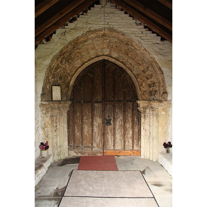
Image copyright © Richard Croft, 2009
CC-BY-SA-2.0
Results: 4 records
view of church exterior - south portal
Scene Description: Photo caption: "All Saints' south door. Bold chevron moulding in a gothic arch - most likely a 12th century round-headed doorway re-set in the 13th century as a pointed arch"
Copyright Statement: Image copyright © Richard Croft, 2009
Image Source: digital photograph taken 5 October 2009 by Richard Croft [www.geograph.org.uk/photo/1526395] [accessed 26 July 2014]
Copyright Instructions: CC-BY-SA-2.0
view of church exterior - southeast view
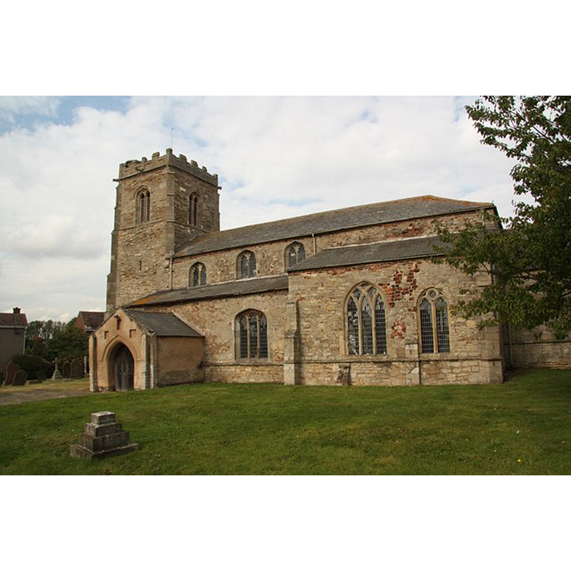
Copyright Statement: Image copyright © Richard Croft, 2009
Image Source: digital photograph taken 5 October 2009 by Richard Croft [www.geograph.org.uk/photo/1521884] [accessed 26 July 2014]
Copyright Instructions: CC-BY-SA-2.0
view of church interior - nave - looking east
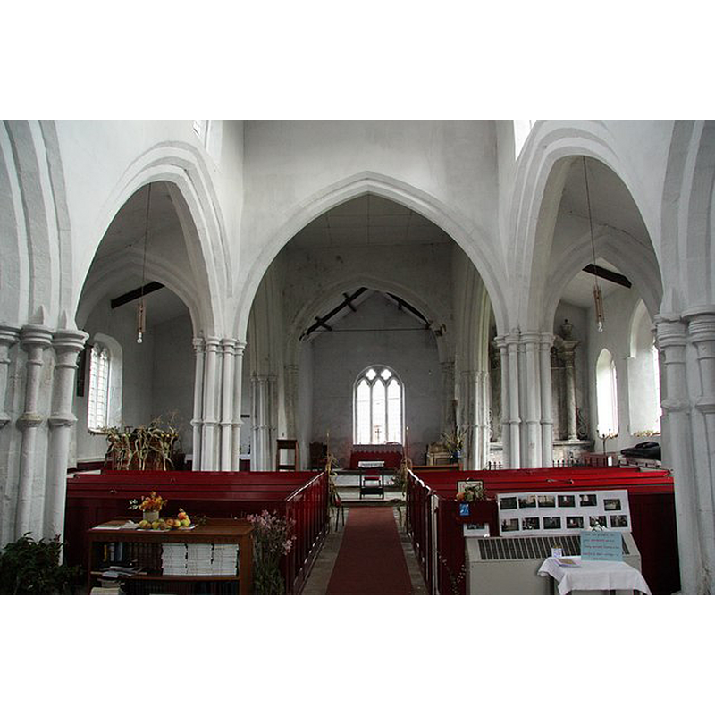
Copyright Statement: Image copyright © Richard Croft, 2009
Image Source: digital photograph taken 5 October 2009 by Richard Croft [www.geograph.org.uk/photo/1526292] [accessed 26 July 2014]
Copyright Instructions: CC-BY-SA-2.0
view of church interior - nave - looking west
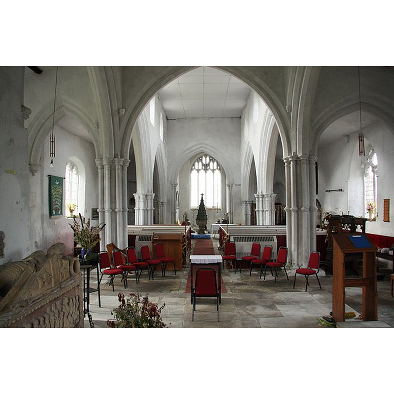
Scene Description: the font and cover at the west end
Copyright Statement: Image copyright © Richard Croft, 2009
Image Source: digital photograph taken 5 October 2009 by Richard Croft [www.geograph.org.uk/photo/1526285] [accessed 26 July 2014]
Copyright Instructions: CC-BY-SA-2.0
INFORMATION
Font ID: 11159ADL
Object Type: Baptismal Font1
Font Century and Period/Style: 15th century, Perpendicular
Church / Chapel Name: Parish Church of All Saints
Font Location in Church: Inside the church, at the W end
Church Patron Saint(s): All Saints
Church Address: All Saints Church Adlingfleet, Goole DN14 8HX, United Kingdom
Site Location: East Riding of Yorkshire, Yorkshire and the Humber, England, United Kingdom
Directions to Site: Located 2-3 km N of Fockerby, about 13 km DE of Howden
Ecclesiastic Region: Diocese of Sheffield
Historical Region: Hundred of Staincross -- formerly in the West Riding of Yorkshire
Additional Comments: disappeared font? (the one from the Domesday-time church here?)
Font Notes:
Click to view
There is an entry for Adlingfleet [variant spelling] in the Domesday survey [http://domesdaymap.co.uk/place/SE8421/adlingfleet/] [accessed 26 July 2014], and it mentions a priest and a church in it. A font here is noted in Morris (1932): "Octagonal, cup-shaped font." The entry for this church in English Heritage [Listing NGR: SE8439521002] describes it as 15th-century with a 19th-century tall cover.
COORDINATES
UTM: 30U 650323 5950206
Latitude & Longitude (Decimal): 53.678931, -0.724022
Latitude & Longitude (DMS): 53° 40′ 44.15″ N, 0° 43′ 26.48″ W
MEDIUM AND MEASUREMENTS
Material: stone
Font Shape: octagonal, mounted
Basin Interior Shape: round
Basin Exterior Shape: octagonal
LID INFORMATION
Date: 19th century?
Material: wood
Apparatus: no
Notes: [cf. FontNotes]
REFERENCES
- Morris, Joseph Ernest, The West Riding of Yorkshire, London: Methuen & Co., 1932, p. 74