Ferry Fryston / Fereia
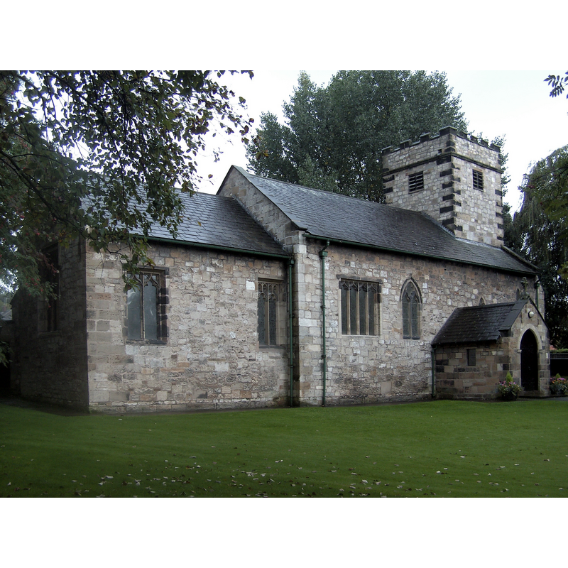
Image copyright © Derek Dye, 2010
CC-BY-SA-2.0
Results: 6 records
view of church exterior - northeast view
Scene Description: Source caption: "St Andrews Church Ferrybridge. The church was moved (dismantled and rebuilt) in the 1950's. It used to stand in marshy land at the side of the power station cooling towers. The graveyard still remains in situ."
Copyright Statement: Image copyright © Derek Dye, 2010
Image Source: digital photograph taken 17 September 2010 by Derek Dye [www.geograph.org.uk/photo/2128179] [accessed 26 October 2018]
Copyright Instructions: CC-BY-SA-2.0
view of font and cover in context
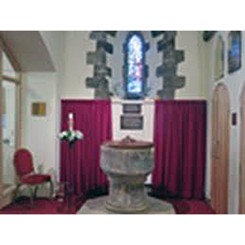
Copyright Statement: Image copyright © Ferrybridge Parish, 2018
Image Source: digital photograph in the Parish site [http://www.leeds.anglican.org/sites/default/files/vacancies/St Andrew-%20 Booklet pdf.pdf] [accessed 26 October 2018]
Copyright Instructions: No known copyright restriction / Fair Dealing
view of font

Copyright Statement: Image copyright © CRSBI, 2018
Image Source: digital image of a B&W photograph taken 20 June 2000 by John McElheran [www.crsbi.ac.uk/site/2161/] [accessed 26 October 2018]
Copyright Instructions: PERMISSION NOT AVAILABLE -- IMAGE NOT FOR PUBLIC USE
design element - patterns - ribbed - flat
Scene Description: around the irregular sides of the roughly cylindrical basin
Copyright Statement: Image copyright © CRSBI, 2018
Image Source: digital image of a B&W photograph taken 20 June 2000 by John McElheran [www.crsbi.ac.uk/site/2161/] [accessed 26 October 2018]
Copyright Instructions: PERMISSION NOT AVAILABLE -- IMAGE NOT FOR PUBLIC USE
design element - motifs - roll moulding
Copyright Statement: Image copyright © CRSBI, 2018
Image Source: digital image of a B&W photograph taken 20 June 2000 by John McElheran [www.crsbi.ac.uk/site/2161/] [accessed 26 October 2018]
Copyright Instructions: PERMISSION NOT AVAILABLE -- IMAGE NOT FOR PUBLIC USE
design element - motifs - roll moulding - graded
Copyright Statement: Image copyright © CRSBI, 2018
Image Source: digital image of a B&W photograph taken 20 June 2000 by John McElheran [www.crsbi.ac.uk/site/2161/] [accessed 26 October 2018]
Copyright Instructions: PERMISSION NOT AVAILABLE -- IMAGE NOT FOR PUBLIC USE
INFORMATION
Font ID: 11155FER
Object Type: Baptismal Font1
Font Century and Period/Style: 12th century (late?), Transitional
Church / Chapel Name: Parish Church of St. Andrew
Font Location in Church: Inside the church at Ferrybridge
Church Patron Saint(s): St. Andrew
Church Notes: [NB: Old St Andrew's church was moved stone by stone from Ferry Fryston to Ferrybridge and re-consecrated on 12 September 1953]
Church Address: 5 Pontefract Road, Ferrybridge, Knottingley WF11 8QS, UK -- Tel.: +44 1977 671415 [NB: address and coordinates are for Ferrybridge]
Site Location: West Yorkshire, Yorkshire and the Humber, England, United Kingdom
Directions to Site: Located 3 km NW of Pontefract [NB: Old St Andrew's church was moved stone by stone from Ferry Fryston to Ferrybridge and re-consecrated on 12 September 1953]
Ecclesiastic Region: Diocese of Leeds
Historical Region: Hundred of Osgodcross -- formerly WRYrks
Additional Comments: altered font / unfinished font / damaged font / repaired font
Font Notes:
Click to view
There is an entry for Ferry [Fryston] [variant spelling] in the Domesday survey [http://opendomesday.org/place/SE4824/ferry-fryston/] accessed 26 October 2018] but it mentions neither cleric nor church in it. Morris (1932) lists this as one of two fonts [the other at Penistone] in this county "the carving on which is only partly completed", this one, massive circular font -- probably coeval with the original building" [i.e., Transitional]. [NB: according to the National Gazetteer of 1868, the original church dates from the early 11th century [source: 2003 transcription by Colin Hinson [www.genuki.org.uk]]. Pevsner (1986 c1967), who mentions the move of the church [Old St Andrew's church was moved stone by stone from Ferry Fryston to Ferrybridge and re-consecrated on 12 September 1953 -- source: St Andrew's Parish web site [http://mysite.wanadoo-members.co.uk/ferrybridge]], writes: "Font. Circular, reeded bowl. Is it Norman? It is hard to suggest a date." Noted and illustrated in the CRSBI (2018): "The font is now in the tower space standing on a large modern octagonal peninsula. It is of three sections, base, pillar and bowl. The base has a double torus in a fine sandstone that is beginning to decay - it has all the appearance of a restoration. The stem is a plain squat cylinder, probably limestone, in two halves, like courses in some pillars. The limestone bowl has a ring at the junction with the pillar, then a chamfer with a rounded angle, after which it is vertical and cylindrical to the top. The flat rim has been repaired where the medieval lock and clasp were inset. The surface has been generally worked over with a claw. The pattern on the bowl consists of incised ‘vertical’ grooves. These grooves end near the bottom of the chamfer in a bored hole, very like those commonly seen on waterleaf capitals, for example in Selby Abbey N porch, and just identifiable on the N doorway here. Sometimes the grooves join as they rise up the chamfer, making a form like the dart on a scallop capital. Perhaps it should properly have been reeded. Both the stem and the bowl could be Romanesque." The entry for this church in Historic England [Listing NGR: SE4803624150] notes: "Church. C12 and c.1500; restored in C19 and removed to this site with
alterations, 1952-3 [...] tub font with reeded decoration to the side (perhaps C12)". In Harman & Pevsner (2017) as "probably C12".
alterations, 1952-3 [...] tub font with reeded decoration to the side (perhaps C12)". In Harman & Pevsner (2017) as "probably C12".
COORDINATES
UTM: 30U 613446 5953074
Latitude & Longitude (Decimal): 53.714, -1.281
Latitude & Longitude (DMS): 53° 42′ 50.4″ N, 1° 16′ 51.6″ W
MEDIUM AND MEASUREMENTS
Material: stone, limestone
Font Shape: round, mounted
Basin Interior Shape: round
Basin Exterior Shape: round
Rim Thickness: 12 cm [calculated]
Diameter (inside rim): 53 cm*
Diameter (includes rim): 77 cm*
Basin Depth: 32 cm*
Basin Total Height: 48 cm*
Height of Base: 44 cm*
Font Height (less Plinth): 93 cm*
Notes on Measurements: * CRSBI (2018)
REFERENCES
- Harman, Ruth, Yorkshire West Riding: Sheffield and the South, New Haven; London: Yale University Press, 2017, p. 248
- Morris, Joseph Ernest, The West Riding of Yorkshire, London: Methuen & Co., 1932, p. 67, 188-189
- Pevsner, Nikolaus, Yorkshire: the West Riding, Harmondsworth: Penguin Books, 1986 c1967, p. 200