Stanwick St. John / Stanwegg / Stanwigge / Staynwigges / Steinewegges / Steinueges / Stenuueghe / Stenwege
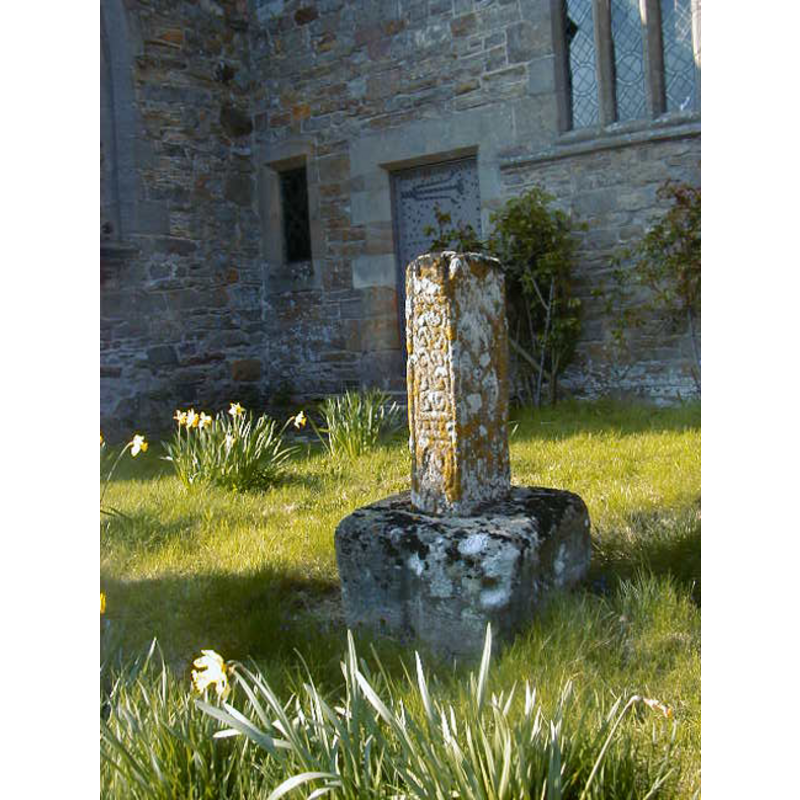
Image copyright © [in the public domain]
Released by its author into the public domain
Results: 5 records
view of church exterior - cross - shaft
Copyright Statement: Image copyright © [in the public domain]
Image Source: digital photograph taken 24 April 2005 by Lizzyp [http://en.wikipedia.org/wiki/File:P4240038.JPG] [accessed 28 May 2012]
Copyright Instructions: Released by its author into the public domain
view of church exterior - southwest view
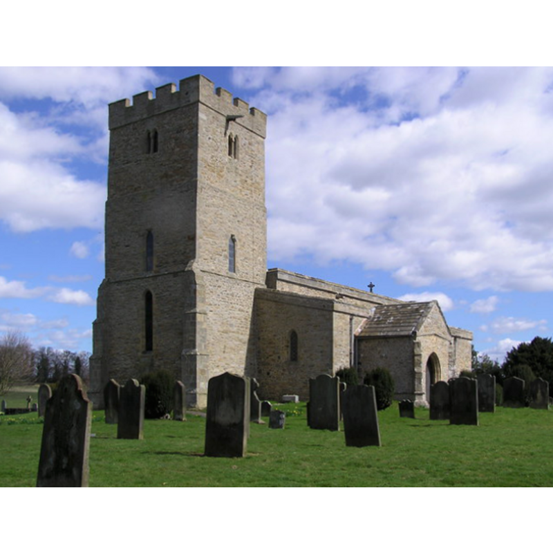
Copyright Statement: Image copyright © Hugh Mortimer, 2006
Image Source: digital photograph taken 10 April 2006 by Hugh Mortimer [www.geograph.org.uk/photo/149773] [accessed 28 May 2012]
Copyright Instructions: CC-BY-SA-3.0
view of church exterior in context
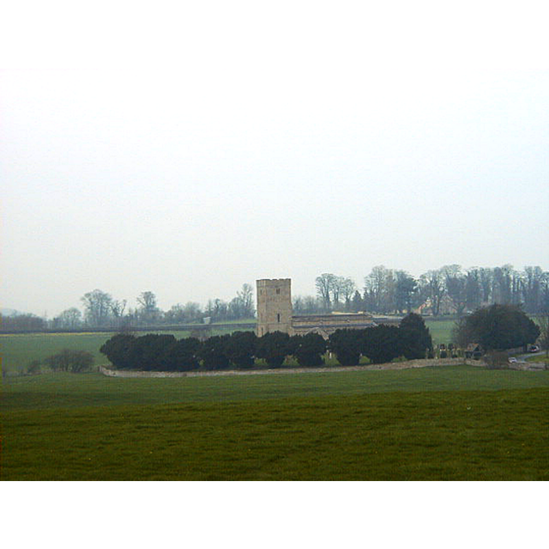
Copyright Statement: Image copyright © [in the public domain]
Image Source: digital photograph taken 3 April 2005 by Lizzyp [http://en.wikipedia.org/wiki/File:P4030002.JPG] [accessed 28 May 2012]
Copyright Instructions: Released by its author into the public domain
view of church interior - cross - shaft
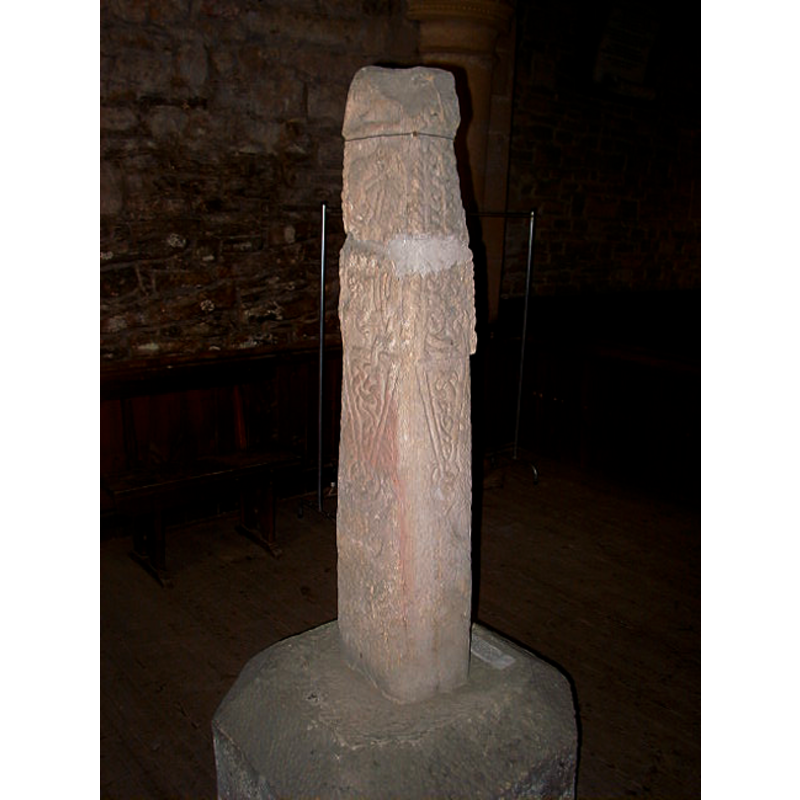
Scene Description: said to be of the 9th century
Copyright Statement: Image copyright © [in the public domain]
Image Source: digital photograph taken 24 April 2005 by Lizzyp [http://en.wikipedia.org/wiki/File:P4240036.JPG] [accessed 28 May 2012]
Copyright Instructions: Released by its author into the public domain
view of church interior - looking east
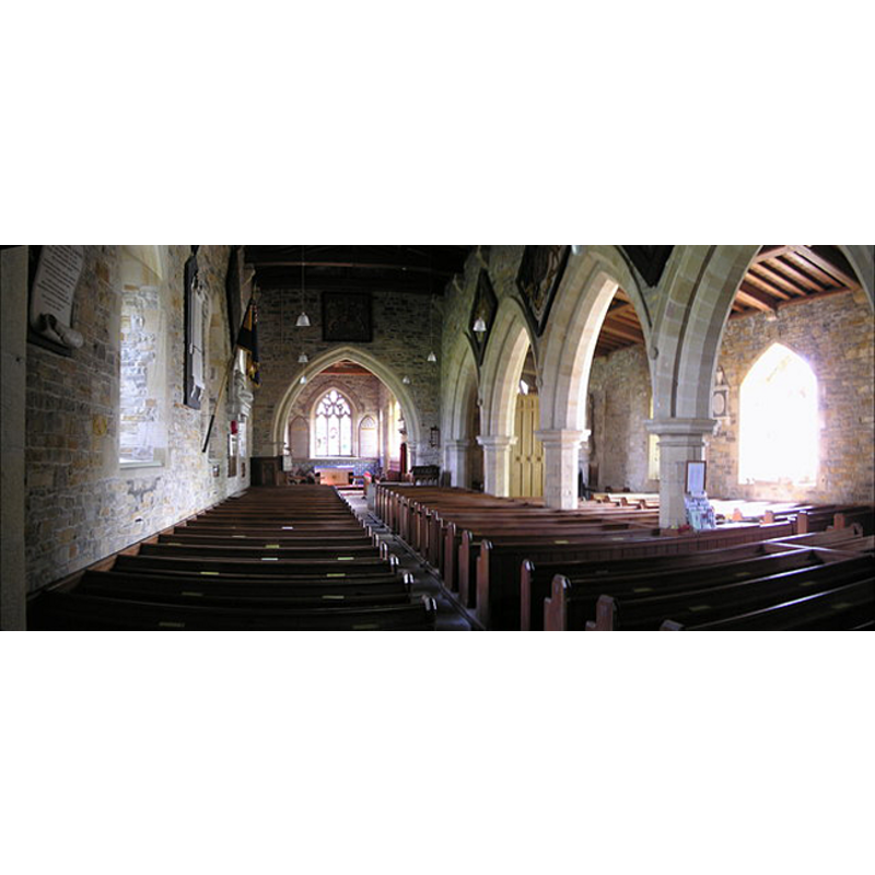
Copyright Statement: Image copyright © Hugh Mortimer, 2006
Image Source: digital photograph taken 10 April 2006 by Hugh Mortimer [www.geograph.org.uk/photo/158158] [accessed 28 May 2012]
Copyright Instructions: CC-BY-SA-3.0
INFORMATION
Font ID: 11117STA
Object Type: Baptismal Font1
Font Century and Period/Style: Medieval [altered]? / Modern?
Church / Chapel Name: Parish Church of St. John the Baptist [redundant]
Font Location in Church: Inside the church [cf. FontNotes
Church Patron Saint(s): St. John the Baptist
Church Notes: Redundant church now under the care of the Churches Conservation Trust
Church Address: Stanwick, Stanwick St John, North Yorkshire, DL11 7RT
Site Location: North Yorkshire, Yorkshire and the Humber, England, United Kingdom
Directions to Site: Located close to Scotch Corner, 13 km N of Richmond
Ecclesiastic Region: Diocese of Ripon & Leeds
Additional Comments: recycled font: [cf. FontNotes]
Font Notes:
Click to view
No individual entry fount for Stanwick St John in the Domesday survey. The entry for this parish in the Victoria County History (North York Riding, vol. 1, 1914) notes: "The church in Aldbrough mentioned in 1086 [...] must have been the church of St. John's Stanwick, as no other church is mentioned in any ancient records. Probably Aldbrough was the head of the Saxon parish, and lost its prestige in its decay. [...] The pointed chancel arch of two chamfered orders rests on semicircular shafts having octagonal moulded capitals, one of which appears to be original but re-worked and of the 13th century. [...] The registers begin in 1667. [...] The church of St. John the Baptist, almost entirely rebuilt in 1868". There is no mention of a font in the VCH entry for this parish. Noted in Morris (1931): "Tabernacled font-cover (?Jacobean)." Pevsner (1985) notes the font cover: "Early C17? With two tiers of traceried arches, pinnacles, and spire." Clifford (2004) cites a 1807 drawing prepared by the churchwardens of St. John the Baptist's and now at the County Records Office in his brief history of the church [www.stanwick-st-john.co.uk]; "The font is shown in the drawing in the same position which it occupies today, but things aren't quite as straightforward as that. I understand from Churchwarden Willy Lax that until the end of the last war the font stood under the tower, close to where the Viking Cross stands today. The carved cover was so heavy that it took three men to remove it, and Mr. Lax's father suggested that if it was removed to its present position a rope and pulley mechanism could be fixed to the roof of the south aisle. This was donr and the font moved and rebuilt, necessitating some redressing and replacement of stone, which accounts for the font itself looking new, whilst the cover, although much restored, is 17th century."
COORDINATES
UTM: 30U 583158 6040145
Latitude & Longitude (Decimal): 54.502087, -1.715841
Latitude & Longitude (DMS): 54° 30′ 7.51″ N, 1° 42′ 57.03″ W
MEDIUM AND MEASUREMENTS
Material: stone
LID INFORMATION
Date: 17th century / Jacobean?
Material: wood
Apparatus: yes: rope-and-pulley [added in the mid-20th century]
Notes: [cf. FontNotes]
REFERENCES
- Victoria County History [online], University of London, 1993-. URL: https://www.british-history.ac.uk.
- Clifford, Allen, "The Church of St. John the Baptist, Stanwick", [s.d.], pp. 1-10; www.stanwick-st-john.co.uk/home/
- Morris, Joseph Ernest, The North Riding of Yorkshire, London: Methuen & Co., 1931, p. 364
- Pevsner, Nikolaus, Yorkshire: the North Riding, Harmondsworth: Penguin Books, 1985 c1966, p. 468