Thurne / Thura
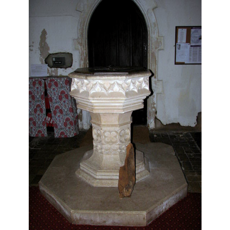
Image copyright © Evelyn Simak, 2007
CC-BY-SA-3.0
Results: 4 records
view of font and cover
Scene Description: the modern font
Copyright Statement: Image copyright © Evelyn Simak, 2007
Image Source: digital photograph taken June 2007 by Evelyn Simak [www.geograph.org.uk/photo/587455] [accessed 26 May 2014]
Copyright Instructions: CC-BY-SA-3.0
view of church exterior - southeast view
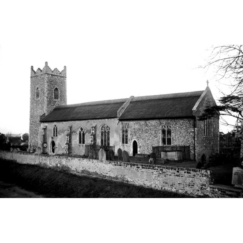
Scene Description: Photo caption: "Early Decorated style"
Copyright Statement: Image copyright © George Plunkett, 2014
Image Source: B&W photograph taken 28 November 1992 by George Plunkett [www.georgeplunkett.co.uk/Norfolk/T/Thurne St Edmund King and Martyr church SE [6939] 1992-11-28.jpg] [accessed 26 May 2014]
Copyright Instructions: Standing permission by Jonathan Plunkett
view of church interior - nave - looking west
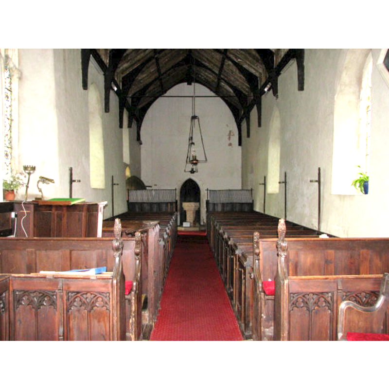
Copyright Statement: Image copyright © Evelyn Simak, 2007
Image Source: digital photograph taken June 2007 by Evelyn Simak [www.geograph.org.uk/photo/587450] [accessed 26 May 2014]
Copyright Instructions: CC-BY-SA-3.0
view of church interior - nave - looking east
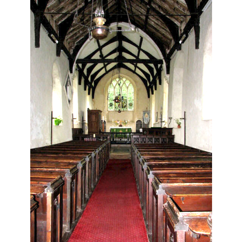
Copyright Statement: Image copyright © Evelyn Simak, 2007
Image Source: digital photograph taken June 2007 by Evelyn Simak [www.geograph.org.uk/photo/587448] [accessed 26 May 2014]
Copyright Instructions: CC-BY-SA-3.0
INFORMATION
Font ID: 11109THU
Object Type: Baptismal Font1?
Font Century and Period/Style: 13th century, Early English
Church / Chapel Name: Parish Church of St. Edmund King and Martyr
Church Patron Saint(s): St. Edmund the Martyr [aka Edmund of East Anglia]
Church Address: Church Road, Thurne, Norfolk, NR29 3BT
Site Location: Norfolk, East Anglia, England, United Kingdom
Directions to Site: Located off (E) the A149, about 24 km ENE of Norwich
Ecclesiastic Region: Diocese of Norwich
Historical Region: Hundred of West Flegg
Additional Comments: disappeared font? (the one from the 13th church here)
Font Notes:
Click to view
There are three entries for Thurne in the Domesday survey [http://domesdaymap.co.uk/place/TG4015/thurne/] [accessed 26 May 2014], neither of which mentions a church or cleric in it. Blomefield (1805-1810) writes; "The Church is a rectory, dedicated to St. Edmund; [...] and was consolidated to Ashby in 1604, and the Bishop of Norwich is patron." Blomefield (ibid.) gives "Reginald le Gross, rector" as first-recorded rector, without a date, and the first dated rector "1323, Ralph de Colby, presented by the abbot of Holm." The modern font of this church is illustrated in Knott (2008). The Historic Churches Preservation Trust notes that this 13th-century church was "reordered in 1851" at which time a new font was added [source: 'Recent Grants' issue of the Grants Cttee. Meeting of 13 September 2005, [www.historicchurches.org.uk]. [NB: we have no information on the earlier font(s) of this church]
Credit and Acknowledgements: We are grateful to Jonathan Plunkett for the photograph of this church taken by his father, George Plunkett, in 1992
COORDINATES
UTM: 31U 402441 5838070
Latitude & Longitude (Decimal): 52.683763, 1.556772
Latitude & Longitude (DMS): 52° 41′ 01.55″ N, 1° 33′ 24.38″ E
REFERENCES
- Blomefield, Francis, An essay towards a topographical history of Norfolk, 1805-1810, vol. 11: 179-180 / [www.british-history.ac.uk/report.aspx?compid=78778] [accessed 26 May 2014]
- Knott, Simon, The Norfolk Churches Site, Simon Knott, 2004. [standing permission to reproduce images received from Simon (February 2005]. URL: www.norfolkchurches.co.uk.