Leake / Lec / Lece / Leche / Lege / Lek
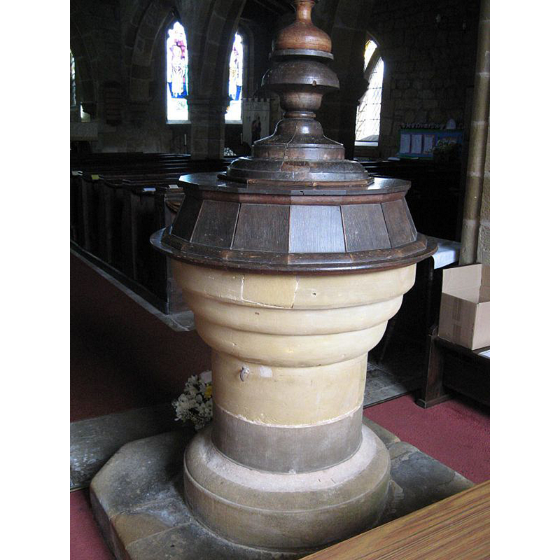
Image copyright © William Metcalfe, 2012
No known copyright restriction / Fair Dealing
Results: 7 records
view of font and cover
Scene Description: notice the lower half of the semt and the lower base, both modern replacements
Copyright Statement: Image copyright © William Metcalfe, 2012
Image Source: digital photograph 2012 by William Metcalfe [www.britishlistedbuildings.co.uk/images/buildings/en/332/332170-50878-800.jpg] [accessed 3 April 2016]
Copyright Instructions: No known copyright restriction / Fair Dealing
design element - motifs - roll moulding - graded
Copyright Statement: Image copyright © William Metcalfe, 2012
Image Source: digital photograph 2012 by William Metcalfe [www.britishlistedbuildings.co.uk/images/buildings/en/332/332170-50878-800.jpg] [accessed 3 April 2016]
Copyright Instructions: No known copyright restriction / Fair Dealing
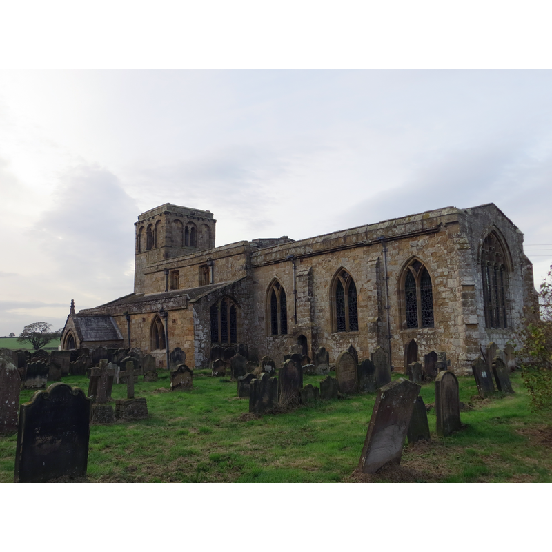
view of church exterior - southeast view
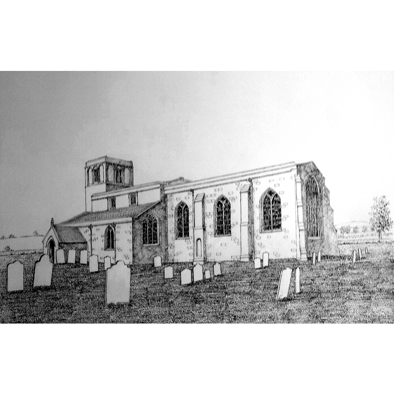
Copyright Statement: Image copyright © Robert Wilkes, 2016
Image Source: drawing done by Robert Wilkes in 2016
Copyright Instructions: Standing permission
view of church exterior - west tower - south view
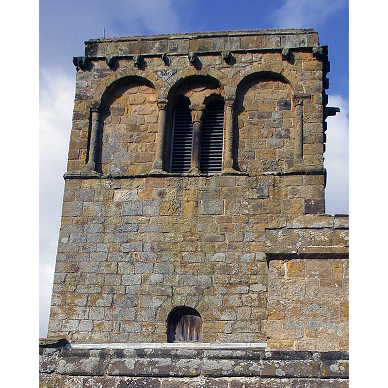
Scene Description: Source caption: "Norman Tower at Leake. The C11th tower is the oldest part of Leake church."
Copyright Statement: Image copyright © Matthew Hatton, 2008
Image Source: digital photograph taken 22 March 2008 by Matthew Hatton [www.geograph.org.uk/photo/734316] [accessed 3 April 2016]
Copyright Instructions: CC-BY-SA-2.0
view of church exterior - south wall
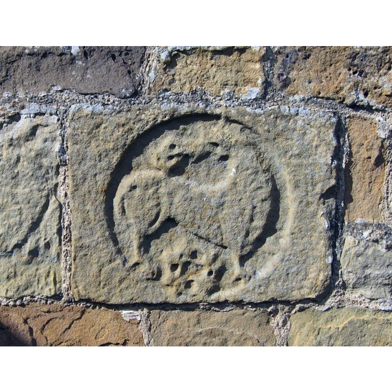
Scene Description: a lion, most likely -- near the south entranceway
Copyright Statement: Image copyright © Antonia, 2007
Image Source: digital photograph taken 12 August 2007 by Antonia [www.geograph.org.uk/photo/953286] [accessed 3 April 2016]
Copyright Instructions: CC-BY-SA-2.0
view of church exterior - north view
Copyright Statement: Image copyright © Bill Boaden, 2013
Image Source: digital photograph taken 31 August 2013 by Bill Boaden [www.geograph.org.uk/photo/3645251] [accessed 3 April 2016]
Copyright Instructions: CC-BY-SA-2.0
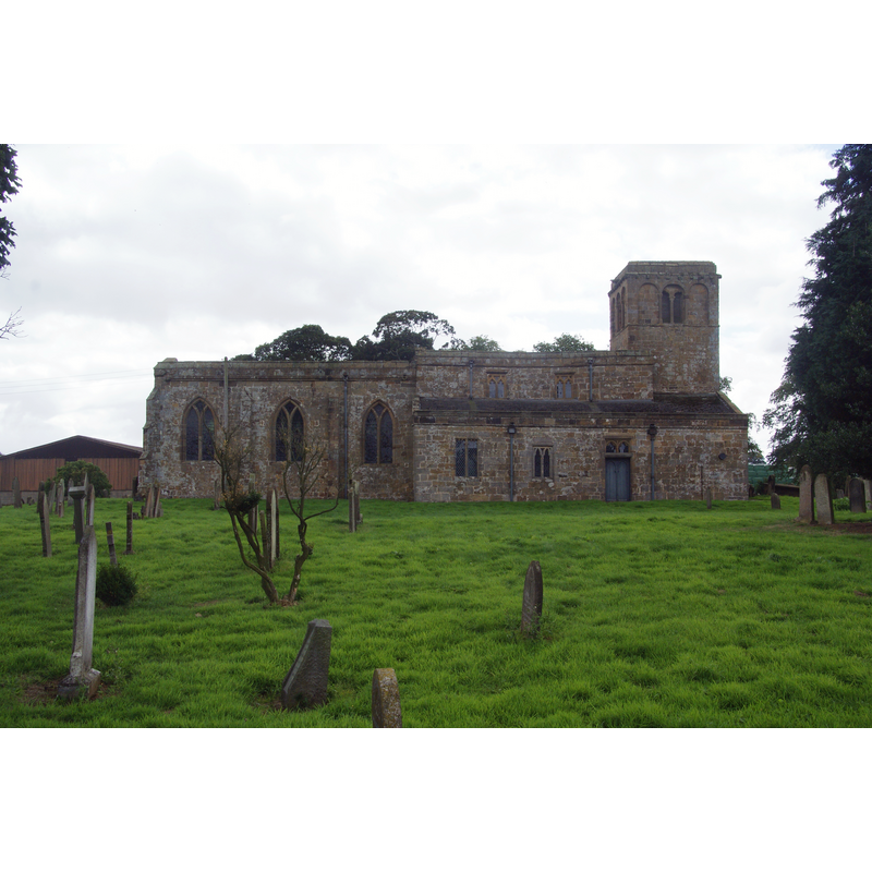
view of church exterior - southeast view
Copyright Statement: Image copyright © Peter Wood, 2014
Image Source: digital photograph taken 17 October 2014 by Peter Wood [www.geograph.org.uk/photo/4209732] [accessed 3 April 2016]
Copyright Instructions: CC-BY-SA-2.0
INFORMATION
Font ID: 11074LEA
Object Type: Baptismal Font1
Font Century and Period/Style: Medieval [altered]
Church / Chapel Name: Parish Church of St. Mary the Virgin
Font Location in Church: Inside the church, at the W end of the nave
Church Patron Saint(s): St. Mary the Virgin
Church Address: A19, Leake, Thirsk YO7 4BN, UK
Site Location: North Yorkshire, Yorkshire and the Humber, England, United Kingdom
Directions to Site: Located off (E) the A19, 10 km ESE of Northallerton
Ecclesiastic Region: Diocese of Thirsk
Historical Region: Hundred of Allerton
Additional Comments: altered font? (appears to have been re-tooled -- base is modern replacement)
Font Notes:
Click to view
There are two entries [one is multiple-place] for this Leake [variant spelling] in the Domesday survey [http://opendomesday.org/place/SE4390/leake/] [accessed 3 April 2016], neither of which mentions cleric or church in it. The entry for this parish in the Victoria County History (York North Riding, vol. 1, 1914) notes: "Early in the 12th century a church stood on this site consisting of the present west tower, a nave and a small chancel"; the only font in this church mentioned in the VCH entry is "a pewter font basin". Morris (1931) notes a "17th-cent. font-cover". So does Pevsner (1985): "An uncommonly substantial piece of the C17, heavily moulded. An acorn on the top." No mention is made of the font, which consists of a round basin with two (?) large roll mouldings as all ornamentation; the circular stem is plain; the lower end of the stem and the lower base are a modern replacement. The font appears old, probably medieval, and has had at least one repair of inserted stone; it has also been drastically re-tooled. The stone looks like a fine sandstone. The entry for this church in Historic England [Listing NGR: SE4331490632] notes: "Church C12, C13, C14 and C15. [...] Font cover, C17, heavily-moulded with acorn finial."
[NB: we have no information on the earlier font of this church which may go as far back as Anglo-Saxon times]
[NB: we have no information on the earlier font of this church which may go as far back as Anglo-Saxon times]
Credit and Acknowledgements: We are grateful to Robert Wilkes for his drawing of this church
COORDINATES
UTM: 30U 608461 6019100
Latitude & Longitude (Decimal): 54.30825, -1.33295
Latitude & Longitude (DMS): 54° 18′ 29.7″ N, 1° 19′ 58.62″ W
MEDIUM AND MEASUREMENTS
Material: stone, sandstone?
Font Shape: round, mounted
Basin Exterior Shape: round
LID INFORMATION
Date: 17th century?
Material: wood, oak?
Notes: [cf. FontNotes]
REFERENCES
- Victoria County History [online], University of London, 1993-. URL: https://www.british-history.ac.uk.
- Morris, Joseph Ernest, The North Riding of Yorkshire, London: Methuen & Co., 1931, p. 238
- Pevsner, Nikolaus, Yorkshire: the North Riding, Harmondsworth: Penguin Books, 1985 c1966, p. 227