Kildale No. 1 / Childale
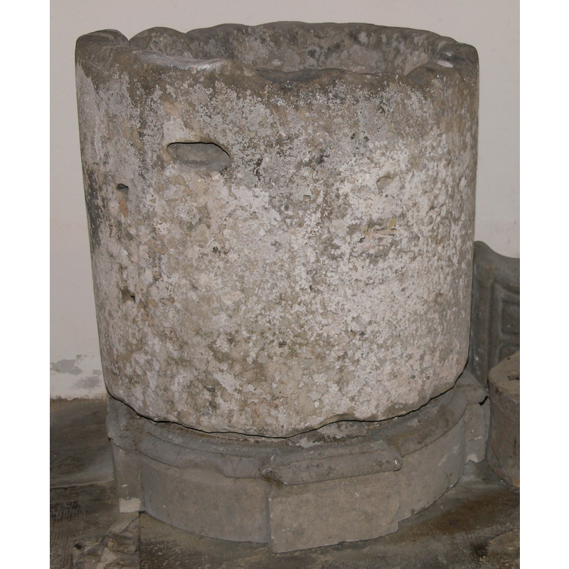
Image copyright © Colin Hinson, 2008
Standing permission
Results: 7 records
view of font
Copyright Statement: Image copyright © Colin Hinson, 2008
Image Source: digital photograph taken 2007 by Colin Hinson [www.yorkshireCDbooks.com]
Copyright Instructions: Standing permission
view of font
Copyright Statement: Image copyright © Colin Hinson, 2008
Image Source: digital photograph taken 2007 by Colin Hinson [www.yorkshireCDbooks.com]
Copyright Instructions: Standing permission
view of basin - interior
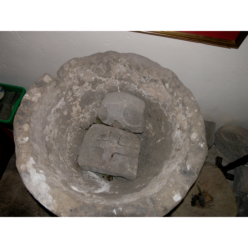
Copyright Statement: Image copyright © Colin Hinson, 2008
Image Source: digital photograph taken 2007 by Colin Hinson [www.yorkshireCDbooks.com]
Copyright Instructions: Standing permission
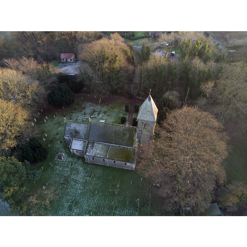
view of church exterior - east view
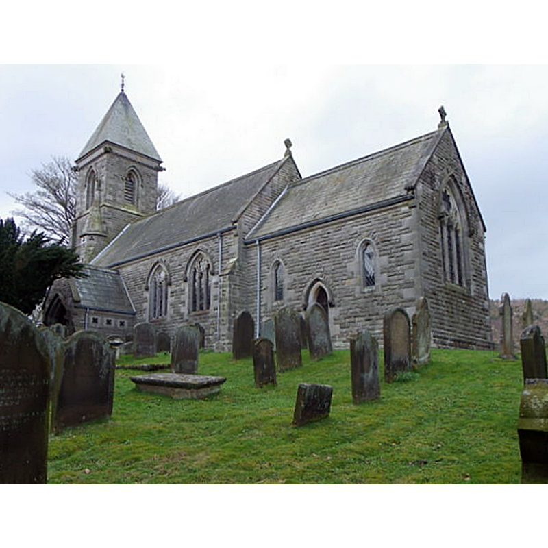
Scene Description: Source caption: "St Cuthbert's Church, Kildale. The church was rebuilt on the site of a previous church in 1868".
Copyright Statement: Image copyright © Maigheach-gheal, 2011
Image Source: digital photograph taken 4 April 2011 by Maigheach-gheal [www.geograph.org.uk/photo/2436443] [accessed 17 December 2019]
Copyright Instructions: CC-BY-SA-2.0
view of church exterior - north view
Copyright Statement: Image copyright © Colin Grice, 2016
Image Source: digital photograph taken 29 December 2016 by Colin Grice [www.geograph.org.uk/photo/5237829] [accessed 17 December 2019]
Copyright Instructions: CC-BY-SA-2.0
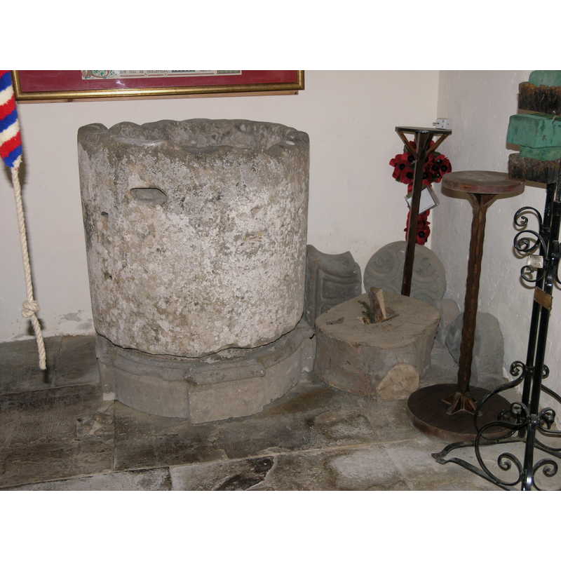
view of font in context
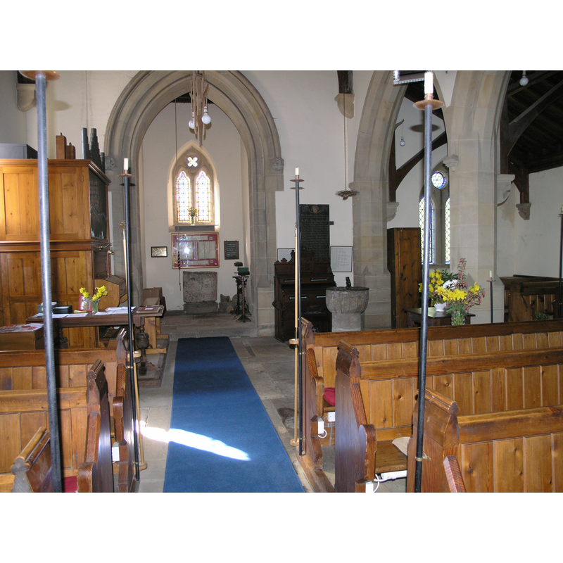
Scene Description: at the back, in the tower space
Copyright Statement: Image copyright © Colin Hinson, 2008
Image Source: digital photograph taken 2007 by Colin Hinson [www.yorkshireCDbooks.com]
Copyright Instructions: Standing permission
design element - patterns - fluted


INFORMATION
Font ID: 11073KIL
Object Type: Baptismal Font1
Font Century and Period/Style: 11th - 12th century, Norman
Church / Chapel Name: Parish Church of St. Cuthbert
Font Location in Church: Located beneath the tower [cf. FontNotes below]
Church Patron Saint(s): St. Cuthbert [aka Cubertus]
Church Address: Station Rd, Kildale, Whitby YO21 2RH, UK -- Tel.: +44 1642 710045
Site Location: North Yorkshire, Yorkshire and the Humber, England, United Kingdom
Directions to Site: Located E of the A172, 5 km WSW of Great Ayton, 9 km E of Stokesley
Ecclesiastic Region: Diocese of York
Historical Region: Hundred of Langbaurgh
Additional Comments: damaged font / disused font / abandoned font
Font Notes:
Click to view
There is an entry for Kildale [variant spelling] in the Domesday survey [https://opendomesday.org/place/NZ6009/kildale/] [accessed 17 December 2019]; it reports a priest and a church in it. The entry for this parish in the Victoria County History (York North Riding, vol. 2, 1923) notes: "There was a church with a priest at Kildale in the 11th century [...] The church of ST. CUTHBERT was entirely rebuilt in 1868 [...] Two preConquest stones have also been found, one the end of a cross arm and the other an incised cross, perhaps part of a grave slab, [...] as well as fragments of coped gravestones with rectilinear patterns which may belong to the same period, but are possibly postConquest. [...] Some old stones apparently of 12th-century date are built up into the walls of the porch outside, and in the churchyard is an ancient circular font, with raised vertical bands on the bowl." Morris (1931) wrote: "In the churchyard is an old circular font." Pevsner (1985) notes: "Font. Goblet-shaped, with slight flutes. Is it Norman?". It is likely that Morris saw the large tub-shaped font in the churchyard ca. 1931, whereas Pevsner was noted ca. 1965 only the smaller hemispherical mounted inside the church. Both fonts are inside the church now [April 2007]. The unused tub-shaped basin is badly damaged, especially at the upper rim, but also all around the outer surface; it has been raised on a short modern base and is now located beneath the tower. [cf. Index entry for Kildale No. 2 for the other font in this church]. [We are grateful to Colin Hinson, of www.yorkshireCDbooks.co.uk, for his photographs of church and font]
Credit and Acknowledgements: We are grateful to Colin Hinson, of www.yorkshireCDbooks.com, for his photographs of church and font.
COORDINATES
UTM: 30U 625114 6038426
Latitude & Longitude (Decimal): 54.47803, -1.069
Latitude & Longitude (DMS): 54° 28′ 40.91″ N, 1° 4′ 8.4″ W
MEDIUM AND MEASUREMENTS
Material: stone
Font Shape: tub-shaped
Basin Interior Shape: round
Basin Exterior Shape: round
Drainage System: centre hole in basin?
Drainage Notes: no lining
REFERENCES
- Victoria County History [online], University of London, 1993-. URL: https://www.british-history.ac.uk.
- Morris, Joseph Ernest, The North Riding of Yorkshire, London: Methuen & Co., 1931, p. 211
- Pevsner, Nikolaus, Yorkshire: the North Riding, Harmondsworth: Penguin Books, 1985 c1966, p. 207