Forcett / Forsate / Forset
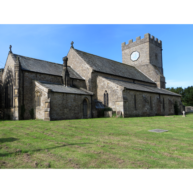
Image copyright © Peter Wood, 2015
CC-BY-SA-2.0
Results: 2 records
view of church exterior - northeast view
Copyright Statement: Image copyright © Peter Wood, 2015
Image Source: digital photograph taken 15 July 2015 by Peter Wood [www.geograph.org.uk/photo/4571536] [accessed 11 November 2019]
Copyright Instructions: CC-BY-SA-2.0
view of church exterior - southeast view
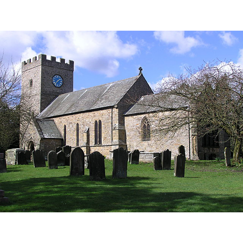
Scene Description: Source caption: "St. Cuthbert's Church: Forcett. Norman south doorway, tower and (re-used) south porch entry. The rest mostly from drastic restoration of 1859 which also produced refurnishing in high Victorian style. Many sculptural fragments (Anglo-Danish c800-1066) medieval coffin lids and worn effigy of 14th C. priest."
Copyright Statement: Image copyright © Hugh Mortimer, 2016
Image Source: digital photograph taken 10 April 2016 by Hugh Mortimer [www.geograph.org.uk/photo/163916] [accessed 11 November 2019]
Copyright Instructions: CC-BY-SA-2.0
INFORMATION
Font ID: 11067FOR
Object Type: Baptismal Font1?
Font Date: ca. 1130?
Font Century and Period/Style: 12th century (early?), Norman
Church / Chapel Name: Parish Church of St. Cuthbert
Church Patron Saint(s): St. Cuthbert [aka Cubertus]
Church Address: B6274, Forcett, Richmond DL11 7SD, UK -- Tel.: +44 1325 374634
Site Location: North Yorkshire, Yorkshire and the Humber, England, United Kingdom
Directions to Site: Located off (W) the B6274, 13-14 km S of Staindrop, by the county border with Durham
Ecclesiastic Region: Diocese of Leeds
Historical Region: Hundred of Land of Count Alan
Additional Comments: disappeared font? (only a 19th-century font remains in this Norman church)
Font Notes:
Click to view
There is a multiple-place entry for Forcett [variant spelling] in the Domesday survey [https://opendomesday.org/place/NZ1712/forcett/] [accesed 8 November 2019]; it includes two churches. The entry for this parish in the Victoria County History (York North Riding, vol. 1, 1914) notes: "The church of ST. CUTHBERT was practically rebuilt in 1859 and consists of chancel with south vestry, nave with north aisle, south porch and west tower. A good deal of old work is re-used in the tower and elsewhere, but the building as a whole has little historical interest. A number of early carved stones and architectural details have been built into the south porch. Its outer and inner doorways are both of 12th-century date, the former c. 1180, with foliate capitals and engaged shafts, the latter c. 1130 [...] The font, of 15th-century style, is modern". The present baptismal font in this church is a modern, probably from the mid-19th century Victorian renovation of the interior of this church; it is a plain octagonal basin raised on a central shaft and four attached colonnettes with moulded capitals and bases [source: This is the North East, Communigate www.communigate.co.uk]. The entry for this church in Historic England [Listing NGR: NZ1755612246] mentions no font in it. [NB: we have no information on the earlier font(s) of this church which dates back to Norman times]
COORDINATES
UTM: 30U 582154 6040431
Latitude & Longitude (Decimal): 54.50482, -1.73126
Latitude & Longitude (DMS): 54° 30′ 17.35″ N, 1° 43′ 52.54″ W
REFERENCES
- Victoria County History [online], University of London, 1993-. URL: https://www.british-history.ac.uk.