Felixkirk / Feliskirk
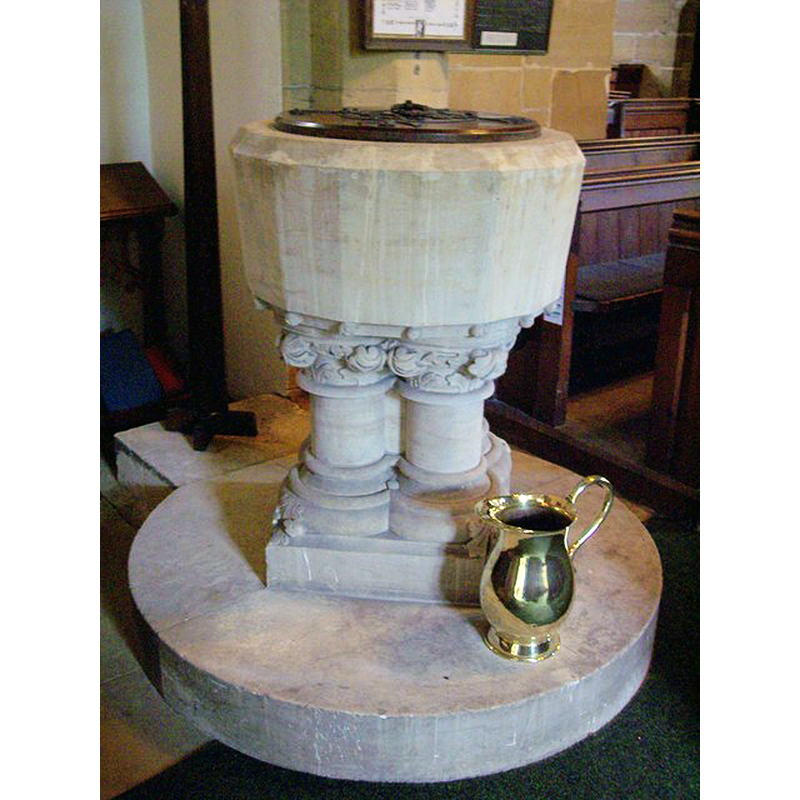
Image copyright © Maigheach-gheal, 2007
CC-BY-SA-2.0
Results: 4 records
view of font and cover
Scene Description: the modern font
Copyright Statement: Image copyright © Maigheach-gheal, 2007
Image Source: digital photograph taken 10 July 2007 by Maigheach-gheal [www.geograph.org.uk/photo/516994] [accessed 28 June 2017]
Copyright Instructions: CC-BY-SA-2.0
view of church exterior - south view
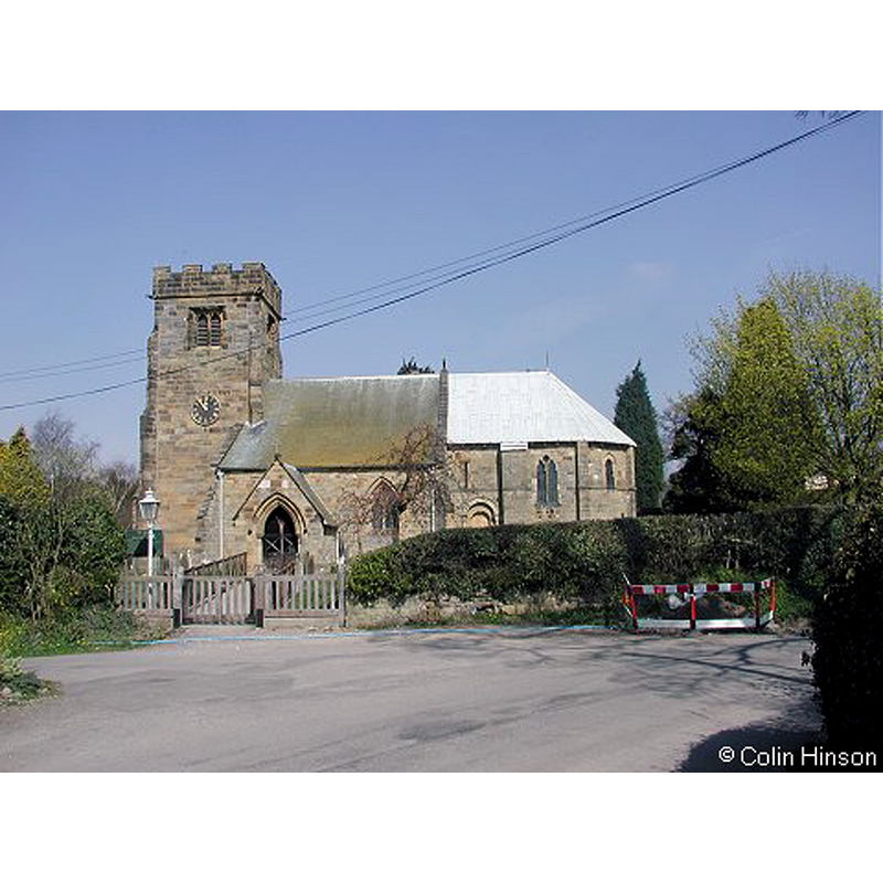
Copyright Statement: Image copyright © Colin Hinson, 2008
Image Source: digital photograph taken in 2008 by Colin Hinson
Copyright Instructions: Standing permission
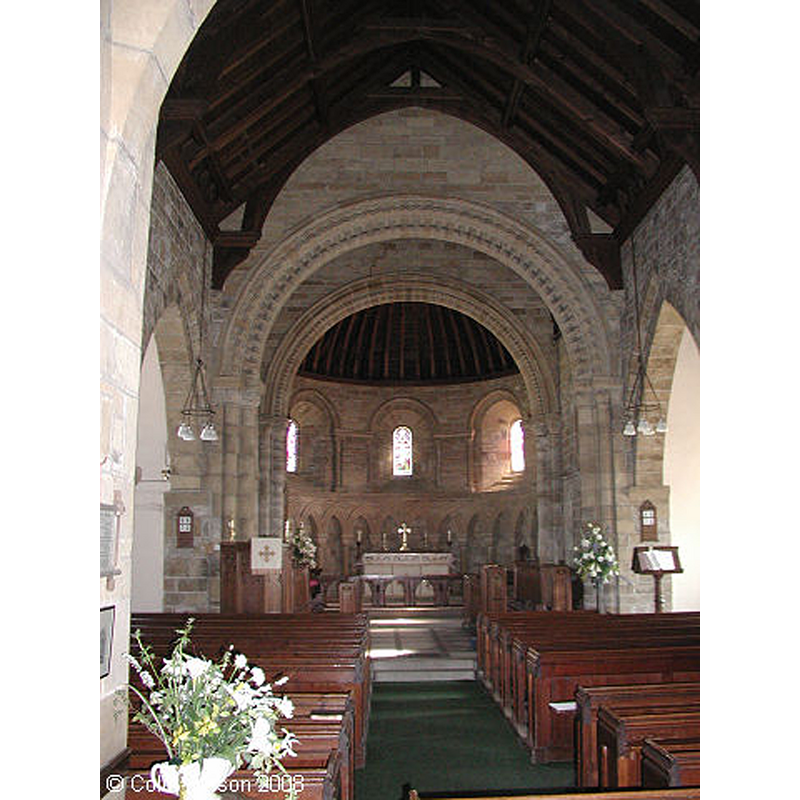
view of church interior - nave - looking west
![the modern font is partially visible at the far [west] end of the left [south] aisle](/static-50478a99ec6f36a15d6234548c59f63da52304e5/compressed/1170628026_compressed.png)
Scene Description: the modern font is partially visible at the far [west] end of the left [south] aisle
Copyright Statement: Image copyright © Colin Hinson, 2008
Image Source: digital photograph taken in 2008 by Colin Hinson
Copyright Instructions: Standing permission
view of church interior - nave - looking east
Copyright Statement: Image copyright © Colin Hinson, 2008
Image Source: digital photograph taken in 2008 by Colin Hinson
Copyright Instructions: Standing permission
INFORMATION
Font ID: 11066FEL
Object Type: Baptismal Font1, basin only
Font Century and Period/Style: 12th century, Late Norman
Church / Chapel Name: Parish Church of St. Felix [originally from the disappeared church at Sutton-under-Whitestonecliffe]
Font Location in Church: [cf. FontNotes]
Church Patron Saint(s): St. Felix
Church Address: Saint Johns Garth, Felixkirk, North Yorkshire, YO7 2EG
Site Location: North Yorkshire, Yorkshire and the Humber, England, United Kingdom
Directions to Site: Located 5 km NE of Thirsk
Ecclesiastic Region: Diocese of York
Historical Region: Hundred of Yarlestre
Additional Comments: disused font? [cf. FontNotes]
Font Notes:
Click to view
There is an entry for Felixkirk in the Domesday Survey [http://opendomesday.org/place/SE4684/felixkirk/] [accessed 29 June 2017] but it mentions neither priest nor church int. A description in The Hillside Villages North Yorkshire [www.thirsk.org.uk/felixkirk/stfelix1.html] signed "A.J.N." reads: "Entering through the modern porch one can see the basin of an early font which is believed to come from a long-disappeared church in the neighbouring village of Sutton-under-Whitestonecliffe. The font in the church is modern." Pevsner (1985) mentions neither.
Credit and Acknowledgements: We are grateful to Colin Hinson, of www.yorkshireCDbooks.com, for his photographs of church
COORDINATES
UTM: 30U 611883 6013400
Latitude & Longitude (Decimal): 54.2563, -1.2825
Latitude & Longitude (DMS): 54° 15′ 22.68″ N, 1° 16′ 57″ W
MEDIUM AND MEASUREMENTS
Material: stone