Yedingham nr. Scarborough No. 1 / Yeallingham / Yeddingham
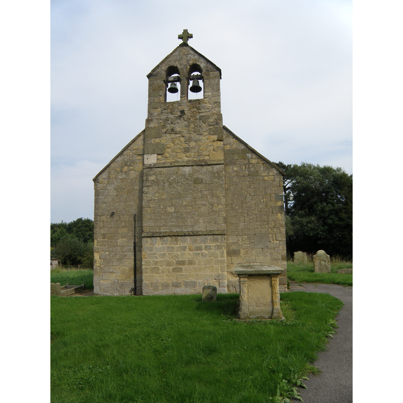
Image copyright © Martin Dawes, 2015
CC-BY-SA-2.0
Results: 4 records
view of church exterior - west view
Scene Description: FONT1 & 2 digital photograph taken September/October 2017 by Rita Wood, in the CRSBI [www.crsbi.ac.uk/site/3240/] [accessed 29 August 2019]
Copyright Statement: Image copyright © Martin Dawes, 2015
Image Source: digital photograph taken 3 September 2012 by Martin Dawes [www.geograph.org.uk/photo/3116360] [accessed 29 August 2019]
Copyright Instructions: CC-BY-SA-2.0
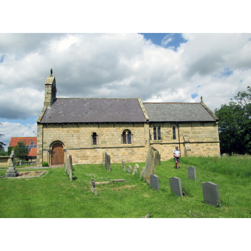
view of church exterior - south view
Copyright Statement: Image copyright © Martin Dawes, 2015
Image Source: digital photograph taken 9 July 2015 by Martin Dawes [www.geograph.org.uk/photo/4568389] [accessed 29 August 2019]
Copyright Instructions: CC-BY-SA-2.0
view of font

Copyright Statement: Image copyright © CRSBI, 2019
Image Source: digital photograph taken September/October 2017 by Rita Wood, in the CRSBI [www.crsbi.ac.uk/site/3240/] [accessed 29 August 2019]
Copyright Instructions: PERMISSION NOT AVAILABLE -- IMAGE NOT FOR PUBLIC USE
design element - motifs - moulding
Copyright Statement: Image copyright © CRSBI, 2019
Image Source: digital photograph taken September/October 2017 by Rita Wood, in the CRSBI [www.crsbi.ac.uk/site/3240/] [accessed 29 August 2019]
Copyright Instructions: PERMISSION NOT AVAILABLE -- IMAGE NOT FOR PUBLIC USE
INFORMATION
Font ID: 11062YED
Object Type: Baptismal Font1
Font Century and Period/Style: 12th century, Late Norman
Church / Chapel Name: Parish Church of St. John the Baptist [aka St. Mary]
Font Location in Church: [cf. FontNotes]
Church Patron Saint(s): St. John the Baptist [St Mary?]
Church Address: B1258, Malton YO17 8SL, UK -- Tel.: +44 1723 850954
Site Location: East Riding of Yorkshire, Yorkshire and the Humber, England, United Kingdom
Directions to Site: Located off the B1258, S of the A170, 14-15 km NE of Malton, 15-20 km WSW of Scarborough
Ecclesiastic Region: Diocese of York
Historical Region: Wapentake of Buckrose
Font Notes:
Click to view
No individual entry found for Yedingham in the Domesday survey. Lewis Dictionary of 1848 states that the Church of the Blessed Virgin Mary, ''a small ancient structure, with a tiled chancel, and a belfry, was dedicated in 1241". Sheahan & Whellan (1857) note that ''before the year 1163 Roger and Helewysia de Clere founded at this place a Priory, for nine nuns of the Benedictine Order, which was dedicated in honour of the Blessed Virgin''', but that ''two ancient arches and a piscina or holy water font, are the only remains of this establishment''. Sheahan & Whellan (ibid.) add that ''the church of Yeddingham was consecrated in 1241, and given to the above Priory, by Hanketin de Heslarton'' [NB: Heslerton, East and West, are two villages a few kms S of Yedingham]. Pevsner's 1966 book on the North Riding lists a Yedingham ''2 m. S. of Ebberston Church'' that matches the other locations, and reports that, south of Abbey Farm, ''is a long wall of a shed'' which he describes as ''the S wall of the aisless church'' and, near a doorway at its west end, ''inside, i.e., to the N, a handsome stoup with stiff-leaf and a trefoiled canopy'', all of which would fit the dedication date of 1241. There is no mention of an early font or stoup in Pevsner & Neave's 1995 work on the East Riding, although it includes a church dedicated to St. John the Baptist. The entry for this church in Historic England [Listing NGR: SE8933979580] notes: "Church. 1862-63. By William Butterfield and Tuke of Bradford. [...] Norman tub font on roll-moulded foot and octagonal base." The interior plan of this church in the benefice page [www.buckrosecarrs.org.uk/content/pages/documents/1313434725.pdf] [accessed 29 August 2019] shows the old font located at the northwest corner of the nave. The entry for this church in the CRSBI (2019) describes and illustrates the font: "there is a circular font with moulded profile [...] Cylindrical font on roughly square plinth. Short plain stem tapering slightly inward. The next joint is concealed from above by the small roll moulding; next there is a hollow chamfer, then the bowl, with a slight chamfer on the angle. The bowl tapers slightly outwards. Rim flat. The workmanship is not accurate, that is, the font was not turned on a lathe, but the profile is rather complex. "
COORDINATES
UTM: 30U 654479 6008835
Latitude & Longitude (Decimal): 54.20423, -0.6315
Latitude & Longitude (DMS): 54° 12′ 15.23″ N, 0° 37′ 53.4″ W
MEDIUM AND MEASUREMENTS
Material: stone
Rim Thickness: 8.25 cm [calculated]
Diameter (inside rim): 57 cm*
Diameter (includes rim): 73.5 cm*
Basin Depth: 32 cm*
Font Height (less Plinth): 91 cm*
Notes on Measurements: * CRSBI (2019)
REFERENCES
- Corpus of Romanesque Sculpture in Britain and Ireland, The Corpus of Romanesque Sculpture in Britain and Ireland, The Corpus of Romanesque Sculpture in Britain and Ireland. URL: http://www.crsbi.ac.uk.
- Lewis, Samuel, A Topographical Dictionary of Wales, Comprising the Several Counties, Cities, Boroughs, Corporate and Market Towns, Parishes, Chapelries, and Townships, with Historical and Statistical Descriptions [...], London: S. Lewis, 1833, p. 718
- Pevsner, Nikolaus, Yorkshire: York and the East Riding, London: Penguin, 1995, p. 770
- Pevsner, Nikolaus, Yorkshire: the North Riding, Harmondsworth: Penguin Books, 1985 c1966, p. 408
- Sheahan, James Joseph, History and topography of the city of York; the East Riding of Yorkshire and a portion of the West Riding […], Beverley: printed for the publishers by John Green, Market Place, 1857, p. 674