Barton / Barton Kirk
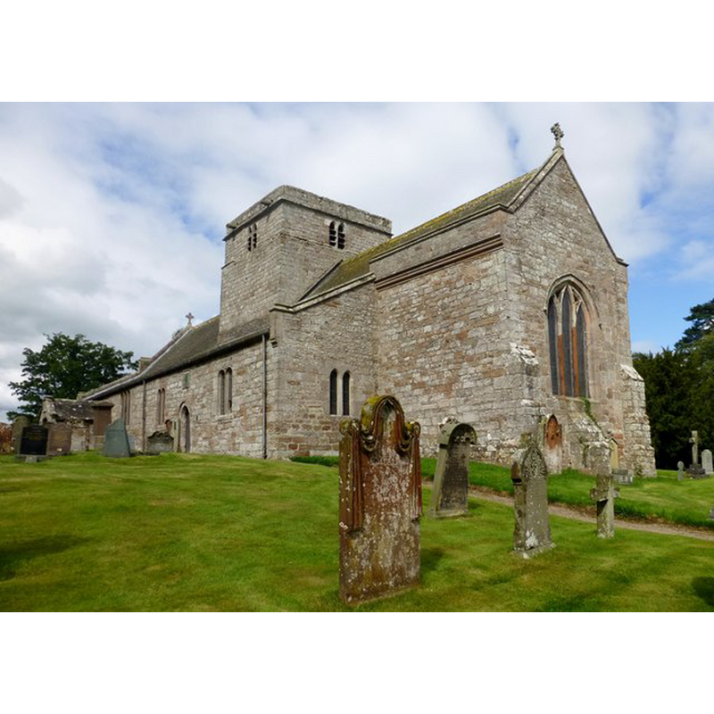
image copyright © Douglas Law, 2014
CC-BY-SA-2.0
Results: 3 records
view of church exterior - southeast view
Copyright Statement: image copyright © Douglas Law, 2014
Image Source: digital photograph taken 19 August 2014 by Douglas Law [www.geograph.org.uk/photo/4127737] [accessed 9 September 2014]
Copyright Instructions: CC-BY-SA-2.0
view of church interior - nave - looking east
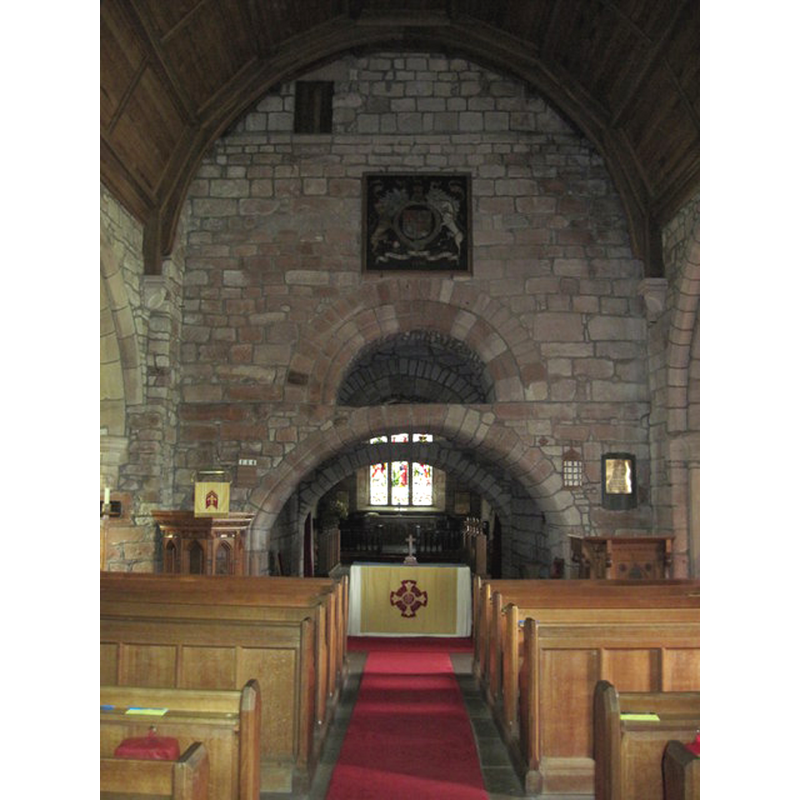
Scene Description: Source caption: "The altar is under the tower"
Copyright Statement: Image copyright © Martin Dawes, 2012
Image Source: digital photograph taken 17 May 2012 by Martin Dawes [www.geograph.org.uk/photo/3150253] [accessed 9 September 2014]
Copyright Instructions: CC-BY-SA-2.0
view of church interior - plan
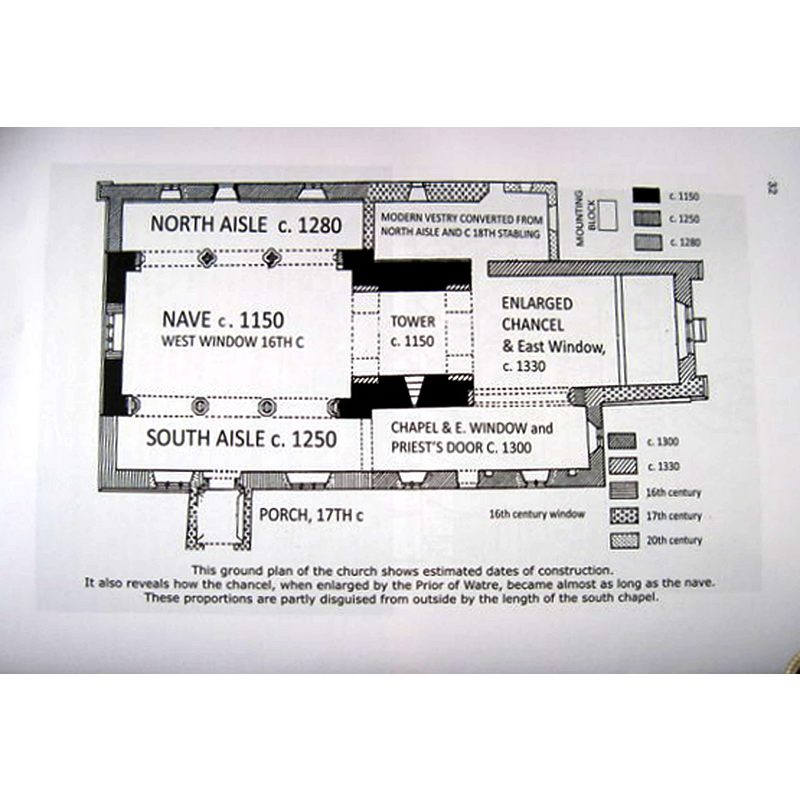
Copyright Statement: Image copyright © [in the public domain]
Image Source: B&W illustration [original source unknown] in Martin Dawes [www.geograph.org.uk/photo/3150258] [accessed 9 September 2014]
Copyright Instructions: PD
INFORMATION
Font ID: 11037BAR
Object Type: Baptismal Font1
Font Century and Period/Style: 13th - 14th century [base only?], Medieval [composite]
Church / Chapel Name: Parish Church of St. Michael
Font Location in Church: Inside the church
Church Patron Saint(s): St. Michael
Church Notes: tower and nave ca. 1150; south aisle 13thC; north aisle 14thC; south porch 17thC; restored 1904
Church Address: Barton, Tirril, near Penrith, Cumbria, CA10 2LR
Site Location: Cumbria, North West, England, United Kingdom
Directions to Site: Located off the B5320, SW of Penrith
Ecclesiastic Region: Diocese of Carlisle
Historical Region: Barony of Appleby -- formerly North Westmoreland
Additional Comments: recycled font? new bowl on an old base? -- disappeared font? (the one from the original 12thC church here)
Font Notes:
Click to view
Pevsner (1967) writes: "Font. The C14-looking font is not ancient, though the base seems to be." Noted in English Heritage [Listing NGR: NY4875126365] (1968): "C13 or C14 font, octagonal bowl splayed out from base, moulded angles", the church itself dated 12th-century for nave and tower. [NB: we have no information on the font of the original mid-12th century church here].
COORDINATES
UTM: 30U 513208 6053616
Latitude & Longitude (Decimal): 54.6298, -2.7954
Latitude & Longitude (DMS): 54° 37′ 47.28″ N, 2° 47′ 43.44″ W
MEDIUM AND MEASUREMENTS
Material: stone
Font Shape: octagonal, mounted
Basin Interior Shape: round
Basin Exterior Shape: octagonal
REFERENCES
- Curwen, John F., The Later Records relating to North Westmorland: or the Barony of Appleby, Kendal: T. Wilson, 1932, p. 256-277 / [www.british-history.ac.uk/report.aspx?compid=43518] [accessed 9 September 2014]
- Pevsner, Nikolaus, Cumberland and Westmorland, Harmondsworth: Penguin Books, 1967, p. 225