Cardington nr. Shrewsbury / Cardintune / Carditon / Cardynton
Results: 6 records
view of font and cover
![the modern font [cf. FontNotes]](/static-50478a99ec6f36a15d6234548c59f63da52304e5/compressed/1150626009_compressed.png)
Scene Description: the modern font [cf. FontNotes]
Copyright Statement: Image copyright © Basher Eyre, 2009
Image Source: digital photograph taken 12 August 2009 by Basher Eyre [www.geograph.org.uk/photo/1445938] [accessed 23 June 2015]
Copyright Instructions: CC-BY-SA-2.0
view of church exterior - southwest view
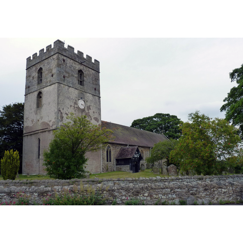
Copyright Statement: Image copyright © Richard Law, 2011
Image Source: digital photograph taken 31 July 2011 by Richard Law [www.geograph.org.uk/photo/2536031] [accessed 23 June 2015]
Copyright Instructions: CC-BY-SA-2.0
view of church exterior - southeast view
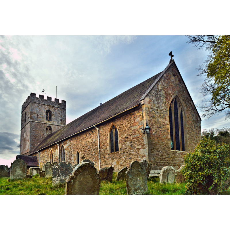
Copyright Statement: Image copyright © Philip Pankhurst, 2015
Image Source: digital photograph taken 17 April 2015 by Philip Pankhurst [www.geograph.org.uk/photo/4459098] [accessed 23 June 2015]
Copyright Instructions: CC-BY-SA-2.0
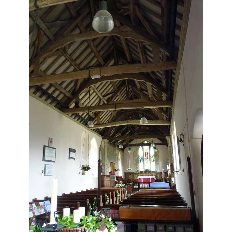
view of church interior - nave - looking west
![the modern font and its cover are partially visible at the far [west] end, behind the left [south] bank of benches](/static-50478a99ec6f36a15d6234548c59f63da52304e5/compressed/1150626008_compressed.png)
Scene Description: the modern font and its cover are partially visible at the far [west] end, behind the left [south] bank of benches
Copyright Statement: Image copyright © Basher Eyre, 2009
Image Source: digital photograph taken 12 August 2009 by Basher Eyre [www.geograph.org.uk/photo/1445992] [accessed 23 June 2015]
Copyright Instructions: CC-BY-SA-2.0
view of church interior - nave - looking east
Copyright Statement: Image copyright © Richard Law, 2011
Image Source: digital photograph taken 31 July 2011 by Richard Law [www.geograph.org.uk/photo/2534500] [accessed 23 June 2015]
Copyright Instructions: CC-BY-SA-2.0
INFORMATION
Font ID: 11009CAR
Object Type: Baptismal Font1
Font Century and Period/Style: 12th century (late?), Late Norman
Church / Chapel Name: Parish Church of St. James
Font Location in Church: [cf. FontNotes]
Church Patron Saint(s): St. James [since 1542 -- earlier dedication unknown]
Church Address: Cardington, Shropshire SY6 7JZ
Site Location: Shropshire, West Midlands, England, United Kingdom
Directions to Site: Located off (E) the A49, 15 km S of Shrewsbury
Ecclesiastic Region: Diocese of Hereford
Historical Region: Hundred of Culvestan [in Domesday] -- Hundred of Munslow
Additional Comments: disappeared font? / disused font? (the Norman font turned out of the church in the 1820s)
Font Notes:
Click to view
There is an entry for this Cardington [variant spelling] in the Domesday survey [http://opendomesday.org/place/SO5095/cardington/] [accessed 23 June 2015], but there is no mention of cleric or church in it. Anderson (1864) notes a very ancient church held by the Templars, and mentions "Arnolf, rector, in 1185". The Victoria County History (Shropshire, vol. 10, 1998) notes: "In 1185 Cardington was evidently a rectory in the patronage of the Templars, though the parson, Arnulf, rendered 3 marks a year to them for the church and 12d. pro fraternitate. [...] Bishop Vere (1186–98) appropriated the church [...] to the Templars of Lydley who evidently became patrons of the vicarage. [...] Parts of the church may be 12thcentury. [...] The eastern part of the nave is probably early 12th-century and one window and a blocked doorway survive in each side wall. The south doorway may have been enlarged in the later 12th century. Late in the 12th century the nave was extended west and new north and south doorways were made in the extension; the north doorway re-uses what is probably an older tympanum reversed. A Norman tub font with arcaded decoration was perhaps turned out in the 1820s." [NB: we have no information on the present whereabouts of the object]. Newman & Pevsner (2006) note an expansion of the nave in the 12th century, but do not mention a font in this church. The English Heritage entry for this church [Listing NGR: SO5063295148] (1958) notes reports a "stone font of 1868 in memory of the Rev. William Jones Hughes M.A. (d. 1865) has triple shafted stem with moulded bases and chamfered capitals, round bowl with chamfered top, and octagonal wooden cover".
COORDINATES
UTM: 30U 518308 5822414
Latitude & Longitude (Decimal): 52.55149, -2.729988
Latitude & Longitude (DMS): 52° 33′ 5.36″ N, 2° 43′ 47.96″ W
MEDIUM AND MEASUREMENTS
Material: stone
Font Shape: tub-shaped
Basin Interior Shape: round
Basin Exterior Shape: round
REFERENCES
- The Victoria History of the Counties of England: A History of the County of Shropshire, London: VCH, 1998, vol. X: 22-44
- Victoria County History [online], University of London, 1993-. URL: https://www.british-history.ac.uk.
- Anderson, John Corbet, Shropshire, its early history and antiquities, comprising […], London: Willis and Sotheran, 1864, p. 333-334
- Newman, John, Shropshire, New Haven: Yale University Press, 2006, p. 190