Boltongate
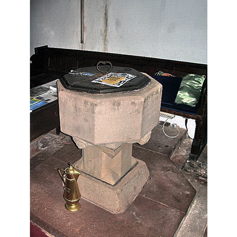
Image copyright © Alexander P Kapp, 2007
CC-BY-SA-2.0
Results: 4 records
view of font and cover
Copyright Statement: Image copyright © Alexander P Kapp, 2007
Image Source: digital photograph taken 20 July 2007 by Alexander P Kapp [www.geograph.org.uk/photo/476049] [accessed 11 October 2018]
Copyright Instructions: CC-BY-SA-2.0
human figure - head - 4
Scene Description: on the sides of the underbowl chamfer
Copyright Statement: Image copyright © Alexander P Kapp, 2007
Image Source: digital photograph taken 20 July 2007 by Alexander P Kapp [www.geograph.org.uk/photo/476049] [accessed 11 October 2018]
Copyright Instructions: CC-BY-SA-2.0
view of church exterior - southwest view
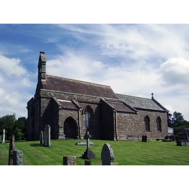
Copyright Statement: Image copyright © Alexander P Kapp, 2007
Image Source: digital photograph taken 20 June 2007 by Alexander P Kapp [www.geograph.org.uk/photo/476185] [accessed 11 October 2018]
Copyright Instructions: CC-BY-SA-2.0
view of church interior - nave - looking east
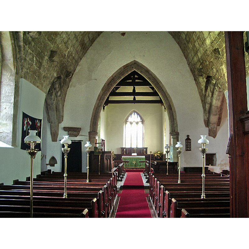
Copyright Statement: Image copyright © Alexander P Kapp, 2007
Image Source: digital photograph taken 20 July 2007 by Alexander P Kapp [www.geograph.org.uk/photo/476054] [accessed 11 October 2018]
Copyright Instructions: CC-BY-SA-2.0
INFORMATION
Font ID: 10996BOL
Object Type: Baptismal Font1
Font Century and Period/Style: 14h century (?) [re-cut?], Medieval [altered]
Church / Chapel Name: Parish Church of All Saints
Font Location in Church: Inside the church, at the W end of the nave
Church Patron Saint(s): All Saints
Church Address: 54° 45′ 21.6″ N, 3° 11′ 54.96″ W
Site Location: Cumbria, North West, England, United Kingdom
Directions to Site: Located off (S) the B5299, 2 km N of Ireby, 5 km SSW of Wigton
Ecclesiastic Region: Diocese of Carlisle
Historical Region: formerly Cumberland
Additional Comments: altered font? [cf. FontNotes] only the base is ancient
Font Notes:
Click to view
No individual entry found for Boltongate in the Domesday survey. Pevsner (1967) notes: "Font. Plain, octagonal, but on four primitive heads." The entry for this church in Historic England [Listing NGR: NY2295640772] notes: "Recut C14 font of which only the carving under the bowl is original."
COORDINATES
UTM: 30U 487219 6067658
Latitude & Longitude (Decimal): 54.756, -3.1986
Latitude & Longitude (DMS): 54° 45′ 21.6″ N, 3° 11′ 54.96″ W
MEDIUM AND MEASUREMENTS
Material: stone
Font Shape: octagonal, mounted
Basin Interior Shape: round
Basin Exterior Shape: octagonal
LID INFORMATION
Date: modern?
Material: wood, oak?
Apparatus: no
Notes: octagonal and flat, with metal decoration and ring handle; appears modern
REFERENCES
- Pevsner, Nikolaus, Cumberland and Westmorland, Harmondsworth: Penguin Books, 1967, p. 71