Whitby No. 1 / Witebi
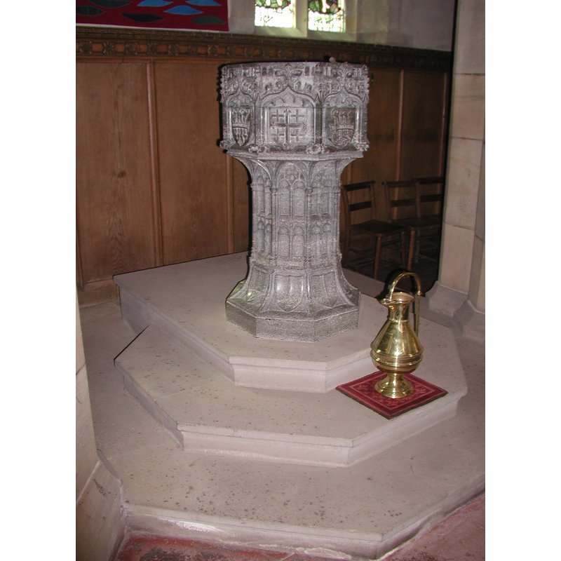
Image copyright © Colin Hinson, 2008
Image and permission received (e-mail of 13 August 2005)
Results: 9 records
view of font - southeast side
Copyright Statement: Image copyright © Colin Hinson, 2008
Image Source: Digital photograph from Colin Hinson [www.yorkshireCDbooks.com]
Copyright Instructions: Image and permission received (e-mail of 13 August 2005)
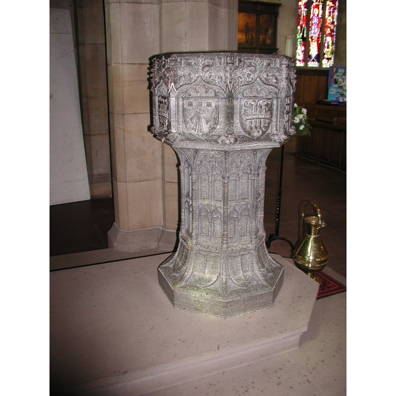
view of font - southwest side
Copyright Statement: Image copyright © Colin Hinson, 2008
Image Source: Digital photograph from Colin Hinson [www.yorkshireCDbooks.com]
Copyright Instructions: Image and permission received (e-mail of 13 August 2005)
design element - architectural - arch - cusped arch - 8
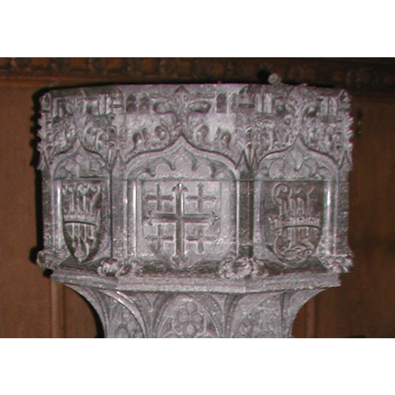
Scene Description: southeast view
Copyright Statement: Image copyright © Colin Hinson, 2008
Image Source: Digital photograph from Colin Hinson [www.yorkshireCDbooks.com]
Copyright Instructions: Image and permission received (e-mail of 13 August 2005)
symbol - shield - coat of arms - 8
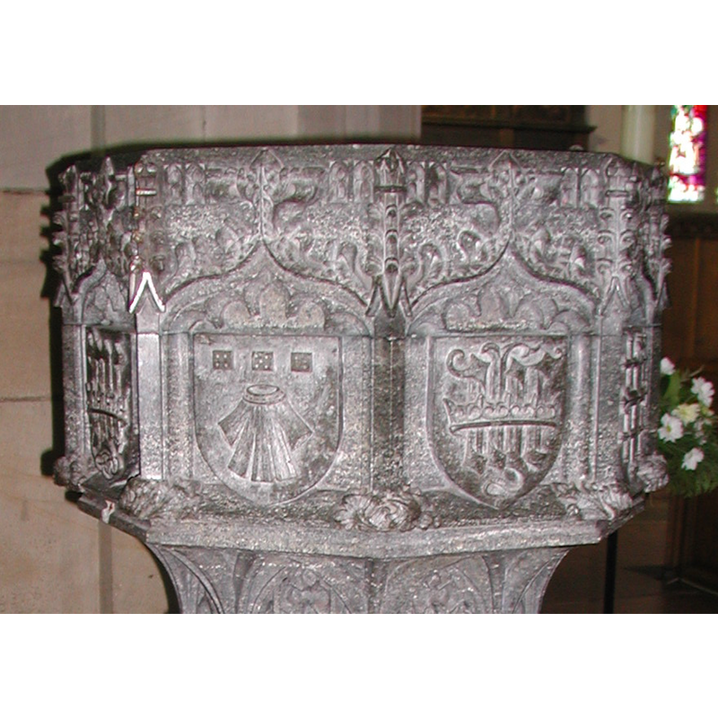
Scene Description: southwest view
Copyright Statement: Image copyright © Colin Hinson, 2008
Image Source: Digital photograph from Colin Hinson [www.yorkshireCDbooks.com]
Copyright Instructions: Image and permission received (e-mail of 13 August 2005)
view of church exterior in context
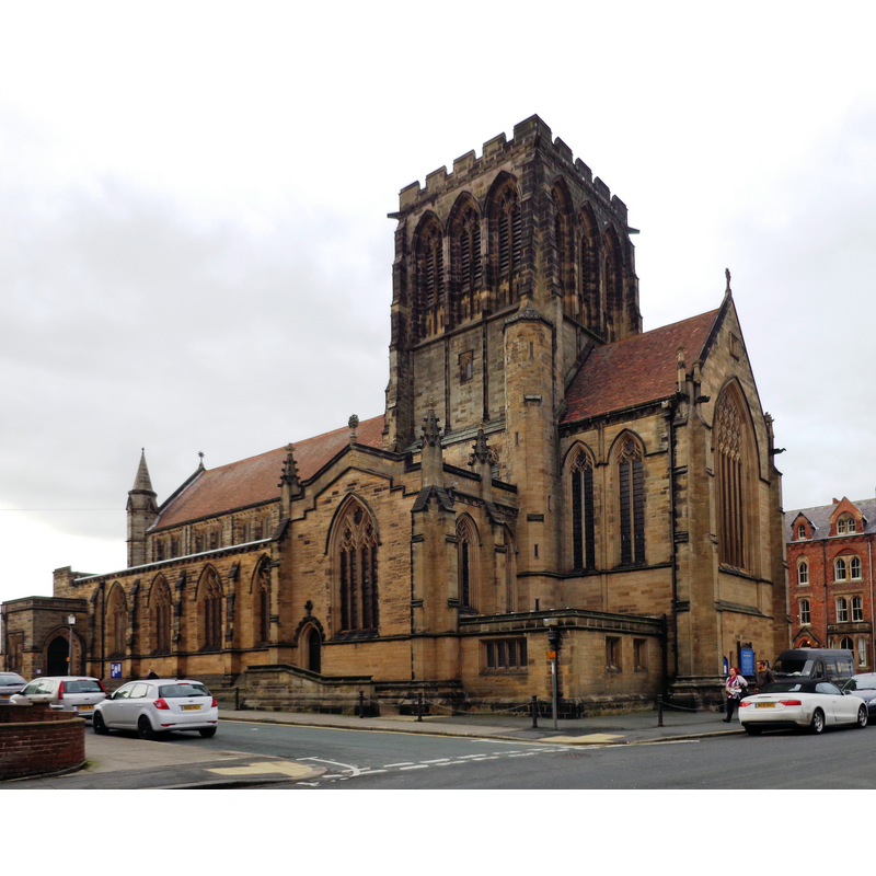
Copyright Statement: Image copyright © Bill Henderson, 2013
Image Source: edited detail of a digital photograph taken 7 February 2013 by Bill Henderson [www.geograph.org.uk/photo/3324254] [accessed 3 September 2019]
Copyright Instructions: CC-BY-SA-2.0
view of font in context
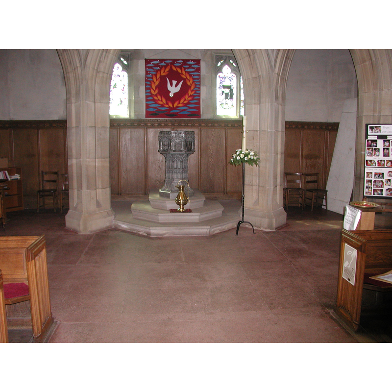
Copyright Statement: Image copyright © Colin Hinson, 2008
Image Source: Digital photograph from Colin Hinson [www.yorkshireCDbooks.com]
Copyright Instructions: Image and permission received (e-mail of 13 August 2005)
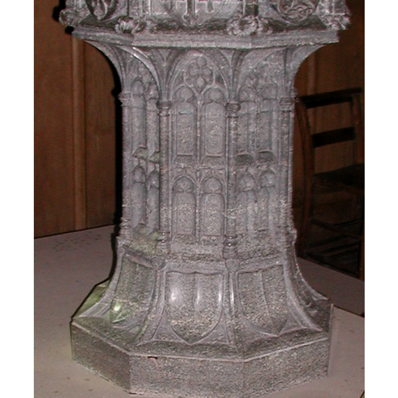
design element - architectural - arcade - blind - two-tiers - trefoiled arches
Copyright Statement: Image copyright © Colin Hinson, 2008
Image Source: Digital photograph from Colin Hinson [www.yorkshireCDbooks.com]
Copyright Instructions: Image and permission received (e-mail of 13 August 2005)
design element - motifs - tracery
Copyright Statement: Image copyright © Colin Hinson, 2008
Image Source: Digital photograph from Colin Hinson [www.yorkshireCDbooks.com]
Copyright Instructions: Image and permission received (e-mail of 13 August 2005)
symbol - shield - blank - 8
Copyright Statement: Image copyright © Colin Hinson, 2008
Image Source: Digital photograph from Colin Hinson [www.yorkshireCDbooks.com]
Copyright Instructions: Image and permission received (e-mail of 13 August 2005)
INFORMATION
Font ID: 10994WHI
Object Type: Baptismal Font1
Font Date: ca. 1888?
Font Century and Period/Style: 19th century (late?), Victorian
Church / Chapel Name: Parish Church of St. Hilda (C of E)
Font Location in Church: Inside the church, in the W end
Church Patron Saint(s): St. Hilda [aka Hild, Hilde]
Church Notes: present church is 19thC
Church Address: 1889 Church Square, Whitby YO21 3EG, UK -- Tel.: +44 947 606578
Site Location: North Yorkshire, Yorkshire and the Humber, England, United Kingdom
Directions to Site: Located off (N) the A171, in the West Cliff area, left bank of the Esk river, 32 km NW of Scarborough
Ecclesiastic Region: Diocese of York
Historical Region: Hundred of Langbaurgh
Font Notes:
Click to view
The entry for this parish in the Victoria County History (York North Riding, vol. 2, 1923) notes: "ST. HILDA'S Church, on the west cliff, was built in 1885 [...] dark marble carved font in the style of the 15th century." Pevsner (1985) notes: "Font. In the Perp[endicular] style, of dark grey marble." Baptismal font of dark-grey stone [Frosterly marble?] probably from the time of the building which was consecrated in 1888; it consists of an octagonal basin the sides of which are decorated with cusped pointed arches, each containing a charged shield, raised on an octagonal pedestal base decorated with two tiers of arches (up-and-down) and tracery; the splaying lower base is decorated with plain shields. The whole is raised on a three-step plinth.
Credit and Acknowledgements: We are grateful to Colin Hinson, of www.yorkshireCDbooks.com, for the photographs of this font.
COORDINATES
UTM: 30U 654089 6040508
Latitude & Longitude (Decimal): 54.48876, -0.6211
Latitude & Longitude (DMS): 54° 29′ 19.54″ N, 0° 37′ 15.96″ W
MEDIUM AND MEASUREMENTS
Material: stone, marble [Frosterly marble?]
Font Shape: octagonal, mounted
Basin Interior Shape: round
Basin Exterior Shape: octagonal
REFERENCES
- Victoria County History [online], University of London, 1993-. URL: https://www.british-history.ac.uk.
- Pevsner, Nikolaus, Yorkshire: the North Riding, Harmondsworth: Penguin Books, 1985 c1966, p. 395