Oswaldkirk / Oswaldescherca / Oswaldeschercha
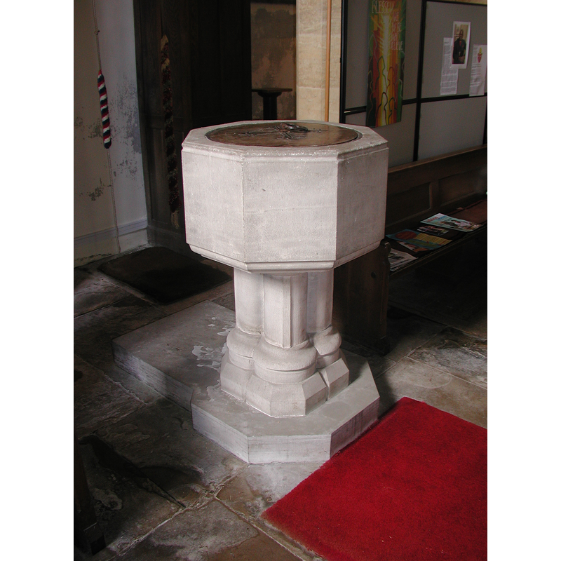
Image copyright © Colin Hinson, 2008
Image and permission received (e-mail of 13 August 2005)
Results: 6 records
view of font and cover
Copyright Statement: Image copyright © Colin Hinson, 2008
Image Source: Colin Hinson [www.yorkshireCDbooks.com]
Copyright Instructions: Image and permission received (e-mail of 13 August 2005)
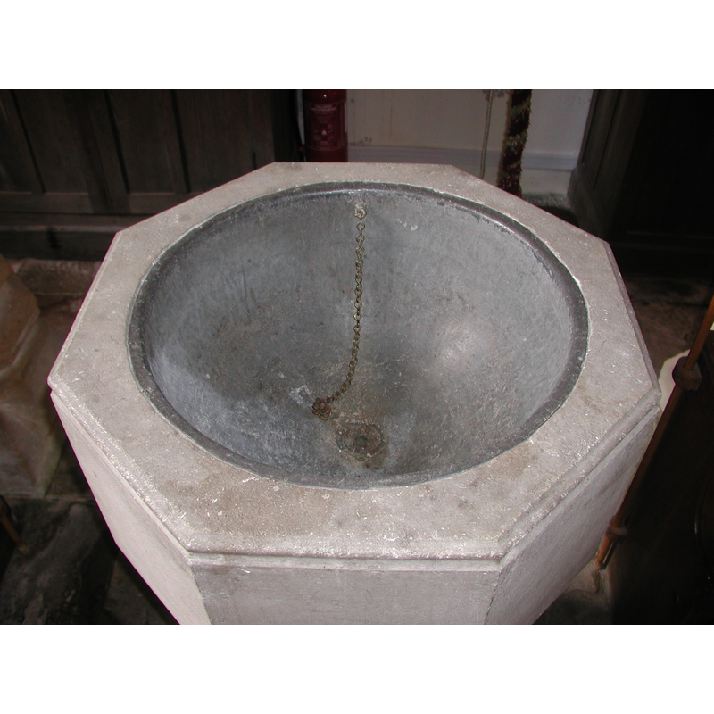
view of basin - interior
Copyright Statement: Image copyright © Colin Hinson, 2008
Image Source: Colin Hinson [www.yorkshireCDbooks.com]
Copyright Instructions: Image and permission received (e-mail of 13 August 2005)
view of church exterior - southeast view
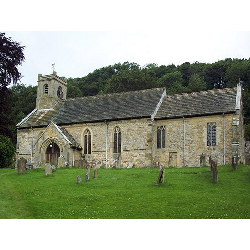
Scene Description: Source caption: "St Oswalds (King and Martyr) Church, Oswaldkirk. King Oswald worked with St Aidan to bring the Gospel to the North Saxons. Christian worship may have started in the village at this time. A wooden church was probably built and dedicated after Oswald was killed in AD642."
Copyright Statement: Image copyright © Trish Steel, 2007
Image Source: edited detail of a digital photograph taken 12 July 2007 by Trish Steel [www.geograph.org.uk/photo/496194] [accessed 14 December 2020]
Copyright Instructions: CC-BY-SA-2.5
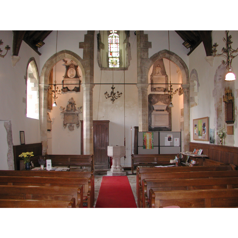
view of font in context
Copyright Statement: Image copyright © Colin Hinson, 2008
Image Source: Colin Hinson [www.yorkshireCDbooks.com]
Copyright Instructions: Image and permission received (e-mail of 13 August 2005)
design element - architectural - column - 4
Copyright Statement: Image copyright © Colin Hinson, 2008
Image Source: Colin Hinson [www.yorkshireCDbooks.com]
Copyright Instructions: Image and permission received (e-mail of 13 August 2005)
design element - motifs - moulding
Copyright Statement: Image copyright © Colin Hinson, 2008
Image Source: Colin Hinson [www.yorkshireCDbooks.com]
Copyright Instructions: Image and permission received (e-mail of 13 August 2005)
INFORMATION
Font ID: 10991OSW
Object Type: Baptismal Font1?
Font Century and Period/Style: 10th - 11th century, Pre-Conquest
Church / Chapel Name: Parish Church of St. Oswald
Church Patron Saint(s): St. Oswald of Nothumbria
Church Address: Main St, Oswaldkirk, York YO62 5XT, UK
Site Location: North Yorkshire, Yorkshire and the Humber, England, United Kingdom
Directions to Site: Located off (S) the A170, at the B1257-B1363 crossroads, 25 km E of Thirsk
Ecclesiastic Region: Diocese of York
Historical Region: Hundred of Maneshou
Additional Comments: disappeared font? (no info on the earlier font(s) of this church which may go back to the 10th century)
Font Notes:
Click to view
There are two entries for Oswaldkirk [variant spelling] in the Domesday survey [https://opendomesday.org/place/SE6278/oswaldkirk/] [accessed 3 December 2019] neither of which mentions cleric or church in it. The entry for this parish in the Victoria County History (York North Riding, vol. 1, 1914) notes: "The nave appears to be of late 12th-century date, but the only detail now surviving of this period is the north doorway, now built up, a small narrow roundarched window immediately to the westward of it and two capitals built into the jambs of the south doorway, rebuilt in the 16th century"; no font mentioned in it. The entry for this church in Historic England [Listing NGR: SE6208578922] notes: "Church. C12 nave with late C13 insertions and 1886 restoration including substantial rebuilding of chancel"; no font mentioned in it. The baptismal font in the church of St. Oswald is modern, probably of the 19th century; it consists of an octagonal basin raised on a columnar base, quadrangular lower base and rectangular plinth with chamfered front angles; the basin is plain except for two grooves at the upper and lower rims; the base has four attached colonnettes with moulded bases; the inner well of the basin is round and lined, and has a central drain; the cover is plain, modern as well. [The original church of St. Oswald may go back as early as the 10th century as witnessed by the fragments of hogback tombs still kept in the church, but we have no record of the earlier font[s] of this church].
Credit and Acknowledgements: We are grateful to Colin Hinson, of www.yorkshireCDbooks.com, for the photographs of this font.
COORDINATES
UTM: 30U 627212 6007778
Latitude & Longitude (Decimal): 54.202222, -1.049722
Latitude & Longitude (DMS): 54° 12′ 8″ N, 1° 2′ 59″ W
LID INFORMATION
Date: modern
Material: wood
Apparatus: no
Notes: flat and plain
REFERENCES
- Victoria County History [online], University of London, 1993-. URL: https://www.british-history.ac.uk.