Kirby Misperton / Cherchebi / Chirchebi / Kirby-over-Carr / Kirkby Misperton / Kirkeby Misperton / Kyrkby Mysperton / Kyrkby Overcarr
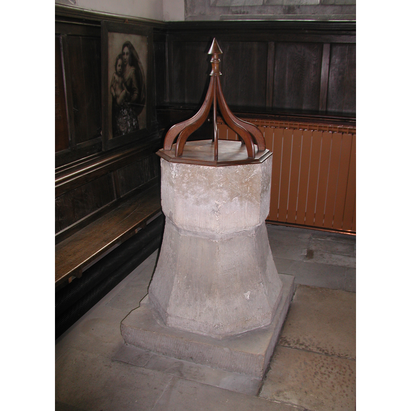
Image copyright © Colin Hinson, 2008
Image and permission received (e-mail of 13 August 2005)
Results: 5 records
view of font and cover
Copyright Statement: Image copyright © Colin Hinson, 2008
Image Source: digital photograph taken by Colin Hinson [www.yorkshireCDbooks.com]
Copyright Instructions: Image and permission received (e-mail of 13 August 2005)
view of font
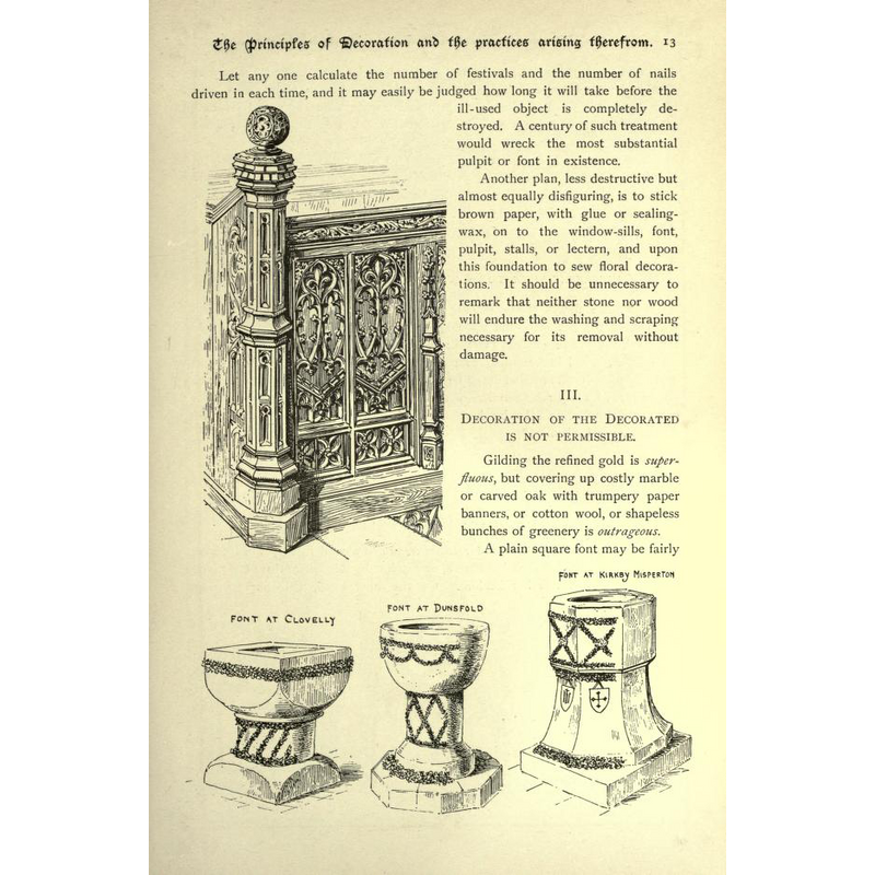
Scene Description: this illustration in Geldart (1899) shows his guidelines for 'permissible' font decoration
view of basin - interior
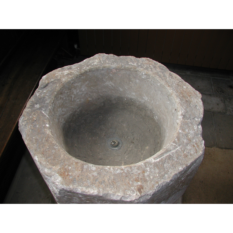
Copyright Statement: Image copyright © Colin Hinson, 2008
Image Source: digital photograph taken by Colin Hinson [www.yorkshireCDbooks.com]
Copyright Instructions: Image and permission received (e-mail of 13 August 2005)
view of church exterior - southwest view
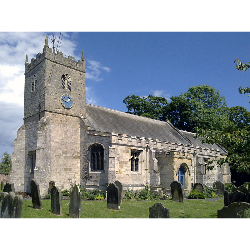
Copyright Statement: Image copyright © Nigel Coates, 2009
Image Source: digital photograph taken 15 June 2009 by Nigel Coates [https://commons.wikimedia.org/wiki/File:Kirby_Misperton_St_Laurences_June_2009_(Nigel_Coates).jpg] [accessed 14 September 2018]
Copyright Instructions: CC-BY-SA-2.0
view of font and cover in context
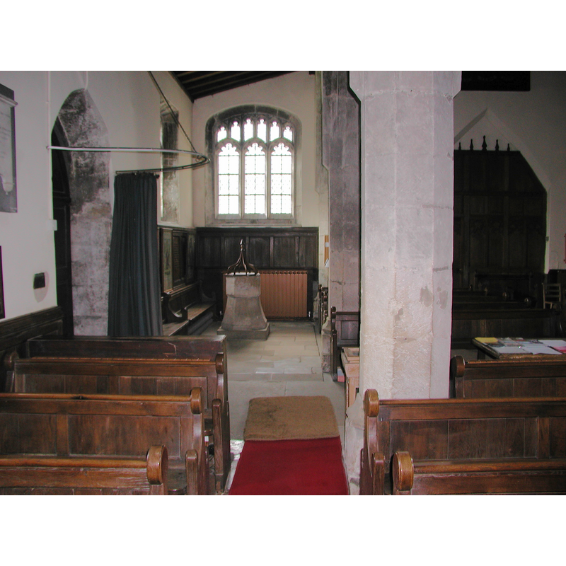
Copyright Statement: Image copyright © Colin Hinson, 2008
Image Source: digital photograph taken by Colin Hinson [www.yorkshireCDbooks.com]
Copyright Instructions: Image and permission received (e-mail of 13 August 2005)
INFORMATION
Font ID: 10988KIR
Object Type: Baptismal Font1
Font Century and Period/Style: 13th - 14th century [basin only] [composite font], Medieval [composite]
Church / Chapel Name: Parish Church of St. Lawrence
Font Location in Church: Inside the church, W end, S side, just W of the S door
Church Patron Saint(s): St. Lawrence [aka Laurence]
Church Address: Kirby Misperton Rd, Kirby Misperton, Malton YO17 , UK -- Tel.: 01751 476686
Site Location: North Yorkshire, Yorkshire and the Humber, England, United Kingdom
Directions to Site: Located off (W) the A169, 6 km SSW of Pickering, 11 km N of Malton
Ecclesiastic Region: Diocese of York
Historical Region: Hundred of Maneshou -- formerly in the North Riding of Yorkshire
Additional Comments: composite font (the medieval basin is raised on a 19thC pedestal base) -- disappeared font? (the one from the Domesday-time church here)
Font Notes:
Click to view
There is an entry for Kirby [Misperton] [variant spelling] in the Domesday survey [https://opendomesday.org/place/SE7779/kirby-misperton/] [accessed 14 September 2018]; it reports a priest and "0.5 churches" in it. The National Gazetteer of 1868 reports a font here. Illustrated in Geldart (1899). The entry for this parish in the Victoria County History (York, North Riding, vol. 4, 1923) notes: "There were a church and priest at Kirkby Misperton in 1086 [...] portion of the existing building appears to date from earlier than the 15th century, when a complete reconstruction took place. The site is, however, of great antiquity, as numerous Saxon stones are built into the present fabric, and a drawing of the interior in 1873, preserved in the vestry, appears to indicate the existence of an early Norman chancel arch. The church has, however, since then been considerably altered and restored, the chancel being entirely rebuilt and the south porch added. The upper stage of the tower is an early 19th-century reconstruction. [...] The font has a plain octagonal bowl." The entry for this church in Historic England [Listing NGR: SE7792379545] notes: "Octagonal font on C19 pedestal." Baptismal font consisting of an octagonal basin with plain vertical sides and a rounded underbowl, raised on a splaying base, also octagonal and a rectangular plinth; the upper rim of the basin shows some damage; the inner well of the basin is not lined but has a central drain. Modern octagonal wooden cover, arrow finial over an eight-rib arrangement. [NB: the churches at Great Barugh, Great Habton and Ryton are identified in the VCH entry (ibid.) as mid-19th century].
Credit and Acknowledgements: We are grateful to Colin Hinson, of www.yorkshireCDbooks.com, for the photographs of this font.
COORDINATES
UTM: 30U 642147 6008555
Latitude & Longitude (Decimal): 54.205278, -0.820556
Latitude & Longitude (DMS): 54° 12′ 19″ N, 0° 49′ 14″ W
MEDIUM AND MEASUREMENTS
Material: stone
Font Shape: octagonal, mounted
Basin Interior Shape: round
Basin Exterior Shape: octagonal
Drainage System: centre hole in basin
Drainage Notes: no lining
LID INFORMATION
Date: modern
Material: wood
Apparatus: no
Notes: [cf. FontNotes]
REFERENCES
- Victoria County History [online], University of London, 1993-. URL: https://www.british-history.ac.uk.