Cold Kirby / Carebi / Karebi / Keerby
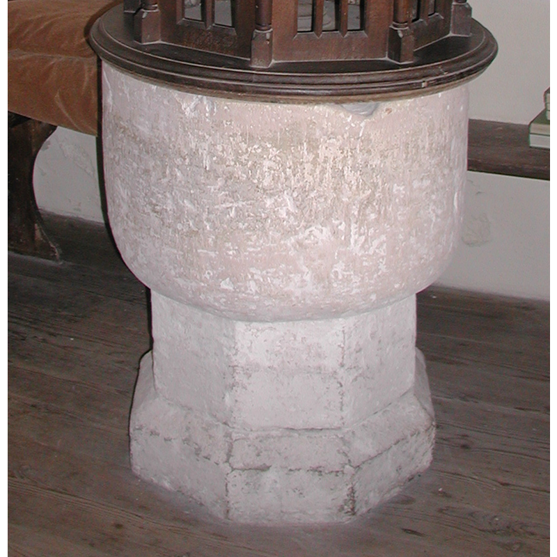
Image copyright © Colin Hinson, 2008
Image and permission received (e-mail of 13 August 2005)
Results: 8 records
view of font
Copyright Statement: Image copyright © Colin Hinson, 2008
Image Source: digital photograph August 2005 by Colin Hinson [www.yorkshireCDbooks.com]
Copyright Instructions: Image and permission received (e-mail of 13 August 2005)
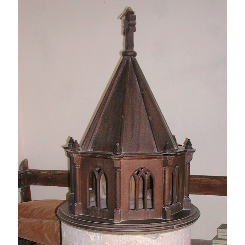
view of font and cover
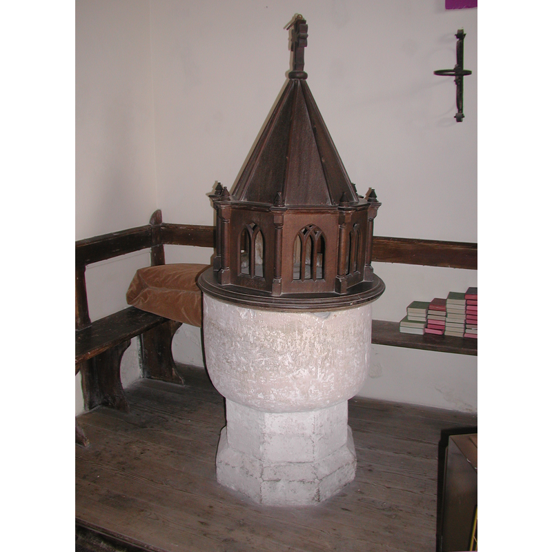
Copyright Statement: Image copyright © Colin Hinson, 2008
Image Source: digital photograph August 2005 by Colin Hinson [www.yorkshireCDbooks.com]
Copyright Instructions: Image and permission received (e-mail of 13 August 2005)
view of basin - interior
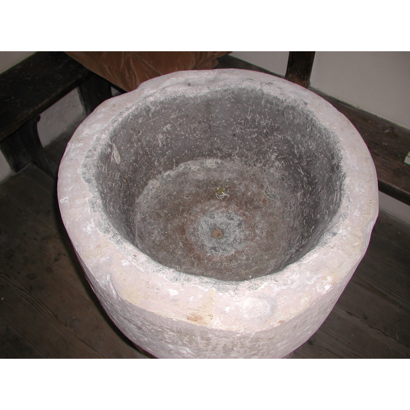
Copyright Statement: Image copyright © Colin Hinson, 2008
Image Source: digital photograph August 2005 by Colin Hinson [www.yorkshireCDbooks.com]
Copyright Instructions: Image and permission received (e-mail of 13 August 2005)
view of church exterior - southwest view
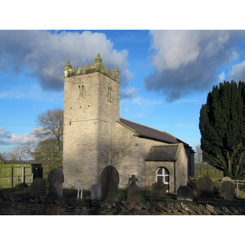
Scene Description: Source caption; "St Michael's Church was built in 1841 on the site of a much older church."
Copyright Statement: Image copyright © David Tyers, 2016
Image Source: digital photograph taken 21 February 2015 by David Tyers [www.geograph.org.uk/photo/4879692] [accessed 5 December 2019]
Copyright Instructions: CC-BY-SA-2.0
view of church exterior in context - southeast view
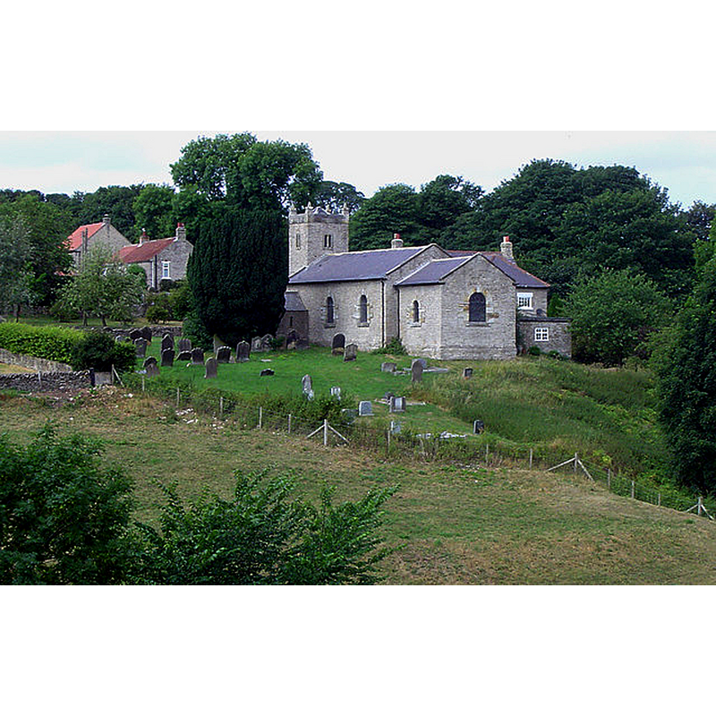
Copyright Statement: Image copyright © Scott Robinson, 2007
Image Source: digital photograph taken 27 July 2006 by Scott Robinson [www.geograph.org.uk/photo/516326] [accessed 5 December 2019]
Copyright Instructions: CC-BY-SA-2.0
view of church interior - looking east
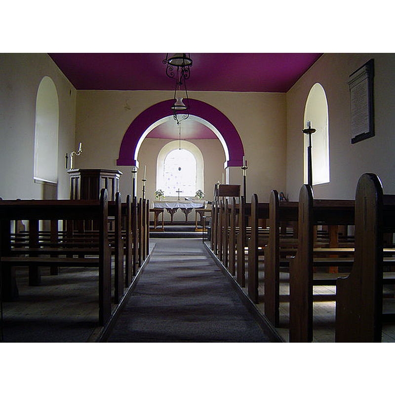
Copyright Statement: Image copyright © Scott Robinson, 2007
Image Source: digital photograph taken 27 July 2006 by Scott Robinson [www.geograph.org.uk/photo/516333] [accessed 5 December 2019]
Copyright Instructions: CC-BY-SA-2.0
view of font and cover in context
Copyright Statement: Image copyright © Colin Hinson, 2008
Image Source: digital photograph August 2005 by Colin Hinson [www.yorkshireCDbooks.com]
Copyright Instructions: Image and permission received (e-mail of 13 August 2005)
design element - architectural - building - church or chapel
Copyright Statement: Image copyright © Colin Hinson, 2008
Image Source: digital photograph August 2005 by Colin Hinson [www.yorkshireCDbooks.com]
Copyright Instructions: Image and permission received (e-mail of 13 August 2005)
INFORMATION
Font ID: 10978COL
Object Type: Baptismal Font1
Font Century and Period/Style: 12th century, Norman
Church / Chapel Name: Parish Church of St. Michael
Font Location in Church: Inside the church, in the W end of the nave, S side, by the S door
Church Patron Saint(s): St. Michael
Church Notes: Although the present church is from the mid-19th century, it replaced the older 12th-century parish church that had been administered by the Knights Templar until their demise, then by the Hospitallers until the Reformation
Church Address: Cold kirkby, Thirsk YO7 2HL, UK
Site Location: North Yorkshire, Yorkshire and the Humber, England, United Kingdom
Directions to Site: Located just 3-4 km W of Rievaulx, off the B1257 at the A170, 20-22 km E of Thirsk, in Upper Ryedale
Ecclesiastic Region: Diocese of York
Historical Region: Hundred of Bulford
Additional Comments: recycled font: re-used from the old 12th-century church
Font Notes:
Click to view
There is a multiple-place entry for [Cold] Kirby [variant spelling] in the Domesday survey [https://opendomesday.org/place/SE5384/cold-kirby/] [accessed 5 December 2019]; it mentions a priest and a church in it. The entry for this parish in the Victoria County History (York North Riding, vol. 2, 1923) notes that the church here "was entirely rebuilt in 1841, the only trace of the original building being the font, which has a circular 12th-century bowl on a short octagonal stem with a chamfered base. In the upper edge of the bowl are the holes where the staples of the cover were fixed." The VCH entry [ibid.] adds: "Another fragment, a small stoup, is in the possession of the village schoolmaster." Baptismal font of the original 12th-century church; it consists of a plain small hemispherical basin raised on an octagonal pedestal base; the inner well of the basin is lead lined and has a central darin hole. The wooden cover is in the shape of an octagonal chapel or church with tracery windows and a tall pyramidal roof; appears 19th-century. Not noted in Pevsner (1985).
Credit and Acknowledgements: We are grateful to Colin Hinson, of www.yorkshireCDbooks.com, for the photographs of this font.
COORDINATES
UTM: 30U 618431 6013256
Latitude & Longitude (Decimal): 54.25354, -1.1821
Latitude & Longitude (DMS): 54° 15′ 12.74″ N, 1° 10′ 55.56″ W
MEDIUM AND MEASUREMENTS
Material: stone
Font Shape: hemispheric, mounted
Basin Interior Shape: round
Basin Exterior Shape: round
Drainage System: centre hole in basin
Drainage Notes: lead lining
LID INFORMATION
Date: 19th century?
Material: wood, oak?
Apparatus: no
Notes: [cf. FontNotes]
REFERENCES
- Victoria County History [online], University of London, 1993-. URL: https://www.british-history.ac.uk.