Hilton nr. Huntingdon / Hiltone / Hulton
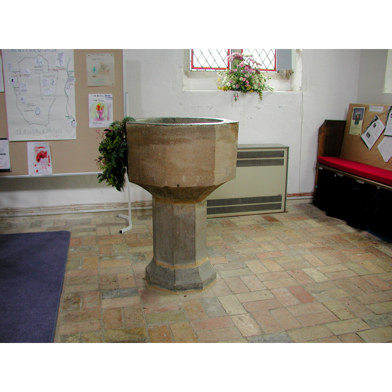
Image copyright © Colin Hinson, 2008
Image and permission received (10 July 2005)
Results: 5 records
view of font
Copyright Statement: Image copyright © Colin Hinson, 2008
Image Source: Digital photograph taken in 2005 by Colin Hinson [www.yorkshireCDbooks.com]
Copyright Instructions: Image and permission received (10 July 2005)
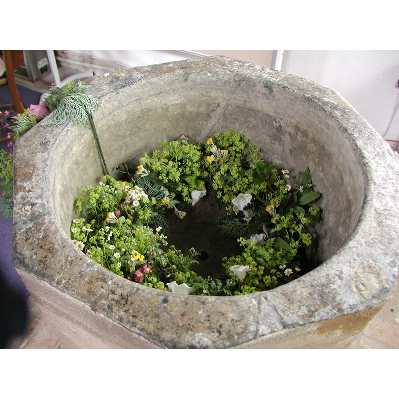
view of basin - interior
Copyright Statement: Image copyright © Colin Hinson, 2008
Image Source: Digital photograph taken in 2005 by Colin Hinson [www.yorkshireCDbooks.com]
Copyright Instructions: Image and permission received (10 July 2005)
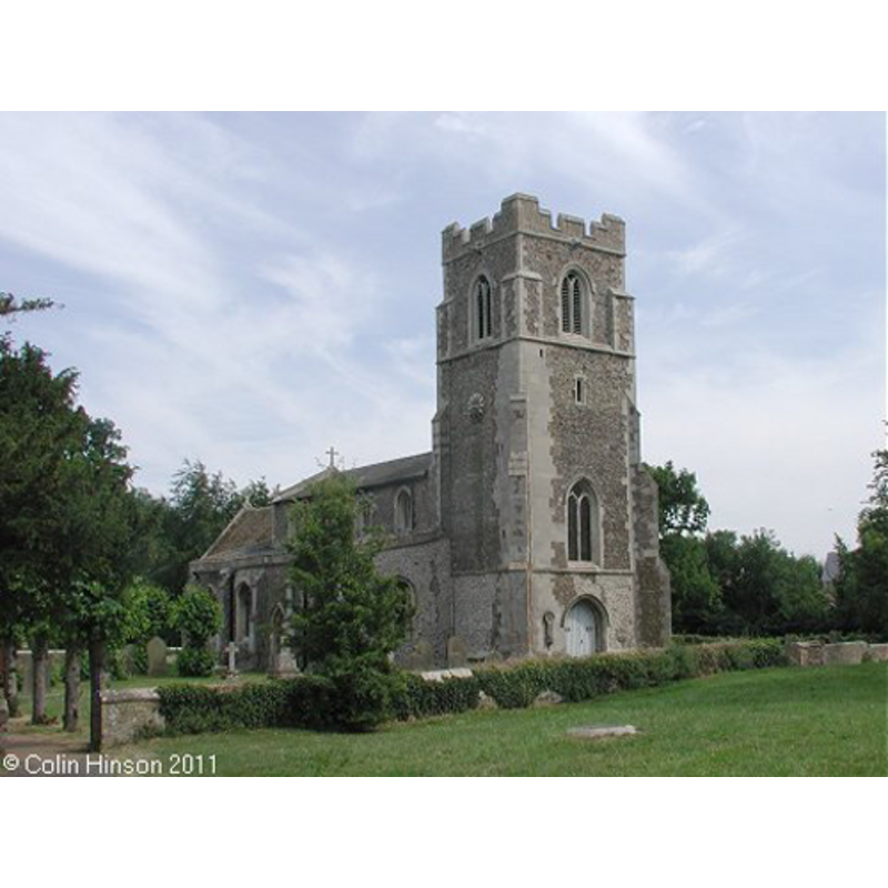
view of church exterior - northwest view
Copyright Statement: Image copyright © Colin Hinson, 2011
Image Source: Digital photograph taken by Colin Hinson [www.yorkshireCDbooks.com]
Copyright Instructions: Standing permission
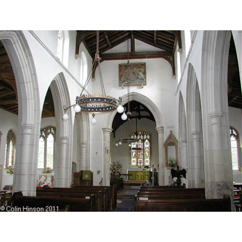
view of church interior - nave - looking east
Copyright Statement: Image copyright © Colin Hinson, 2011
Image Source: Digital photograph taken by Colin Hinson [www.yorkshireCDbooks.com]
Copyright Instructions: Standing permission
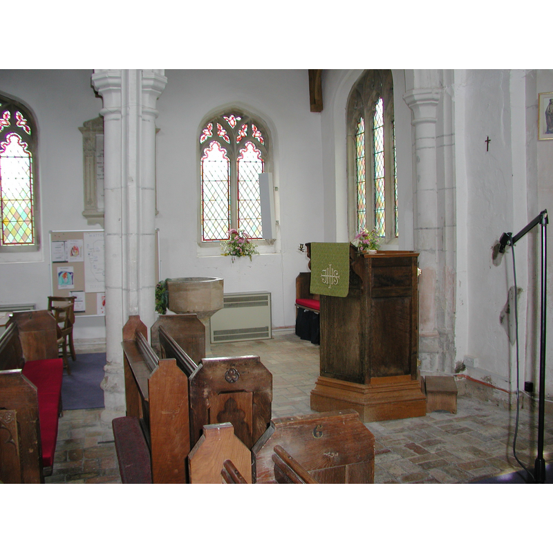
view of font in context
Copyright Statement: Image copyright © Colin Hinson, 2008
Image Source: Digital photograph taken in 2005 by Colin Hinson [www.yorkshireCDbooks.com]
Copyright Instructions: Image and permission received (10 July 2005)
INFORMATION
Font ID: 10951HIL
Object Type: Baptismal Font1
Font Century and Period/Style: 15th century?, Late Medieval
Church / Chapel Name: Parish Church [formerly Chapel] of St. Mary Magdalene
Font Location in Church: Inside the church, E end, N side
Church Patron Saint(s): St. Mary Magdalene
Church Notes: before 1873 it had been a chapelry of Fenstanton
Church Address: Church End, Hilton, Cambridgeshire PE28 9NY
Site Location: Cambridgeshire, East, England, United Kingdom
Directions to Site: Located off the B1040, 5 WSW of St. Ives, 7-8 km SE of Huntingdon, about 20 km WNW of Cambridge
Ecclesiastic Region: Diocese of Ely
Historical Region: formerly Huntingdonshire -- Hundred of Toseland
Font Notes:
Click to view
The Victoria County History (Huntingdon, vol. 2, 1932) notes: "The church, which was a chapelry to Fen Stanton, is not mentioned in the Domesday Survey (1086), but apparently there was a stone church here in the 12th century, of which small portions of walling and of impost moulding remain on each side of the chancel arch. The chancel arch and its responds are of the 13th century, and the tower of the late 14th century, but the rest of the church is wholly of 15th-century date. The church was restored in 1850 and 1889. [...] The 15th-century font is a plain octagon on an octagonal stem and base." The batismal font in this church consists of a plain octagonal basin with a chamfered underbowl, raised on a thin pedestal base with splaying lower base, both octagonal and as plain as the basin itself; although devoid of any decoration, the font probably dates to the major re-building of this church in the 15th century [cf. supra]; the font is now located in the east end of the nave, against one of the pillars of the arcade that divides the north aisle and the nave, probably not in its original location.
Credit and Acknowledgements: We are grateful to Colin Hinson, of www.yorkshireCDbooks.com, for his photographs of this church and font.
COORDINATES
UTM: 30U 697009 5795881
MEDIUM AND MEASUREMENTS
Material: stone
Font Shape: octagonal, mounted
Basin Interior Shape: round
Basin Exterior Shape: octagonal
Drainage Notes: lead lining
REFERENCES
- Victoria County History [online], University of London, 1993-. URL: https://www.british-history.ac.uk.