Eltisley / Hecteslei
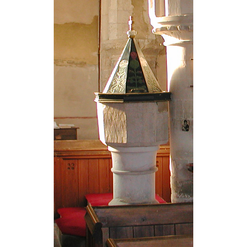
Image copyright © Colin Hinson, 2008
Standing permission
Results: 5 records
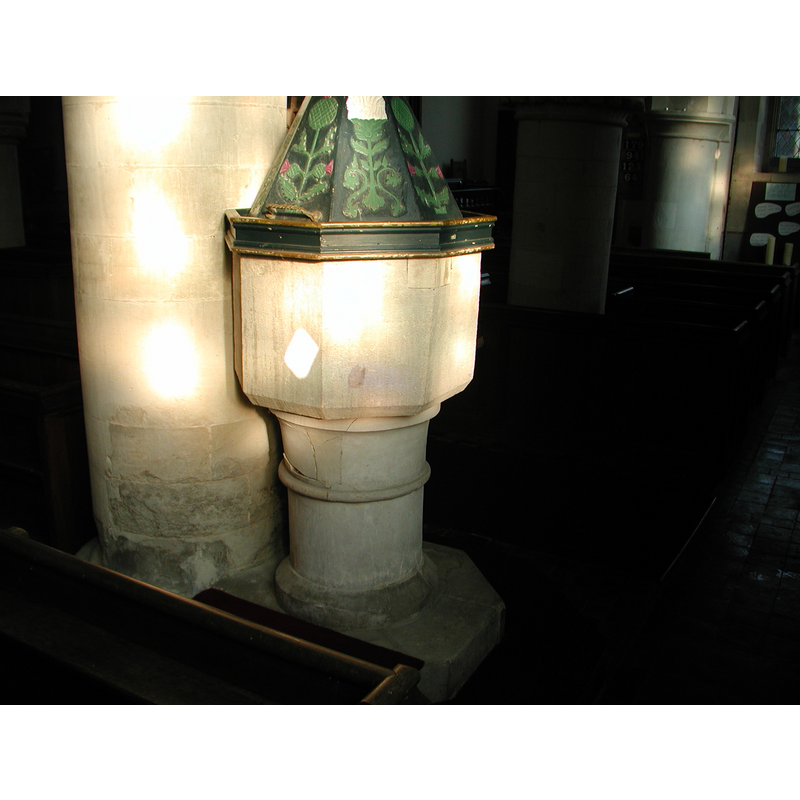
view of font and cover
Copyright Statement: Image copyright © Colin Hinson, 2008
Image Source: Digital photograph taken by Colin Hinson, 2005 [www.yorkshirecdbooks.com]
Copyright Instructions: Standing permission
view of church exterior - northeast view
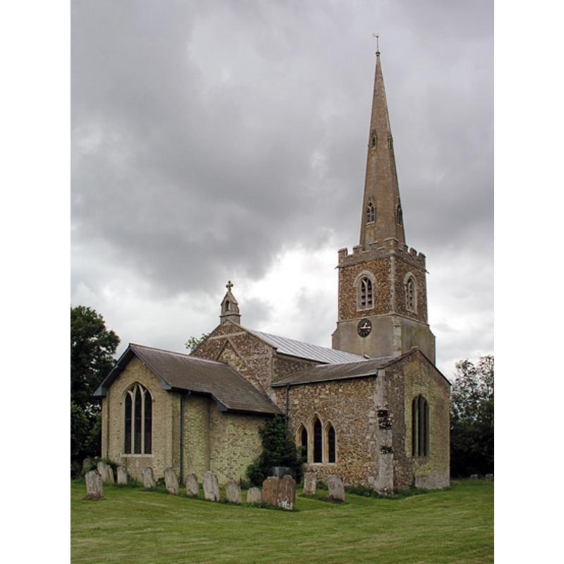
Copyright Statement: Image copyright © Mark Ynys-Mon, 2004
Image Source: Digital photograph taken by Mark Ynys-Mon, 2004, in Cambridgeshire Churches [http://www.druidic.org/camchurch/churches/eltisley.htm] [accessed 25 October 2007]
Copyright Instructions: Standing permission
view of font and cover in context
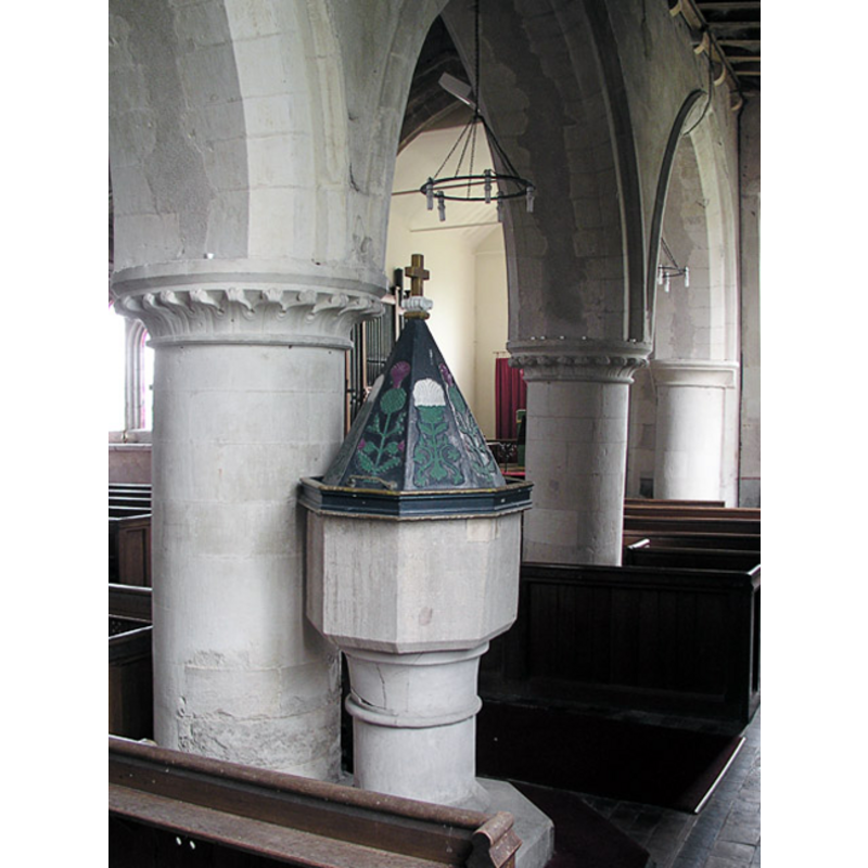
Scene Description: in the south aisle, looking east
Copyright Statement: Image copyright © Mark Ynys-Mon, 2004
Image Source: Digital photograph taken by Mark Ynys-Mon, 2004, in Cambridgeshire Churches [http://www.druidic.org/camchurch/churches/eltisley.htm] [accessed 25 October 2007]
Copyright Instructions: Standing permission
view of font and cover in context
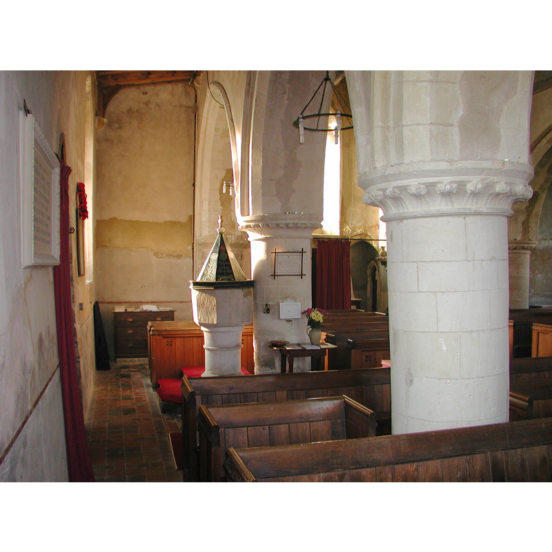
Copyright Statement: Image copyright © Colin Hinson, 2008
Image Source: Digital photograph taken by Colin Hinson, 2005 [www.yorkshirecdbooks.com]
Copyright Instructions: Standing permission
design element - motifs - moulding
Scene Description: on the stem of the base
Copyright Statement: Image copyright © Colin Hinson, 2008
Image Source: Digital photograph taken by Colin Hinson, 2005 [www.yorkshirecdbooks.com]
Copyright Instructions: Standing permission
INFORMATION
Font ID: 10948ELT
Object Type: Baptismal Font1
Font Century and Period/Style: 13th century, Early English
Church / Chapel Name: Parish Church of St. Pandionia and St. John the Baptist
Font Location in Church: Inside the church, S aisle, W end, against one of the dividing pillars
Church Patron Saint(s): St. Pandonia [aka Pandionia, Pandwyna] and St. John the Baptist
Church Address: St Neots Road, Eltisley, Cambridgeshire PE19 6TG
Site Location: Cambridgeshire, East, England, United Kingdom
Directions to Site: Located on the A428, about 19 km W of Cambridge
Ecclesiastic Region: Diocese of Ely
Historical Region: Hundred of Longstowe
Additional Comments: altered font (re-tooled and/or re-cut) -- disppeared font? (the one from the mid-12thC(?) church here)
Font Notes:
Click to view
There is an entry for Elstesley [variant spelling] in the Domesday survey [http://opendomesday.org/place/TL2759/eltisley/] [accessed 28 April 2016], but it mentions neither cleric nor church in it. The RCHM (1968) notes: "plain octagonal bowl with chamfered lower edge, 13th-century, on re-tooled clunch stem; pyramidal cover of eight sides carved in low relief with thistles and other conventional flowers and with moulded base and finial, 17th-century." The Victoria County History (Cambridge and the Isle of Ely, vol. 5, 1973) notes: "The first reference to the parish church occurs [...] before 1173 [...] The parish church of St. Pandonia and St. John the Baptist bore the dedication to the former by c. 1230 [...] the earliest surviving part is the aisled nave of c. 1200 [...] In 1878 the whole church was restored"; there is, however, no mention of the font in the VCH entry. The baptismal font in this church appears to be of a composite nature: the basin is octagonal and has been clearly re-cut, perhaps to destroy whatever ornamentation it may have had; there is also an insert of different-colour stone in the upper rim side, a repair consistent with the damage resulting from the forceful removal of the staples from an old cover; the cylindrical pedestal base on which the basin now stands is either not the original base, or it has been re-tooled, as indicated in the RCHM above. The pyramidal wooden cover is brightly painted with floral and foliage motifs, with a cross finial, a striking contrast to the austere appearance of the re-cut basin.
Credit and Acknowledgements: We are grateful to Colin Hinson, of www.yorkshireCDbooks.com, and to Mark Ynys-Mon, of Cambridgeshire Churches, www.druidic.org/camchurches], for the photographs of church and font.
COORDINATES
UTM: 30U 694898 5789350
Latitude & Longitude (Decimal): 52.22005, -0.14671
Latitude & Longitude (DMS): 52° 13′ 12.18″ N, 0° 8′ 48.16″ W
MEDIUM AND MEASUREMENTS
Material: stone
Font Shape: octagonal, mounted
Basin Interior Shape: round
Basin Exterior Shape: octagonal
LID INFORMATION
Date: 17th-century?
Material: wood
Apparatus: no
Notes: pyramidal shape, with metal handles on the lower part
REFERENCES
- Victoria County History [online], University of London, 1993-. URL: https://www.british-history.ac.uk.
- Great Britain. Royal Commission on Historical Monuments (England), An inventory of historical monuments in the County of Cambridge, Woking; London: Printed in England for Her Majesty's Stationary Office by Unwin Brothers Unlimited, 1968, vol. 1: 92