Elsworth / Elesuuorde / Elesworde
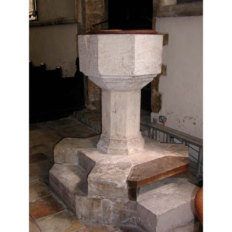
Image copyright © Colin Hinson, 2008
Image and permission received (10 July 2005)
Results: 6 records
view of font and cover
Copyright Statement: Image copyright © Colin Hinson, 2008
Image Source: Digital photograph taken 2005 by Colin Hinson [www.yorkshirecdbooks.com]
Copyright Instructions: Image and permission received (10 July 2005)
design element - motifs - moulding
Copyright Statement: Image copyright © Colin Hinson, 2008
Image Source: Digital photograph taken 2005 by Colin Hinson [www.yorkshirecdbooks.com]
Copyright Instructions: Image and permission received (10 July 2005)
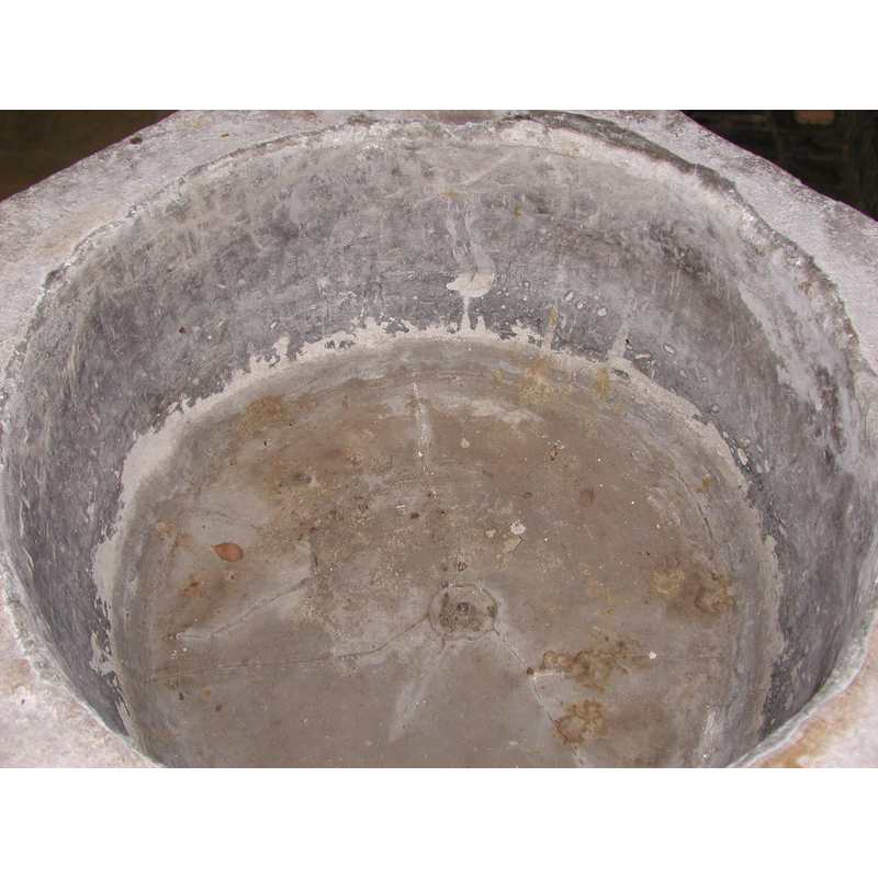
view of basin - interior
Copyright Statement: Image copyright © Colin Hinson, 2008
Image Source: Digital photograph taken 2005 by Colin Hinson [www.yorkshirecdbooks.com]
Copyright Instructions: Image and permission received (10 July 2005)
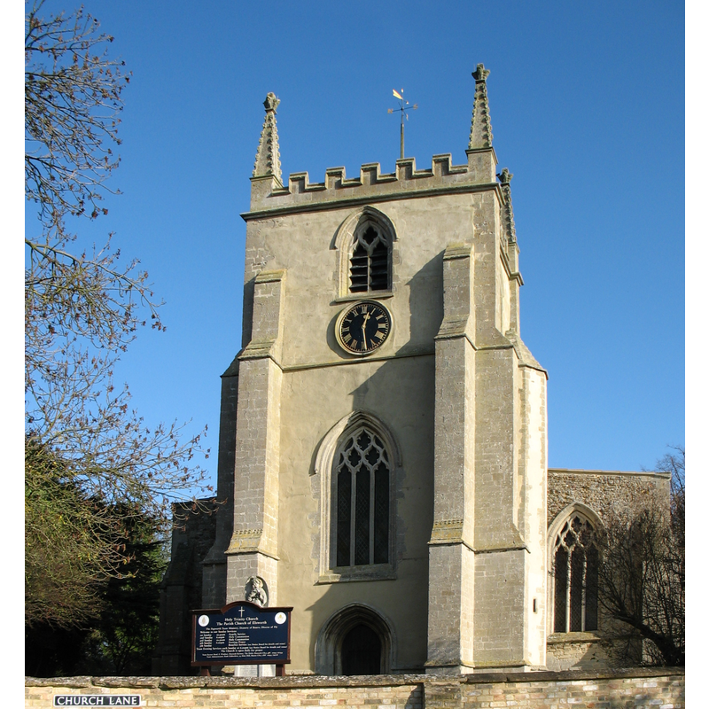
view of church exterior - west view
Copyright Statement: Image copyright © David Purchase, 2011
Image Source: digital photograph taken 13 November 2011 by David Purchase [www.geograph.org.uk/photo/2694207] [accessed 4 July 2010]
Copyright Instructions: CC-BY-SA-2.0
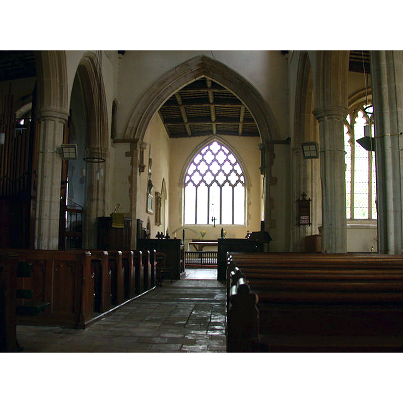
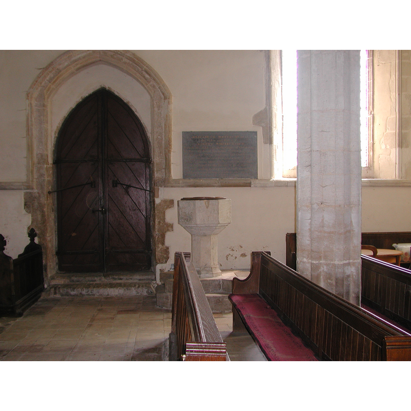
view of church interior - nave - looking east
Copyright Statement: Image copyright © Keith Edkins, 2008
Image Source: digital photograph taken 30 July 2008 by Keith Edkins [www.geograph.org.uk/photo/2694207] [accessed 4 July 2016]
Copyright Instructions: CC-BY-SA-2.0
view of font and cover in context
Copyright Statement: Image copyright © Colin Hinson, 2008
Image Source: Digital photograph taken 2005 by Colin Hinson [www.yorkshirecdbooks.com]
Copyright Instructions: Image and permission received (10 July 2005)
INFORMATION
Font ID: 10947ELS
Object Type: Baptismal Font1
Font Century and Period/Style: 14th century, Decorated
Church / Chapel Name: Parish Church of the Holy Trinity
Font Location in Church: Inside the church, in the W end, S aisle, by the entrance
Church Patron Saint(s): The Holy Trinity
Church Address: Church Lane, Elsworth, Cambridgeshire CB3 8HT
Site Location: Cambridgeshire, East, England, United Kingdom
Directions to Site: Located off (N) the A428, about 15 km WNW of Cambridge
Ecclesiastic Region: Diocese of Ely
Historical Region: Hundred of Papworth
Additional Comments: disappeared font? (the one from the ca. 1000 church here)
Font Notes:
Click to view
There are three entries for this Elsworth [variant spelling] in the Domesday survey [http://opendomesday.org/place/TL3163/elsworth/] [accessed 4 July 2016], neither of which mentions cleric or church in it. The RCHM (1968) reports a late-medieval limestone font here. The Victoria County History (Cambridge, vol. 9, 1989) notes: "Elsworth had a church by a.d. 1000 whose advowson, then given to Ramsey abbey, (fn. 1) remained with it throughout the Middle Ages […] A fragment of carving in the vestry may derive from a 12th-century building. The church was rebuilt in the 14th century"; no font mentioned in the VCH entry. Baptismal font dating probably from the 14th-century rebuilding of this church; it consists of a plain octagonal basin with graded chamfer, raised on a plain octagonal pedestal and moulded lower base, and a two-step plinth; the inner basin is lead-lined, with a central drain; plain and flat wooden font cover, appears modern, but damage to one of the upper sides of the basin is indicates the existence of staples from an old cover.
Credit and Acknowledgements: We are grateful to Colin Hinson, of www.yorkshirecdbooks.com, for his photographs of this font.
COORDINATES
UTM: 30U 699945 5793321
Latitude & Longitude (Decimal): 52.253894, -0.070575
Latitude & Longitude (DMS): 52° 15′ 14.02″ N, 0° 4′ 14.07″ W
MEDIUM AND MEASUREMENTS
Material: stone, limestone
Font Shape: octagonal, mounted
Basin Interior Shape: round
Basin Exterior Shape: octagonal
Drainage System: centre hole in basin
Drainage Notes: lead lining
LID INFORMATION
Date: modern?
Material: wood
Apparatus: no
Notes: [cf. FontNotes]
REFERENCES
- Victoria County History [online], University of London, 1993-. URL: https://www.british-history.ac.uk.
- Great Britain. Royal Commission on Historical Monuments (England), An inventory of historical monuments in the County of Cambridge, Woking; London: Printed in England for Her Majesty's Stationary Office by Unwin Brothers Unlimited, 1968, vol. 1: 85