Dry Drayton / Draitone
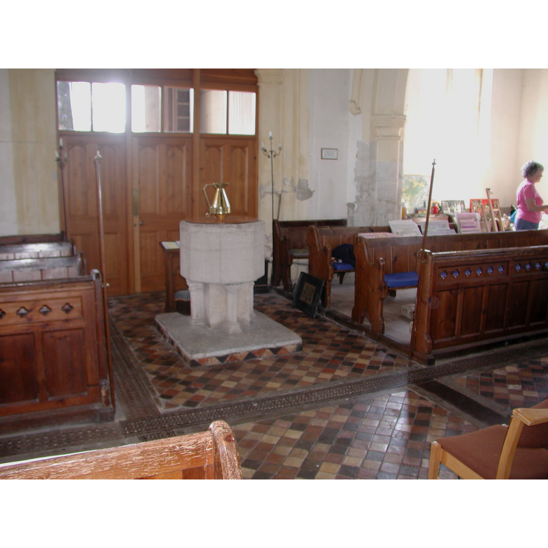
Image copyright © Colin Hinson, 2008
Standing permission
Results: 4 records
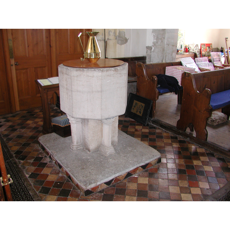
view of font and cover in context
Copyright Statement: Image copyright © Colin Hinson, 2008
Image Source: Digital photograph taken 2005 by Colin Hinson [www.yorkshirecdbooks.com]
Copyright Instructions: Standing permission
view of basin - interior
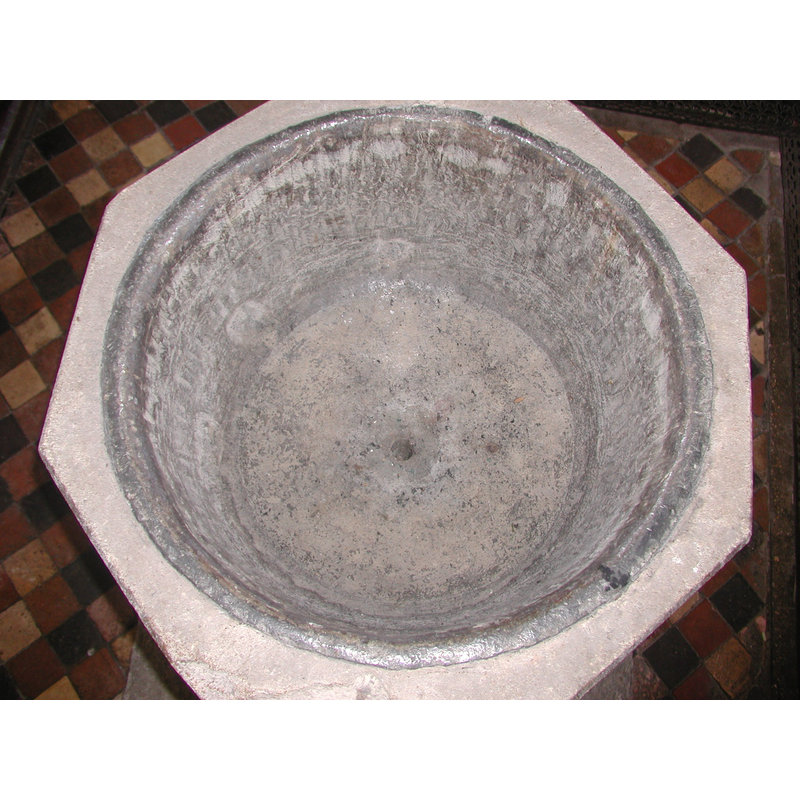
Copyright Statement: Image copyright © Colin Hinson, 2008
Image Source: Digital photograph taken 2005 by Colin Hinson [www.yorkshirecdbooks.com]
Copyright Instructions: Standing permission
view of church exterior - northeast view
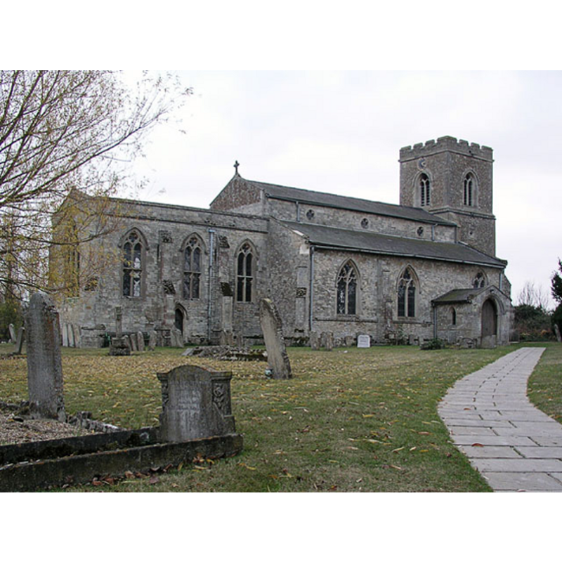
Copyright Statement: Image copyright © Mark Ynys-Mon, 2004
Image Source: digital photograph by Mark Ynys-Mon, 2004, in Cambrdgeshire Churches [http://www.druidic.org/camchurch/churches/drydrayton.htm] [accessed 21 October 2007]
Copyright Instructions: Standing permission
design element - motifs - moulding
Scene Description: on the top and bottom of the colonnettes of the base
Copyright Statement: Image copyright © Colin Hinson, 2008
Image Source: Digital photograph taken 2005 by Colin Hinson [www.yorkshirecdbooks.com]
Copyright Instructions: Standing permission
INFORMATION
Font ID: 10946DRA
Object Type: Baptismal Font1
Font Century and Period/Style: 13th century, Early English
Church / Chapel Name: Parish Church of St. Peter and St. Paul
Font Location in Church: Inside the church, at the W end
Church Patron Saint(s): St. Peter & St. Paul
Church Address: Madingley Road, Dry Drayton, Cambridgeshire CB3 8DA
Site Location: Cambridgeshire, East, England, United Kingdom
Directions to Site: Located off (N) the A428, 7 km WNW of Cambridge
Ecclesiastic Region: Diocese of Ely
Historical Region: Hundred of Chesterton
Additional Comments: disappeared font? (the one from the mid-12thC (?) or earlier church here)
Font Notes:
Click to view
There are five entries for [Dry] Drayton [variant spelling] in the Domesday survey [http://opendomesday.org/place/TL3762/dry-drayton/] [accessed 28 June 2016], none of which mentions cleric or church in it. The RCHM (1968) reports a baptismal font here with date in the 13th century, the base restored. The entry for this church in English Heritage [Listing NGR: TL3799961957] (1962) notes: "Font: C13 limestone. Octagonal basin on square stem with polygonal shafts to each side." The Victoria County History (Cambridge…, vol. 9, 1989) notes: "Rectors were recorded from the mid 12th century, the first known being William of Lavington, archdeacon of Ely c. 1150-8. […] The plain octagonal font is 13th-century." Actually, though the octagonal basin of vertical sides is indeed plain, the base is not: it consists of a square pedestal with a constructional colonnette with moulded capital and base on each side, all of which is raised on a square plinth; the plain and flat wooden lid is modern; the basin well is lead-lined, with a central drain; the lining is modern.
Credit and Acknowledgements: We are grateful to Colin Hinson, of www.yorkshirecdbooks.com, for the photographs of this font.
COORDINATES
UTM: 31U 296482 5791737
Latitude & Longitude (Decimal): 52.238364, 0.019264
Latitude & Longitude (DMS): 52° 14′ 18.11″ N, 0° 1′ 9.35″ E
MEDIUM AND MEASUREMENTS
Material: stone, limestone
Font Shape: octagonal, mounted
Basin Interior Shape: round
Basin Exterior Shape: octagonal
Drainage System: centre hole in basin
Drainage Notes: lead lining [modern]
LID INFORMATION
Date: modern
Material: wood
Apparatus: no
Notes: plain and flat, round; modern
REFERENCES
- The Victoria History of the Counties of England: A History of the County of Cambridge and the Isle of Ely, 2002, p. 84-88
- Victoria County History [online], University of London, 1993-. URL: https://www.british-history.ac.uk.
- Great Britain. Royal Commission on Historical Monuments (England), An inventory of historical monuments in the County of Cambridge, Woking; London: Printed in England for Her Majesty's Stationary Office by Unwin Brothers Unlimited, 1968, vol. 1: 82