Bainton No. 1
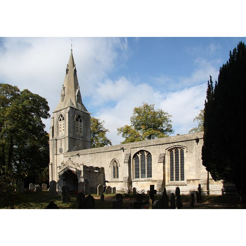
Image copyright © Richard Croft, 2009
CC-BY-SA-3.0
Results: 7 records
view of church exterior - southeast view
Copyright Statement: Image copyright © Richard Croft, 2009
Image Source: digital photograph taken 29 September 2009 by Richard Croft [www.geograph.org.uk/photo/1513513] [accessed 20 July 2014]
Copyright Instructions: CC-BY-SA-3.0
view of church interior - nave - looking northeast
![the font and cover are partially visible in the foreground, left [north] side](/static-50478a99ec6f36a15d6234548c59f63da52304e5/compressed/1140720025_compressed.png)
Scene Description: the font and cover are partially visible in the foreground, left [north] side
Copyright Statement: Image copyright © Richard Croft, 2009
Image Source: digital photograph taken 29 September 2009 by Richard Croft [www.geograph.org.uk/photo/1513545] [accessed 20 July 2014]
Copyright Instructions: CC-BY-SA-3.0
view of church interior - nave - looking west
![the font and cover are visible at the back [west], on the right [north] side](/static-50478a99ec6f36a15d6234548c59f63da52304e5/compressed/1140720024_compressed.png)
Scene Description: the font and cover are visible at the back [west], on the right [north] side
Copyright Statement: Image copyright © Richard Croft, 2009
Image Source: digital photograph taken 29 September 2009 by Richard Croft [www.geograph.org.uk/photo/1513549] [accessed 20 July 2014]
Copyright Instructions: CC-BY-SA-3.0
view of stoup
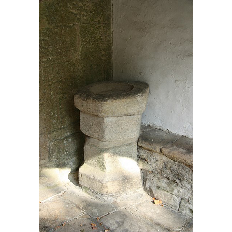
Scene Description: located in the south porch; appears to be a composite object
Copyright Statement: Image copyright © Richard Croft, 2009
Image Source: digital photograph taken 29 September 2009 by Richard Croft [www.geograph.org.uk/photo/1513551] [accessed 20 July 2014]
Copyright Instructions: CC-BY-SA-3.0
view of font

Copyright Statement: Image copyright © Digital Atlas of England, 2005
Image Source: digital image in the Digital Atlas of England, 2005 [www.viewbuildings.com]
Copyright Instructions: PERMISSION NOT AVAILABLE -- IMAGE NOT FOR PUBLIC USE
view of font and cover
Copyright Statement: Image copyright © Digital Atlas of England, 2005
Image Source: digital image in the Digital Atlas of England, 2005 [www.viewbuildings.com]
Copyright Instructions: PERMISSION NOT AVAILABLE -- IMAGE NOT FOR PUBLIC USE
design element - motifs - moulding
Scene Description: on the capitals and bases of the five columns of the base
Copyright Statement: Image copyright © Digital Atlas of England, 2005
Image Source: detail of a digital image in the Digital Atlas of England, 2005 [www.viewbuildings.com]
Copyright Instructions: PERMISSION NOT AVAILABLE -- IMAGE NOT FOR PUBLIC USE
INFORMATION
Font ID: 10854BAI
Object Type: Baptismal Font1
Font Century and Period/Style: 13th century, Early English
Cognate Fonts: the font at Stanground [now Cambs.]
Church / Chapel Name: Parish Church of St. Mary
Font Location in Church: Inside the church
Church Wikidata: https://www.wikidata.org/wiki/Q17528778
Church Patron Saint(s): St. Mary the Virgin
Church Address: Church Lane, Bainton, Peterborough PE9 3AF
Site Location: Cambridgeshire, East, England, United Kingdom
Directions to Site: Located just NE of Barnac, NW of Peterborough, in the Soke of Peterborough
Ecclesiastic Region: Diocese of Peterborough
Historical Region: formerly Northamptonshire
Additional Comments: reycled font? tthe basin appears new or drastically altered
Font Notes:
Click to view
Described in Paley (1844) as a "beautiful though simple font [...] of Early English date", the base of which is "furnished with bold capitals and bases", and cites the font at Stanground, near Peterborough as cognate. Baptismal font probably of the 12th or 13th century consisting of an octagonal basin with plain vertical sides and chamfered underbowl, and a five-support base made up of a broad central shaft and four corner colonnettes at 90-degree angles, all with moulded capitals and bases; the whole stands on a two step plinth, the upper round, the lower octagonal, both with 'priest's stone' extensions. Pyramidal wooden cover, octagonal, mostly plain but for a low crown-like decoration at the base and a ball finial; appears modern. The basin may be a replacement or the original one drastically altered. Noted in Mee (1945): "The font has clustered columns and is 700 years old." Listed and illustrated in The Digital Atlas of England web site [www.viewbuildings.com]. [NB: no mention of it in Pevsner (1970)]
COORDINATES
Latitude & Longitude (Decimal): 52.6412, -0.3839
Latitude & Longitude (DMS): 52° 38′ 27.53″ N, 0° 23′ 01.56″ W
MEDIUM AND MEASUREMENTS
Material: stone
Font Shape: octagonal, mounted
Basin Interior Shape: round
Basin Exterior Shape: octagonal
LID INFORMATION
Date: modern
Material: wood
Apparatus: no
Notes: [cf. FontNotes]
REFERENCES
- Mee, Arthur, The King's England: Northamptonshire, country of spires and stately homes, London: Hodder & Stoughton, 1945, [http://northamptoncastle.homeip.net/northampton/books/Arthur%20Mee.htm] [accessed 15 October 2006]
- Paley, Frederick Apthorp, Illustrations of Baptismal Fonts, London, UK: John van Voorst, 1844, p. 16