Parson Drove No. 1
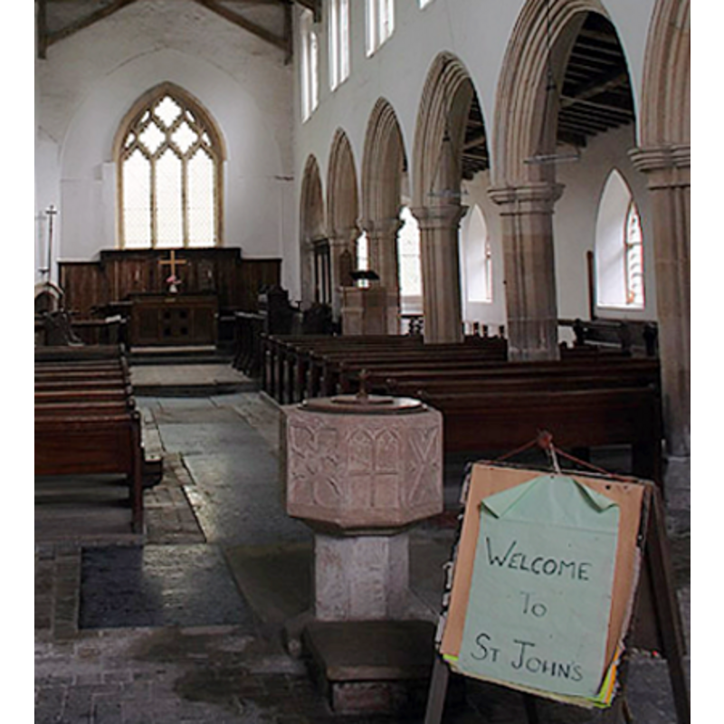
Image copyright © Mark Ynys-Mon, 2005
Standing permission
Results: 4 records
B01: design element - motifs - tracery
Copyright Statement: Image copyright © Mark Ynys-Mon, 2005
Image Source: detail of a digital photograph by Mark Ynys-Mon, 2005, in Cambridgeshire Churches [http://www.druidic.org/camchurch/churches/pardrovejohn.htm] [accessed 22 November 2007]
Copyright Instructions: Standing permission
view of font and cover in context
Copyright Statement: Image copyright © Mark Ynys-Mon, 2005
Image Source: detail of a digital photograph by Mark Ynys-Mon, 2005, in Cambridgeshire Churches [http://www.druidic.org/camchurch/churches/pardrovejohn.htm] [accessed 22 November 2007]
Copyright Instructions: Standing permission
view of church exterior - east view
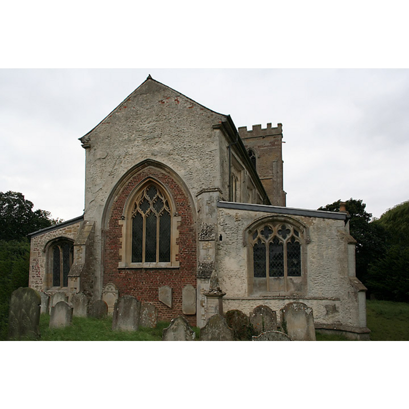
Copyright Statement: Image copyright © Mark Ynys-Mon, 2005
Image Source: digital photograph by Mark Ynys-Mon, 2005, in Cambridgeshire Churches [http://www.druidic.org/camchurch/churches/pardrovejohn.htm] [accessed 22 November 2007]
Copyright Instructions: Standing permission
view of church interior - nave - looking east
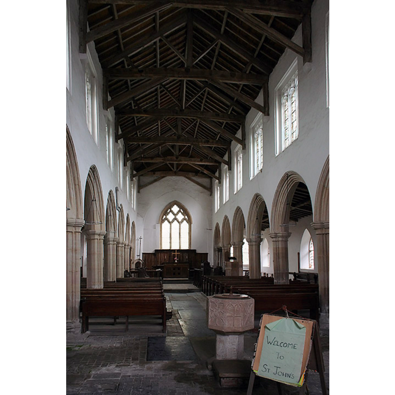
Copyright Statement: Image copyright © Mark Ynys-Mon, 2005
Image Source: digital photograph by Mark Ynys-Mon, 2005, in Cambridgeshire Churches [http://www.druidic.org/camchurch/churches/pardrovejohn.htm] [accessed 22 November 2007]
Copyright Instructions: Standing permission
INFORMATION
Font ID: 10730PAR
Object Type: Baptismal Font1
Font Century and Period/Style: 15th century, Perpendicular
Church / Chapel Name: Chapel of St. John the Baptist [Parish Church of Parson Drove since 1870]
Font Location in Church: Inside the church, in the centre of the nave, opposite the S entrance
Church Patron Saint(s): St. John the Baptist
Church Address: 13 Main Road, Parson Drove, Cambridgeshire PE13 4LF
Site Location: Cambridgeshire, East, England, United Kingdom
Directions to Site: Located 7 km SW of Leverignton, 11 km W of Wisbech
Ecclesiastic Region: Diocese of Ely
Historical Region: Hundred of Wisbech
Additional Comments: disappeared font? (the one from the early-13thC church here)
Font Notes:
Click to view
No individual entry found for Parson Drove in the Domesday survey. The Victoria History of the Counties of England (Cambridge..., vol. 4, 2002) notes: "The chapel of St. John the Baptist, since 1870 (see Leverington) the parish church of Parson Drove, attained at a comparatively early date a more independent status than was usual with parochial chapelries. [...] The earliest portion of the present fabric is the north doorway, which belongs to the first half of the 13th century. [...] The font has a panelled octagonal bowl and is of 15th-century date." Pevsner (1970) writes: "Font. Octagonal, Perp[endicular], big, with elaborate quatrefoil panels on the bowl, and tracery on the stem." The church, now redundant, is in the care of The Churches Conservation Trust. The Trust's web site [www.visitchurches.org.uk] notes a "Perpendicular octagonal font" present in the church. Noted and illustrated in Cambridgeshire Churches (2005): "The 15th century font is octagonal and has shallow carving on the bowl."
Credit and Acknowledgements: We are grateful to Ben Colburn and Mark Ynys-Mon, of Cambridgeshire Churches [www.druidic.org/camchurch/] for the information on and photographs of church and font.
COORDINATES
UTM: 31U 300755 5838625
Latitude & Longitude (Decimal): 52.660908, 0.053769
Latitude & Longitude (DMS): 52° 39′ 39.27″ N, 0° 3′ 13.57″ E
MEDIUM AND MEASUREMENTS
Material: stone
Font Shape: octagonal, mounted
Basin Interior Shape: round
Basin Exterior Shape: octagonal
LID INFORMATION
Date: modern?
Material: wood
Apparatus: no
Notes: round and flat, with knob handle
REFERENCES
- Victoria County History [online], University of London, 1993-. URL: https://www.british-history.ac.uk.
- Pevsner, Nikolaus, Cambridgeshire, Harmonsworth: Penguin, 1970, p. 450