Landwade
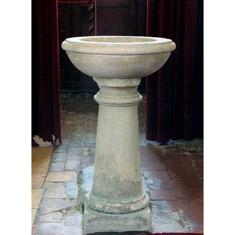
Image copyright © John Salmon, 2009
CC-BY-SA-2.0
Results: 3 records
view of font
Scene Description: the modern font in use
Copyright Statement: Image copyright © John Salmon, 2009
Image Source: digital image of a photograph taken 16 June 1998 by John Salmon [www.geograph.org.uk/photo/1151194] [accessed 20 July 2016]
Copyright Instructions: CC-BY-SA-2.0
view of church exterior - south view
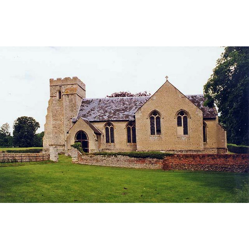
Copyright Statement: Image copyright © John Salmon, 2009
Image Source: digital image of a photograph taken 16 June 1998 by John Salmon [www.geograph.org.uk/photo/1151187] [accessed 20 July 2016]
Copyright Instructions: CC-BY-SA-2.0
view of church interior - nave - looking east
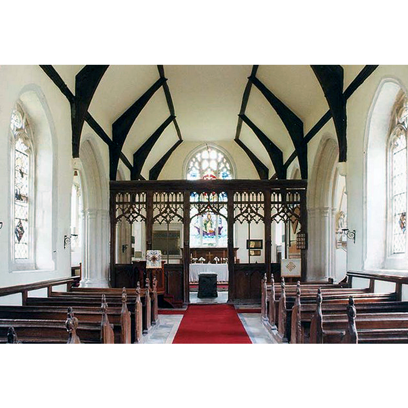
Copyright Statement: Image copyright © John Salmon, 2009
Image Source: digital image of a photograph taken 16 June 1998 by John Salmon [www.geograph.org.uk/photo/1151188] [accessed 20 July 2016]
Copyright Instructions: CC-BY-SA-2.0
INFORMATION
Font ID: 10712LAN
Object Type: Stoup
Font Century and Period/Style: 15th century, Perpendicular
Church / Chapel Name: Church of St. Nicholas [private chapel of the Cotton family]
Font Location in Church: Near the N Doorway
Church Patron Saint(s): St. Nicholas of Myra
Church Address: Lanwade, Suffolk CB8 7NF
Site Location: Suffolk, East Anglia, England, United Kingdom
Directions to Site: Located 5 km NW of Newmarket -- the chapel itself appears to be right at the Suffolk-Cambridgeshire border
Ecclesiastic Region: Diocese of St Edmundsbury & Ipswich [formerly in the Diocese of Ely]
Historical Region: Hundred of Staploe -- formerly Cambridgeshire
Additional Comments: disappeared font? (the one from the 15th-century church here and, perhaps, the one from the original 13thC chapel as well)
Font Notes:
Click to view
No entry for Landwade found in the Domesday survey. Pevsner (1970) writes of a stoup in this church: "Nice embattled arched niche near the N doorway." The Victoria County History (Cambridge…, vol. 10, 2002) notes: "Landwade was probably not originally formally a separate parish, but it came to be accepted as one from the mid 15th century, perhaps through having its own church; it never had an incumbent of its own, but only curates appointed by various authorities. In 1279 a chapel at Landwade, linked to the rectory of St. Andrew's at Burwell, was in the possession of the prior of Fordham […] The church has been dedicated to St. Nicholas since at least c. 1445. The existing church, which is 250 m. north of the modern Landwade Hall but only 5 m. west of the remains of the medieval manorial moat, was apparently built as a private chapel by Walter Cotton c. 1445, and has remained virtually unaltered." The stoup is also noted in www.druidic.org/camchurch/churches/landwade.htm the web site of Cambrdgeshire Churches. The baptismal font in this church is a late one, a miniscule basin on a circular pedestal base [not included in BSI on account of its late date; we have no information on the original font of this church. There is no mention of either font or stoup in Parker's 1855 entry for this church].
COORDINATES
UTM: 31U 321175 5796236
Latitude & Longitude (Decimal): 52.28734, 0.378092
Latitude & Longitude (DMS): 52° 17′ 14.42″ N, 0° 22′ 41.13″ E
MEDIUM AND MEASUREMENTS
Material: stone
REFERENCES
- Pevsner, Nikolaus, Cambridgeshire, Harmonsworth: Penguin, 1970, p. 422