Upper Arley / Aerley / Arleg / Arley on Severn / Arnlee de Port / Earnleia / Erdele / Erleia / Ernlege / Over Areley
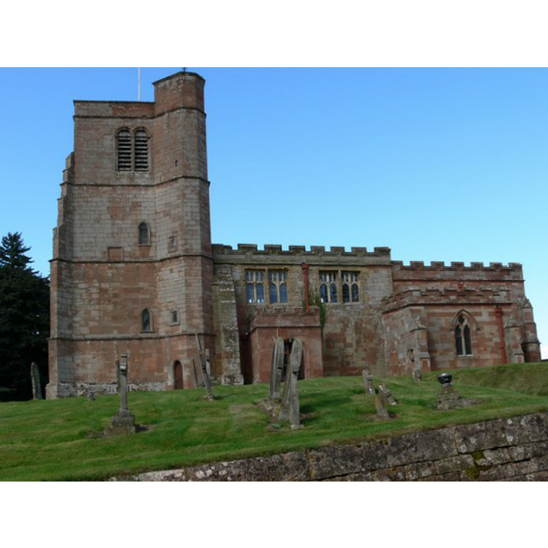
Image copyright © Mat Fascione, 2010
CC-BY-SA-2.0
Results: 3 records
view of church exterior - south view
Copyright Statement: Image copyright © Mat Fascione, 2010
Image Source: digital photograph taken 29 August 2010 by Mat Fascione [www.geograph.org.uk/photo/2053297] [accessed 11 September 2014]
Copyright Instructions: CC-BY-SA-2.0
view of church interior - nave - looking east
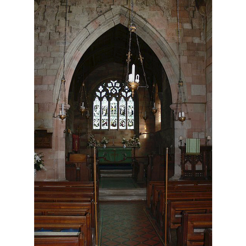
Copyright Statement: Image copyright © Mat Fascione, 2010
Image Source: digital photograph taken 29 August 2010 by Mat Fascione [www.geograph.org.uk/photo/2053280] [accessed 11 September 2014]
Copyright Instructions: CC-BY-SA-2.0
view of font and cover

Scene Description: the modern font
Copyright Statement: Image copyright © jmc4, 2009
Image Source: digital photograph taken 20 September 2009 by jmc4 [http://www.flickr.com/photos/52219527@N00/4460395290/] [accessed 9 June 2010]
Copyright Instructions: PERMISSION NOT AVAILABLE -- IMAGE NOT FOR PUBLIC USE
INFORMATION
Font ID: 10690ARL
Object Type: Baptismal Font1?
Font Century and Period/Style: 12th century, Late Norman
Church / Chapel Name: Parish Church of St. Peter
Church Patron Saint(s): St. Peter
Church Notes: church early 14thC with 12thC fragments
Church Address: Arley Lane, Upper Arley, Worcs., DY12 1XB
Site Location: Worcestershire, West Midlands, England, United Kingdom
Directions to Site: Located off the A442, 8 km N of Bewdley, 10 km NW of Kidderminster
Ecclesiastic Region: Diocese of Worcester
Historical Region: Hundred of Halfshire -- formerly Staffordshire
Additional Comments: disappeared font?
Font Notes:
Click to view
There is an entry for [Upper] Arley [variat spelling] in the Domesday survey [http://domesdaymap.co.uk/place/SO7680/upper-arley/] [accessed 11 September 2014], but it mentions neither cleric nor church in it. The Victoria County History (Worcester, vol. 3, 1913) notes: "Though the earliest detail in situ dates from the beginning of the 14th century, some small pieces of Norman ornament built into the south nave wall at its eastern end [...] point to a church of 12th-century erection", but the font is reported as modern. Noted in Brooks & Pevsner (2007) as a font of 1848. The font has a carved round basin raised on clustered columns. [NB: we have no information on the earlier font(s) of this church]
COORDINATES
UTM: 30U 544287 580812
Latitude & Longitude (Decimal): 52.421525, -2.34875
Latitude & Longitude (DMS): 52° 25′ 17.49″ N, 2° 20′ 55.5″ W
LID INFORMATION
Date: modern
Material: wood
Apparatus: no
Notes: round and flat, with metal decoration and ring handle
REFERENCES
- Victoria County History [online], University of London, 1993-. URL: https://www.british-history.ac.uk.
- Brooks, Alan, Worcestershire, New Haven; London: Yale University Press, 2007, p. 639