Illogan / St. Illogan / Egloshal / Eglossalau
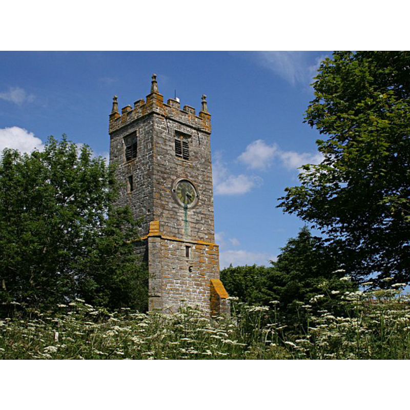
Image copyright © Tony Atkin, 2006
CC-BY-SA-3.0
Results: 4 records
BF01: angel - demi-figure - holding shield - 4

Scene Description: as capitals of the pillars of the modern base; re-tooled
Copyright Statement: Image copyright © A Snap in Time, 2012
Image Source: digital photograph in A Snap in Time [www.caerkief.co.uk/Churches/Illogan.html] [accessed 28 February 2012]
Copyright Instructions: PERMISSION NOT AVAILABLE -- IMAGE NOT FOR PUBLIC USE
view of church exterior - west tower
Copyright Statement: Image copyright © Tony Atkin, 2006
Image Source: digital photograph taken 15 June 2006 by Tony Atkin [www.geograph.org.uk/photo/188951] [accessed 28 February 2012]
Copyright Instructions: CC-BY-SA-3.0
view of church exterior - northeast view
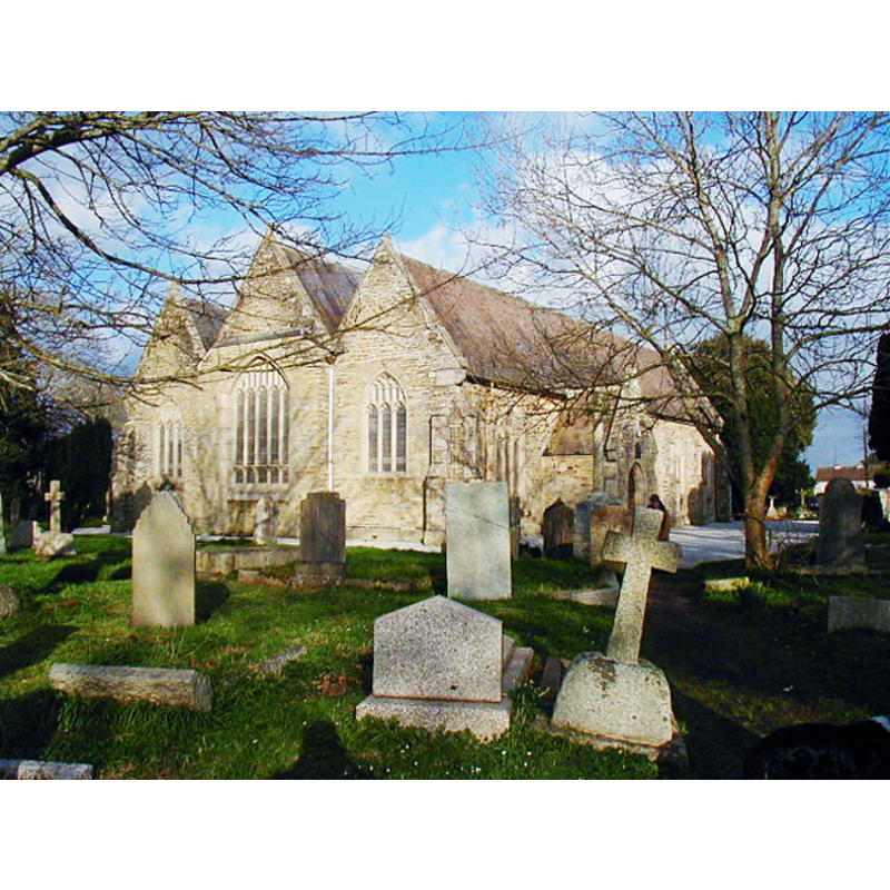
Copyright Statement: Image copyright © Rog Frost, 2004
Image Source: digital photograph taken 17 February 2004 by Rog Frost [www.geograph.org.uk/photo/85178] [accessed 28 February 2012]
Copyright Instructions: CC-BY-SA-3.0
view of font and cover
Copyright Statement: Image copyright © A Snap in Time, 2012
Image Source: digital photograph in A Snap in Time [www.caerkief.co.uk/Churches/Illogan.html] [accessed 28 February 2012]
Copyright Instructions: PERMISSION NOT AVAILABLE -- IMAGE NOT FOR PUBLIC USE
INFORMATION
Font ID: 10653ILL
Object Type: Baptismal Font1
Font Century and Period/Style: 14th century [basin only] [re-tooled] [composite font], Medieval [composite]
Workshop/Group/Artisan: heraldic font
Church / Chapel Name: Parish Church of St. Illogan
Font Location in Church: Inside the church
Church Patron Saint(s): [St. Illogan? -- dedication unknown in Crowford's]
Church Address: Church Road, Illogan, Cornwall, TR16 4SR
Site Location: Cornwall, South West, England, United Kingdom
Directions to Site: Located off the A30, 3 km NW of Redruth
Ecclesiastic Region: Diocese of Truro
Additional Comments: altered font: re-tooled in the mid-19th century -- Illustrated in A Snap in Time [http://www.caerkief.co.uk/Churches/Illogan.html] [accessed 16 November 2009]. The base is a pedestal of clustered columns, raised on a square lower base.
Font Notes:
Click to view
Noted and illustrated in Lysons (1806-1833) as one of a group of Cornish fonts of similar shape as the original fonts of Bodmin, Roche, etc., “but evidently of a much later date [...] that of St. Illogan has angels with shields, as capitals of the pillars. The British Museum's 'Catalogue of the manuscript..." (1844) lists a pencil sketch of "the circular stone font on pillars [...] drawn by Samuel Lysons" [Add. 9462, fol. 37]. The Ecclesiologist (vol. 67, 1848: 393) reports: "The font, removed from the old church, is placed on the west side of the south door, close to the entrance. It is of granite, and has been redressed. The cover is flat, and is ornamented with an iron strap." Noted in Cox (1912): "Old church unhappily destroyed in 1846, and a successor built at some distance to N.W. of old site […] The 14th cent. bowl of old font is in use, but retooled."
COORDINATES
UTM: 30U 338290 5568887
Latitude & Longitude (Decimal): 50.24998, -5.26829
Latitude & Longitude (DMS): 50° 14′ 59.93″ N, 5° 16′ 5.84″ W
MEDIUM AND MEASUREMENTS
Material: stone, granite
Font Shape: hemispheric, mounted
Basin Interior Shape: round
Basin Exterior Shape: round (with heads)
LID INFORMATION
Date: modern?
Material: wood
Apparatus: no
Notes: flat and plain
REFERENCES
- British Museum, Catalogue of the manuscript maps, charts, and plans, and of the topographical drawings in the British Museum, London: Printed by order of the Trustees, 1844-, p. 255
- Cox, John Charles, Cornwall, London: George Allen & Company, 1912, p. 19, 123
- Lysons, Daniel, Magna Britannia, being a concise topographical account of the several counties of Great Britain, London: Printed for T. Cadell and W. Davies, 1806-1822, vol. III: p. ccxxiii