Yelden / Chivelden / Evelden / Giveldene / Gweldene / Gyueldene / Yealdon / Yeilden / Yeldon / Yeveldene / Yielding / Yueldene
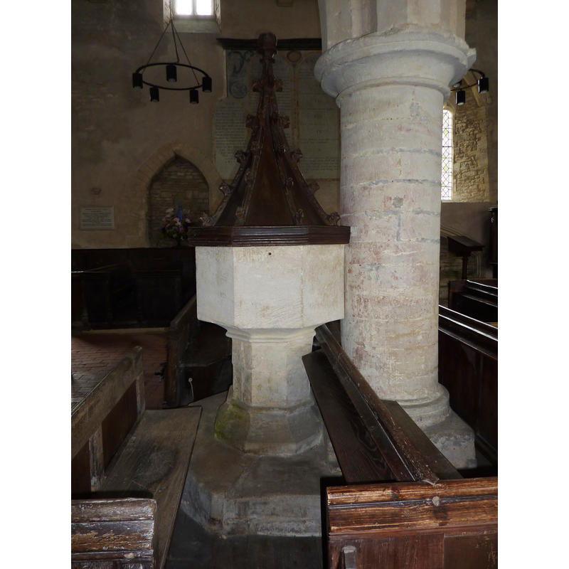
Image copyright © Janice Tostevin, 2010
Standing permission
Results: 5 records
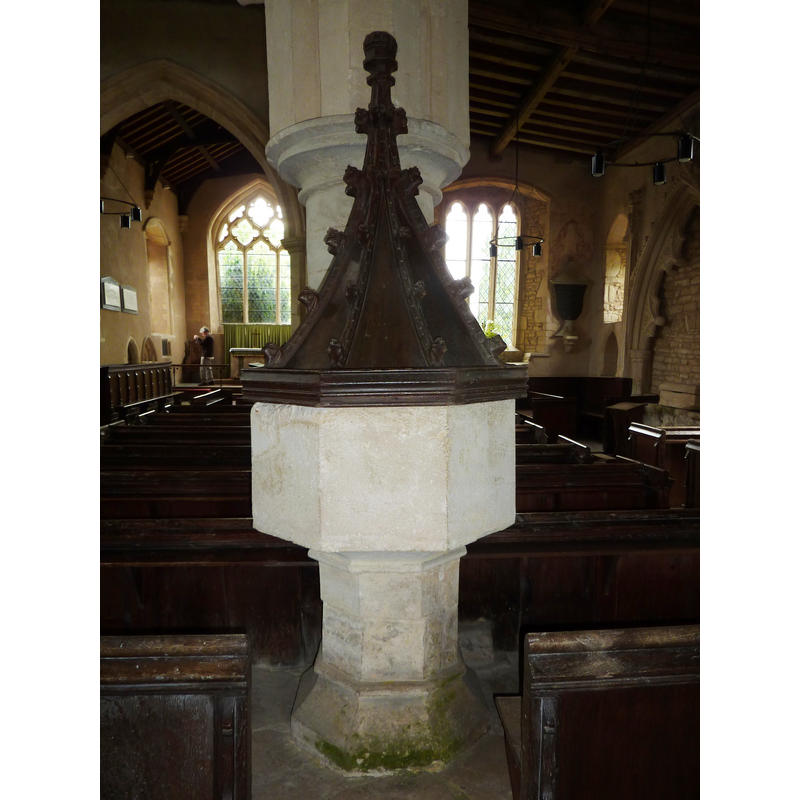
view of font and cover
Copyright Statement: Image copyright © Janice Tostevin, 2010
Image Source: digital photograph taken 29 June 2010 by Janice Tostevin for BSI
Copyright Instructions: Standing permission
view of basin
![with a metal staple in it [cf. Font notes]](/static-50478a99ec6f36a15d6234548c59f63da52304e5/compressed/1100702029_compressed.png)
Scene Description: with a metal staple in it [cf. Font notes]
Copyright Statement: Image copyright © Janice Tostevin, 2010
Image Source: digital photograph taken 29 June 2010 by Janice Tostevin for BSI
Copyright Instructions: Standing permission
view of church exterior - southwest view
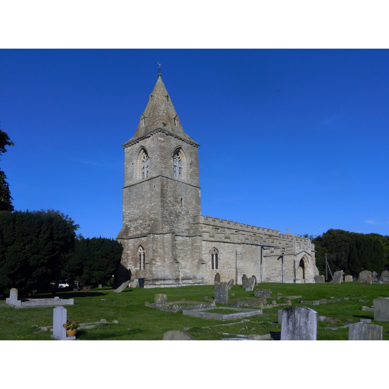
Copyright Statement: Image copyright © Arcusiridis, 2013
Image Source: digital photograph taken 28 September 2013 by Arcusiridis [https://commons.wikimedia.org/wiki/File:St_Mary's_church,_Yelden.JPG] [accessed 15 September 2015]
Copyright Instructions: CC-BY-SA-3.0
view of font and cover in context
Copyright Statement: Image copyright © Janice Tostevin, 2010
Image Source: digital photograph taken 29 June 2010 by Janice Tostevin for BSI
Copyright Instructions: Standing permission
view of font cover
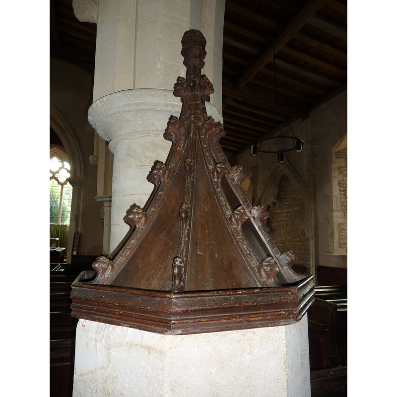
Copyright Statement: Image copyright © Janice Tostevin, 2010
Image Source: digital photograph taken 29 June 2010 by Janice Tostevin for BSI
Copyright Instructions: Standing permission
INFORMATION
Font ID: 10640YEL
Object Type: Baptismal Font1
Font Date: ca. 1500?
Font Century and Period/Style: 15th - 16th century, Perpendicular
Church / Chapel Name: Parish Church of St. Mary the Virgin
Font Location in Church: Inside the church, at the W end, by one of the columns of the S arcade
Church Patron Saint(s): St. Mary the Virgin
Church Address: Church Lane, Yelden, Bedfordshire MK44 1AU
Site Location: Bedfordshire, East, England, United Kingdom
Directions to Site: Located 7-8 km ESE of Higham Ferrers, towards the county border with Northamptonshire
Ecclesiastic Region: Diocese of St. Albans
Historical Region: Hundred of Stodden
Additional Comments: altered font? -- the restoration of the cover was sponsored by English Heritage -- disappeared font? (early-12thC?)
Font Notes:
Click to view
There is an entry for Yelden [variant spelling] in the Domesday survey [http://opendomesday.org/place/TL0166/yelden/] [accessed 15 September 2015], but it mentions niether cleric nor church in it. The Victoria County History (Bedford, vol. 3, 1912) notes: "Yelden Church was given by Geoffrey de Trailly to Abbot Gunter and the monks of Thorney [...] early in the 12th century. [...] The church was confirmed to them by a charter of Pope Alexander III in 1162. [...] The font, at the west of the middle column of the south arcade, is octagonal and quite plain, probably 15th-century work, but has a crocketed conical wooden cover, which is probably coeval with it." Pevsner (1968) mentions only the cover, not the font: "Font cover. Perp[endicular]. Conical and crocketed." There are thin mouldings at either end of the otherwise plain octagonal stem. The font appears to have been re-cut or re-tooled in some places; one of the sides of the basin has a metal staple in it, probably from an old locking mechanism for the cover. [NB: we have no information on the earlier font of the 12th-century church here].
Credit and Acknowledgements: We are grateful to Janice Tostevin for her photographs of, and information on this font
COORDINATES
UTM: 30U 669215 5796550
Latitude & Longitude (Decimal): 52.293211, -0.518691
Latitude & Longitude (DMS): 52° 17′ 35.56″ N, 0° 31′ 7.29″ W
MEDIUM AND MEASUREMENTS
Material: stone, sandstone
Font Shape: octagonal, mounted
Basin Interior Shape: round
Basin Exterior Shape: octagonal
Basin Upper Panel Dimensions: 31-32.5 x 38 cm*
Font Height (less Plinth): 104 cm*
Font Height (with Plinth): 128 cm*
Notes on Measurements: * Bob & Janice Tostevin on-site
LID INFORMATION
Date: 15th-century? / Perpendicular?
Material: wood, oak
Apparatus: no
Notes: [cf. FontNotes]
REFERENCES
- Victoria County History [online], University of London, 1993-. URL: https://www.british-history.ac.uk.
- Pevsner, Nikolaus, Bedfordshire and the County of Huntingdon and Peterborough, Harmondsworth: Penguin, 1968, p. 177