Milton Ernest / Middelton Ernys / Middeltone / Middletone / Mildentone / Milton Harnes / Milton Herneys / Mylton Harneys
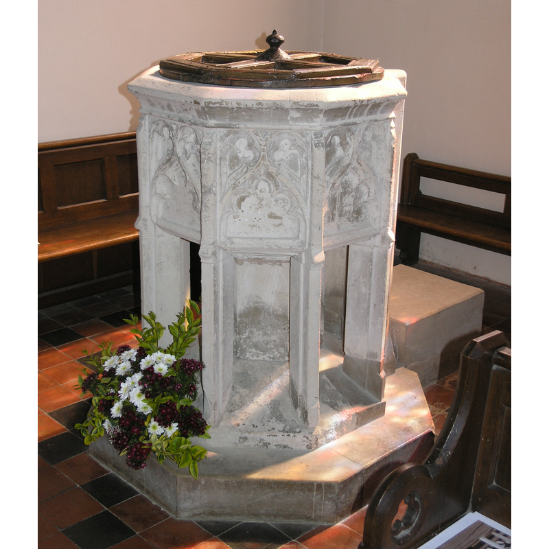
Image copyright © Colin Hinson, 2008
Standing permission
Results: 7 records
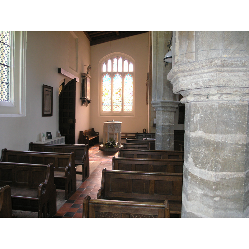
view of font and cover
Copyright Statement: Image copyright © Colin Hinson, 2008
Image Source: digital photograph taken July 2006 by Colin Hinson [www.yorkshireCDbooks.com]
Copyright Instructions: Standing permission
view of basin - interior
![note the two protrusions at the back of the basin [cf. Font notes]](/static-50478a99ec6f36a15d6234548c59f63da52304e5/compressed/1060723019_compressed.png)
Scene Description: note the two protrusions at the back of the basin [cf. Font notes]
Copyright Statement: Image copyright © Colin Hinson, 2008
Image Source: digital photograph taken July 2006 by Colin Hinson [www.yorkshireCDbooks.com]
Copyright Instructions: Standing permission
design element - patterns - tracery
![[cf. Font notes]](/static-50478a99ec6f36a15d6234548c59f63da52304e5/compressed/1060723018_compressed.png)
Scene Description: [cf. Font notes]
Copyright Statement: Image copyright © Colin Hinson, 2008
Image Source: digital photograph taken July 2006 by Colin Hinson [www.yorkshireCDbooks.com]
Copyright Instructions: Standing permission
design element - motifs - moulding
Copyright Statement: Image copyright © Colin Hinson, 2008
Image Source: digital photograph taken July 2006 by Colin Hinson [www.yorkshireCDbooks.com]
Copyright Instructions: Standing permission
view of church exterior - southwest view
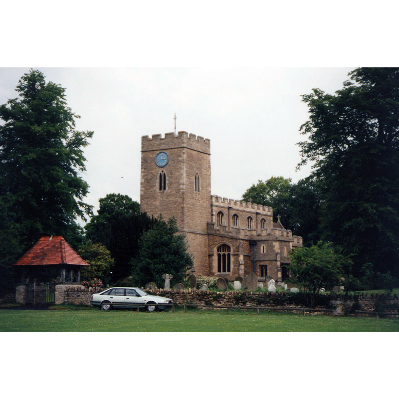
Copyright Statement: Image copyright © John Salmon, 1980
Image Source: photograph taken in 1980 by John Salmon [www.geograph.org.uk/photo/3263653] [accessed 14 September 2015]
Copyright Instructions: CC-BY-SA-2.0
view of church interior - looking east
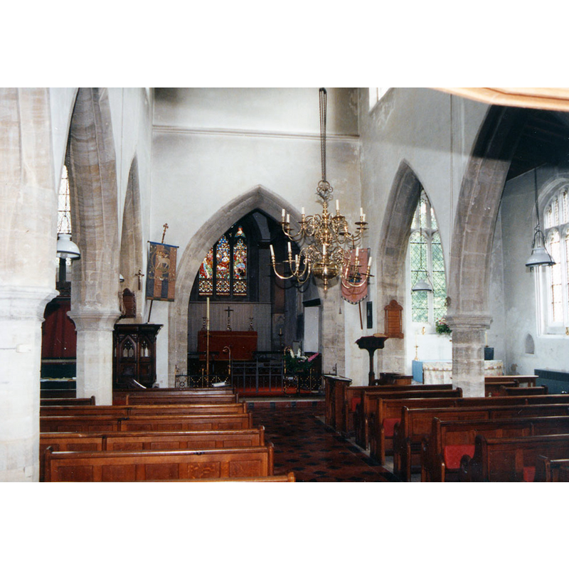
Copyright Statement: Image copyright © John Salmon, 1980
Image Source: photograph taken in 1980 by John Salmon [www.geograph.org.uk/photo/3263653] [accessed 14 September 2015]
Copyright Instructions: CC-BY-SA-2.0
view of font and cover in context
Copyright Statement: Image copyright © Colin Hinson, 2008
Image Source: digital photograph taken July 2006 by Colin Hinson [www.yorkshireCDbooks.com]
Copyright Instructions: Standing permission
INFORMATION
Font ID: 10635MIL
Object Type: Baptismal Font1
Font Century and Period/Style: 14th - 15th century [re-tooled], Decorated [altered]
Church / Chapel Name: Parish Church of All Saints
Font Location in Church: Inside the church, in the W end, S side, W of the S entrance
Church Patron Saint(s): All Saints
Church Address: 11 Thurleigh Road, Milton Ernest, Bedford Borough MK44 1RF
Site Location: Bedfordshire, East, England, United Kingdom
Directions to Site: Located off (E) the A6, 8 km NNW of Bedford (dir. Higham Ferrers)
Ecclesiastic Region: Diocese of St. Albans
Historical Region: Hundred of Stodden
Additional Comments: altered font / re-tooled font (the present font) -- disappeared font? (the one from the original 12thC church here)
Font Notes:
Click to view
There are six entries for Milton [Ernest] [variant spelling] in the Domesday survey [http://opendomesday.org/place/TL0156/milton-ernest/] [accessed 14 September 2015], none of which mentions cleric or church in it. The Victoria County History (Bedford, vol. 3, 1912) notes: "The west half of the chancel is the oldest part of the church, dating from the early years of the 12th century. [...] The font of the 15th century is in clunch, and has an octagonal traceried bowl with angle buttresses carried down clear of the stem; the west face is solid." Noted in Pevsner (1968): "Font. Octagonal bowl on eight buttress supports. The panels have simple Dec[orated] tracery." The octagonal basin is not fully symmetrical, having two spur-like projections on the back {perhaps meant for the anchoring or hinges of the old cover?]; the buttresses of the base are detached from the central shaft; octagonal plinth. Octagonal font cover, flat and almost plain, with knob handle; perhaps 19th-century.
Credit and Acknowledgements: We are grateful to Colin Hinson, of www.yorkshireCDbooks.com, for the photographs of this font.
COORDINATES
UTM: 30U 670249 5785518
Latitude & Longitude (Decimal): 52.1938, -0.5091
Latitude & Longitude (DMS): 52° 11′ 37.68″ N, 0° 30′ 32.76″ W
MEDIUM AND MEASUREMENTS
Material: stone, clunch
Font Shape: octagonal, mounted
Basin Interior Shape: round
Basin Exterior Shape: octagonal
Drainage System: centre hole in basin
Drainage Notes: lead lining
LID INFORMATION
Date: 19th-century?
Material: wood
Apparatus: no
Notes: [cf. FontNotes]
REFERENCES
- Victoria County History [online], University of London, 1993-. URL: https://www.british-history.ac.uk.
- Pevsner, Nikolaus, Bedfordshire and the County of Huntingdon and Peterborough, Harmondsworth: Penguin, 1968, p. 127