Melchbourne / Melceburne
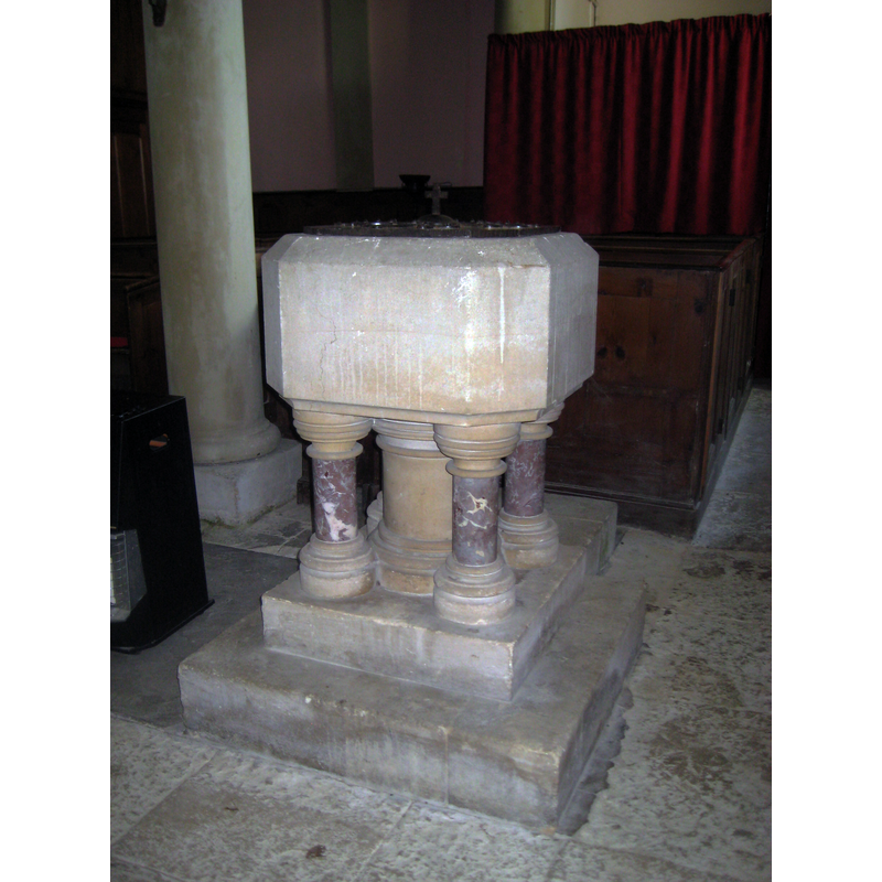
Image copyright © Waymarking, 2011
No known copyright restriction / Fair Dealing
Results: 3 records
view of font and cover
Scene Description: the modern font
Copyright Statement: Image copyright © Waymarking, 2011
Image Source: digital photograph 5 December 2011 in Waymarking [www.waymarking.com/gallery/default.aspx?f=1&guid=fc0faf3d-75b6-4841-88f7-9547a582d60f&lat=52.2538&lon=-0.47385&t=4&id=Odd Graves - Keysoe Road, Riseley, Bedfordshire, UK&gid=2&st=2] [accessed 14 September 2015]
Copyright Instructions: No known copyright restriction / Fair Dealing
view of church exterior - northeast view
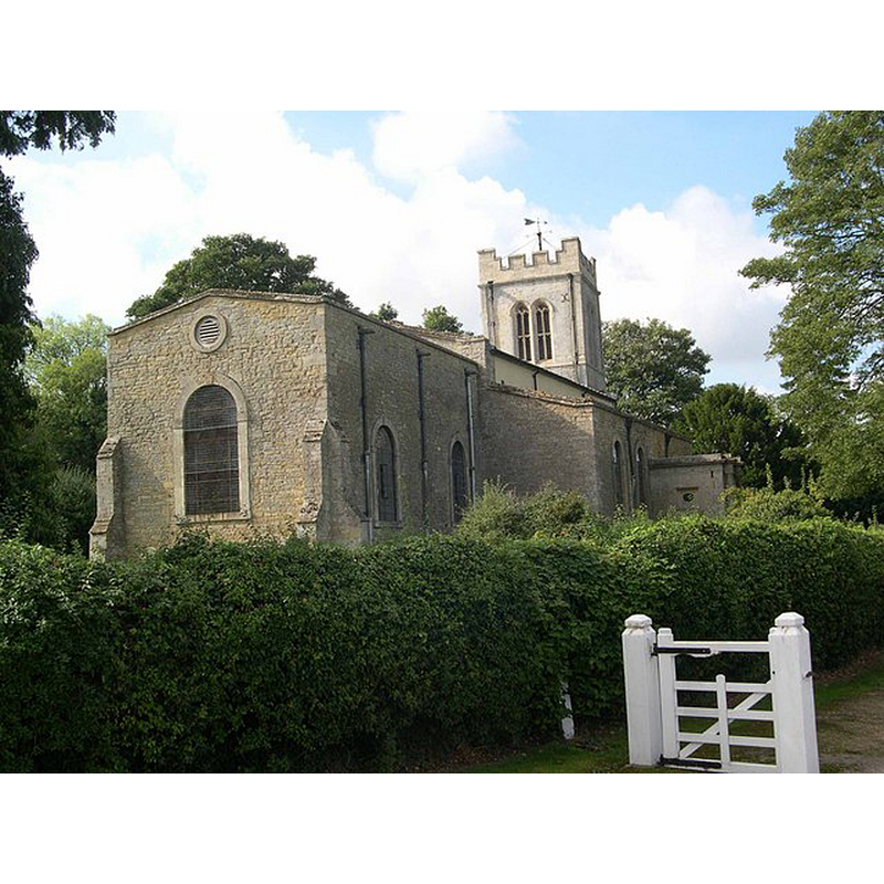
Copyright Statement: Image copyright © Colin Mitchell, 2006
Image Source: digital photograph taken 26 September 2006 by Colin Mitchell [www.geograph.org.uk/photo/249982] [accessed 14 September 2015]
Copyright Instructions: CC-BY-SA-2.0
view of church exterior - north view
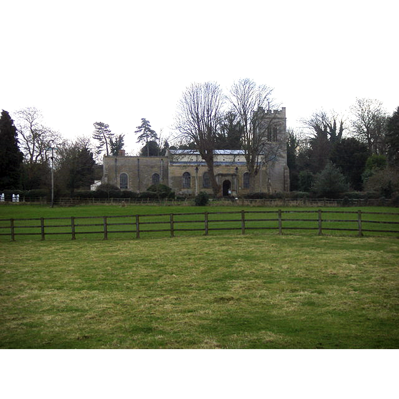
Copyright Statement: Image copyright © Shaun Ferguson, 2009
Image Source: digital photograph taken 5 March 2009 by Shaun Ferguson [www.geograph.org.uk/photo/1195588] [accessed 14 September 2015]
Copyright Instructions: CC-BY-SA-2.0
INFORMATION
Font ID: 10627MEL
Object Type: Baptismal Font1?
Font Century and Period/Style: 12th century, Late Norman
Church / Chapel Name: Parish Church of St. Mary Magdalene
Church Patron Saint(s): St. Mary Magdalene
Church Address: Park Road, Melchbourne, Bedford Borough MK44 1BB
Site Location: Bedfordshire, East, England, United Kingdom
Directions to Site: Located 10 km ESE of Higham Ferrers, between Swineshead and Yielden, 20 km N of Bedford
Ecclesiastic Region: Diocese of St. Albans [formerly in the diocese of Ely]
Historical Region: Hundred of Stodden
Additional Comments: disappeared font? (the medieval one)
Font Notes:
Click to view
There is an entry for Melchbourne [variant spelling] in the Domesday survey [http://opendomesday.org/place/TL0265/melchbourne/] [accessed 14 September 2015], but it mentions neither cleric nor church in it. The Victoria County History (Bedford, vol. 3, 1912) notes: "The church of Melchbourne was given with the manor to the Hospital of St. John of Jerusalem by Alice de Clermont. [...] In 1176 Bartholomew Bishop of Exeter, arbitrating in virtue of a mandate of Alexander III in a dispute between the Hospitallers and the convent of Thorney, decided that the former should retain Melchbourne Church. [...] With the exception of part of the tower, it was rebuilt in 1779." There is no mention of a font in the VCH entry. The modern font is noted in Pevsner (1968) as one of three fonts --Cardington and Melchbourne in Bedfordshire, Esendon in Herfordshire-- made by Josiah Wedgwood in black basalt. [NB: there may be one other font in this church: square basin with chamferred angles, raised on a broad central shaft and four outer colonnettes, the latter of coloured marble, on a quadrangular lower base and plinth -- we have no information on the medieval font from this church].
COORDINATES
UTM: 30U 670975 5794841
Latitude & Longitude (Decimal): 52.277315, -0.493775
Latitude & Longitude (DMS): 52° 16′ 38.33″ N, 0° 29′ 37.59″ W
REFERENCES
- Victoria County History [online], University of London, 1993-. URL: https://www.british-history.ac.uk.
- Pevsner, Nikolaus, Bedfordshire and the County of Huntingdon and Peterborough, Harmondsworth: Penguin, 1968, 63fn