Sundon / Lower Sundon / Sondon / Sonedone / Sonyngdon
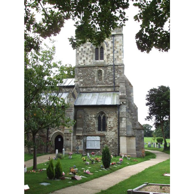
Image copyright © Rob Farrow, 2006
CC-BY-SA-3.0
Results: 2 records
B01: design element - architectural - arcade - blind - pointed arches - 16
![two per side of the octagonal basin [cf. FontNotes]](/static-50478a99ec6f36a15d6234548c59f63da52304e5/others/image_not_available.jpg)
Scene Description: two per side of the octagonal basin [cf. FontNotes]
![two per side of the octagonal basin [cf. FontNotes]](/static-50478a99ec6f36a15d6234548c59f63da52304e5/bsi-testing-site/others/image_not_available.jpg)
view of church exterior - northwest end
Copyright Statement: Image copyright © Rob Farrow, 2006
Image Source: digital photograph taken 25 August 2006 by Rob Farrow [www.geograph.org.uk/photo/225632] [accessed 15 May 2012]
Copyright Instructions: CC-BY-SA-3.0
INFORMATION
Font ID: 10614SUN
Object Type: Baptismal Font1
Font Century and Period/Style: 12th century (late?), Transitional / Early English
Church / Chapel Name: Parish Church of St. Mary [aka Our Lady's]
Font Location in Church: Inside the church, in the third bay of the N arcade
Church Patron Saint(s): St. Mary the Virgin
Church Address: Sundon Road, Sundon, Central Bedfordshire LU3 3PA
Site Location: Bedfordshire, East, England, United Kingdom
Directions to Site: Located 8 km NNW of Luton
Ecclesiastic Region: Diocese of St. Albans [formerly in the diocese of Ely]
Historical Region: Hundred of Flitt
Additional Comments: Upper Sundon does not have a medieval parish church
Font Notes:
Click to view
Noted in Lysons (1806-1833) as one of a group of octagonal fonts made mostly of Totternhoe stone: "Sundon stands on a circular shaft, and has two pointed arches on each side". The Victoria County History (Bedford, vol. 2, 1908) notes: "There is no mention of Sundon Church in the Survey, but the Lincoln Episcopal Registers show that from its foundation, in 1145, Markyate Priory owned the rectory and advowson. [...] The church of Our Lady is, with the exception of its chancel, a very perfect and well-designed example of the second quarter of the fourteenth century. [...] The font stands in the third bay of the north arcade and has an octagonal Purbeck marble bowl on a central and flanking column, the latter being modern. On each face of the bowl are two pointed arches in low relief, and the font belongs to a common late twelfthcentury type." Pevsner (1968) writes: "Font. Octagonal, of Purbeck marble, with two flat, pointed arches on each side."
COORDINATES
UTM: 30U 673461 5756294
Latitude & Longitude (Decimal): 51.9303, -0.477
Latitude & Longitude (DMS): 51° 55′ 49.08″ N, 0° 28′ 37.2″ W
MEDIUM AND MEASUREMENTS
Material: stone, limestone [Purbeck marble? Totternhoe chalk?]
Font Shape: octagonal, mounted
Basin Interior Shape: round
Basin Exterior Shape: octagonal
REFERENCES
- Victoria County History [online], University of London, 1993-. URL: https://www.british-history.ac.uk.
- Lysons, Daniel, Magna Britannia, being a concise topographical account of the several counties of Great Britain, London: Printed for T. Cadell and W. Davies, 1806-1822, vol. I: p. 31
- Pevsner, Nikolaus, Bedfordshire and the County of Huntingdon and Peterborough, Harmondsworth: Penguin, 1968, p. 152