Pertenhall / Partenhale / Pertenhale
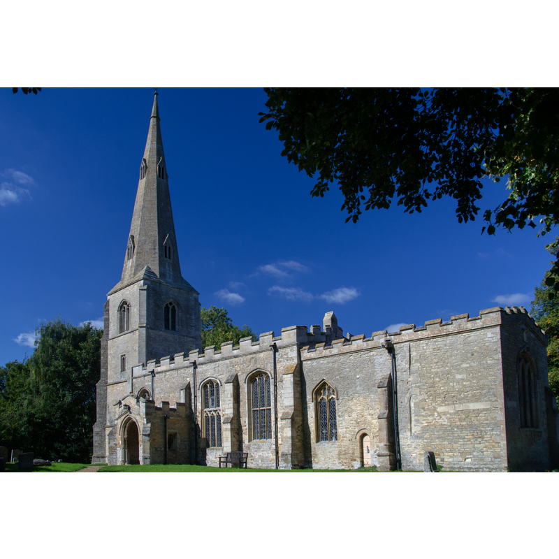
Image copyright © Flutophilus, 2013
CC-BY-SA-2.0
Results: 2 records
view of church exterior - southeast view
Copyright Statement: Image copyright © Flutophilus, 2013
Image Source: digital photograph taken 22 September 2013 by Flutophilus [https://commons.wikimedia.org/wiki/File:Pertenhall_Church_of_St_Peter.jpg] [accessed 15 September 2015]
Copyright Instructions: CC-BY-SA-2.0
design element - motifs - foliage
![[cf. FontNotes]](/static-50478a99ec6f36a15d6234548c59f63da52304e5/others/image_not_available.jpg)
Scene Description: [cf. FontNotes]
![[cf. FontNotes]](/static-50478a99ec6f36a15d6234548c59f63da52304e5/bsi-testing-site/others/image_not_available.jpg)
INFORMATION
Font ID: 10613PER
Object Type: Baptismal Font1
Font Century and Period/Style: 13th century, Early English
Church / Chapel Name: Parish Church of St. Peter
Font Location in Church: Inside the church
Church Patron Saint(s): St. Peter
Church Address: Kimbolton Road, Pertenhall, Bedford Borough MK44 2SP
Site Location: Bedfordshire, East, England, United Kingdom
Directions to Site: Located on the B660, 15 km N of Bedford, just S of the county border with Cambridgeshire [form. Huntingdonshire]
Ecclesiastic Region: Diocese of St. Albans
Historical Region: Hundred of Leightonstone [in Domesday] -- Hundred of Stodden
Additional Comments: disappeared font? (the one from the 12th-century church)
Font Notes:
Click to view
There is an entry for Pertenhall [variant spelling] in the Domesday survey [http://opendomesday.org/place/TL0865/pertenhall/ [accessed 15 September 2015], but it mentions neither cleric nor church in it. A font here is noted in Lysons (1806-1833) as one of a group of octagonal fonts made mostly of Totternhoe stone, the bain raised on a cluster of pillars. The Victoria County History (Bedford, vol. 3, 1912) notes: "In the 12th century the church seems to have consisted of nave and chancel only, to which a north aisle—narrower than the present one—was added about the year 1190, when the present arcade was built. [...] The font is octagonal, on a central and four outer shafts, the capital of one of which has 13th-century foliage. By a curious trick of varying the angles of the sides of the bowl each side is wedge-shaped, wider alternately at top and bottom." Blaydes' Bedfordshire Notes and Queries (vol. 3, 1893: 319) reports "a curious old scrap relating to this parish [Pertenhall]. It appears to be the last page out of some old Church Account Book"; it consists mainly of an account of furnishings and general objects in the church; it does not mention the font but it accounst for "a cover for the Font", but gives no details of it.
COORDINATES
UTM: 30U 676281 5793835
Latitude & Longitude (DMS): 52° 16′ 34.39″ N, 0° 24′ 44.18″ W
MEDIUM AND MEASUREMENTS
Material: stone, limestone (chalk / Totternhoe stone?]
Font Shape: octagonal, mounted
Basin Interior Shape: round
Basin Exterior Shape: octagonal
LID INFORMATION
Notes: [cf. FontNotes]
REFERENCES
- Victoria County History [online], University of London, 1993-. URL: https://www.british-history.ac.uk.
- Lysons, Daniel, Magna Britannia, being a concise topographical account of the several counties of Great Britain, London: Printed for T. Cadell and W. Davies, 1806-1822, vol. I: p. 31