Sherington / Serintone / Schirinton / Scringtone / Sherrington / Sheryngton / Shringtone / Shryngton / Shyriton / Sirinton

Image copyright © Norfolk12, 2011
No known copyright restriction / Fair Dealing
Results: 8 records
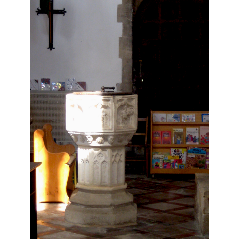
view of font and cover
Copyright Statement: Image copyright © Norfolk12, 2011
Image Source: digital photograph 30 August 2011 by Norfolk12 [www.waymarking.com/waymarks/WMCETT_Font_St_Laud_Sherington_Bucks] [accessed 25 February 2016]
Copyright Instructions: No known copyright restriction / Fair Dealing
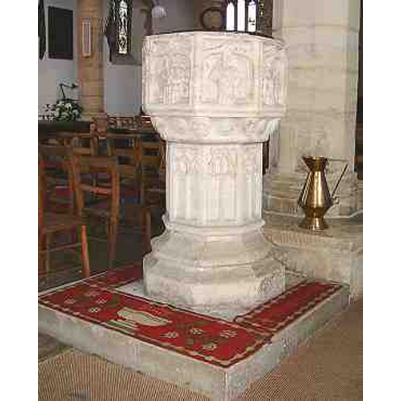
view of font
Copyright Statement: Image copyright © Sherington Historical Society, 2011
Image Source: digital photograph in the Sherington Historical Society page [www.mkheritage.co.uk/shhs/cin5.htm]
Copyright Instructions: No known copyright restriction / Fair Dealing
design element - architectural - arcade - Ogee arches - 8
Scene Description: flat arches with figures in them
Copyright Statement: Image copyright © Norfolk12, 2011
Image Source: digital photograph 30 August 2011 by Norfolk12 [www.waymarking.com/waymarks/WMCETT_Font_St_Laud_Sherington_Bucks] [accessed 25 February 2016]
Copyright Instructions: No known copyright restriction / Fair Dealing
Apostle or saint - saint - 8
Scene Description: one in each of the Ogee arches; defaced, but VCH identifies Paul, Andrew and Catherine [cf. FontNotes]
Copyright Statement: Image copyright © Norfolk12, 2011
Image Source: digital photograph 30 August 2011 by Norfolk12 [www.waymarking.com/waymarks/WMCETT_Font_St_Laud_Sherington_Bucks] [accessed 25 February 2016]
Copyright Instructions: No known copyright restriction / Fair Dealing
view of church exterior - southeast view
Scene Description: ******************* CHANGE N TO NO KNOWN FILE ***************************************
EXT SE digital photograph taken 3 November 2012 by Philip Jeffrey [www.geograph.org.uk/photo/3209262] [accessed 25 February 2016]
INT E digital photograph taken 7 September 2001 by John Salmon [www.geograph.org.uk/photo/332126] [accessed 25 February 2016] copyr2007
FONT digital photograph 30 August 2011 by Norfolk12 [www.waymarking.com/waymarks/WMCETT_Font_St_Laud_Sherington_Bucks] [accessed 25 February 2016] NO KNOWN
Copyright Statement: Image copyright © Philip Jeffrey, 2012
Image Source: digital photograph taken 3 November 2012 by Philip Jeffrey [www.geograph.org.uk/photo/3209262] [accessed 25 February 2016]
Copyright Instructions: CC-BY-SA-2.0
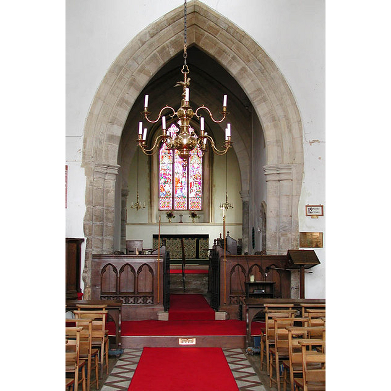
view of church interior - nave - looking east
Copyright Statement: Image copyright © John Salmon, 2007
Image Source: digital photograph taken 7 September 2001 by John Salmon [www.geograph.org.uk/photo/332126] [accessed 25 February 2016]
Copyright Instructions: CC-BY-SA-2.0
design element - patterns - tracery
Copyright Statement: Image copyright © Norfolk12, 2011
Image Source: digital photograph 30 August 2011 by Norfolk12 [www.waymarking.com/waymarks/WMCETT_Font_St_Laud_Sherington_Bucks] [accessed 25 February 2016]
Copyright Instructions: No known copyright restriction / Fair Dealing
design element - motifs - moulding
Copyright Statement: Image copyright © Norfolk12, 2011
Image Source: digital photograph 30 August 2011 by Norfolk12 [www.waymarking.com/waymarks/WMCETT_Font_St_Laud_Sherington_Bucks] [accessed 25 February 2016]
Copyright Instructions: No known copyright restriction / Fair Dealing
INFORMATION
Font ID: 10603SHE
Object Type: Baptismal Font1
Font Century and Period/Style: 15th century, Perpendicular
Cognate Fonts: The font at Clifton Reynes, in the same county
Church / Chapel Name: Parish Church of St. Laud
Font Location in Church: Inside the church, between the S aisle and the nave
Church Patron Saint(s): St. Laud of Coutances
Church Address: 5 Church End, Sherington, Milton Keynes MK16 9PA
Site Location: Buckinghamshire, South East, England, United Kingdom
Directions to Site: Located of the A509, 3 km N of Newport Pagnell, 5 km S of Olney, in the NW area of the county
Ecclesiastic Region: Diocese of Oxford
Historical Region: Hundred of Moulsoe [in Domesday] -- Hundred of Newport
Additional Comments: disappeared font? (the one from the pre-1150 church here) -- photo requested from Sherington Historical Society (26 May 2011) [no reply: use as Fair Dealing]
Font Notes:
Click to view
There is an entry for Sherington [variant spelling] in the Domesday survey [http://opendomesday.org/place/SP8846/sherington/] [accessed 25 February 2016], but it mentions neither cleric nor church in it. Lysons (1806-1833) describe an octagonal font "enriched with figures in niches". Sheahan (1862) notes the font, as well as a holy-water stoup in the porch. The Victoria County History (Buckingham, vo. 4, 1927) notes: "The advowson was held by the Caruns or Sheringtons with the principal manor until granted by William de Sherington to Tickford Priory at some date before 1150. [...] A church existed here in the 12th century, [...] but the earliest parts of the present building, consisting principally of the north arcade and the lower stage of the tower, date from about 1250 [...] The font, which dates from the late 14th century, is octagonal and has a panelled bowl and stem, and a moulded base. On each side of the bowl is a defaced figure of a saint under an ogee crocketed label. The figures of St. Paul, St. Andrew and St. Catherine can be easily recognized." Noted in Pevsner (1960): "Font. Perp, octagonal, with small Saints under flat ogee arches." The Sherington Historical Society site [www.mkheritage.co.uk/shhs/cin5.htm] notes: "Located between the South Aisle and Nave at the western end, the 15th century font at St Lauds is one of this Church's earliest features. The Font is an octagonal bowl with moulded panels of saints under crocheted ogee arches. Below the main panels there is a ring of alternate faces and flower heads. The stem of the Font is decorated with traceried panels and a raised moulded octagonal base. The panels that depict the saints have been defaced, perhaps at the time when Oliver Cromwell's soldiers stabled their horses here in the church. The 'gash' in the eastern side of the font is not the work of a zealous soldier, but probably shows where once a lid was attached to the font."
COORDINATES
UTM: 30U 657441 5776067
Latitude & Longitude (Decimal): 52.1127, -0.7007
Latitude & Longitude (DMS): 52° 6′ 45.72″ N, 0° 42′ 2.52″ W
MEDIUM AND MEASUREMENTS
Material: stone
Font Shape: octagonal, mounted
Basin Interior Shape: round
Basin Exterior Shape: octagonal
REFERENCES
- Victoria County History [online], University of London, 1993-. URL: https://www.british-history.ac.uk.
- Lysons, Daniel, Magna Britannia, being a concise topographical account of the several counties of Great Britain, London: Printed for T. Cadell and W. Davies, 1806-1822, vol. I: p. 489
- Pevsner, Nikolaus, Buckinghamshire, Harmondsworth: Penguin, 1960, p. 235
- Sheahan, James Joseph, History and topography of Buckinghamshire, comprising a general survey of the county, preceded by an epitome of the early history of Great Britain, London; Pontefract: Longman, Green, Longman, and Roberts; William Edward Bonas [...], 1862, p. 602

![******************* CHANGE N TO NO KNOWN FILE ***************************************
EXT SE digital photograph taken 3 November 2012 by Philip Jeffrey [www.geograph.org.uk/photo/3209262] [accessed 25 February 2016]
INT E digital photograph taken 7 September 2001 by John Salmon [www.geograph.org.uk/photo/332126] [accessed 25 February 2016] copyr2007
FONT digital photograph 30 August 2011 by Norfolk12 [www.waymarking.com/waymarks/WMCETT_Font_St_Laud_Sherington_Bucks] [accessed 25 February 2016] NO KNOWN](/static-50478a99ec6f36a15d6234548c59f63da52304e5/compressed/1160226008_compressed.png)
