Lavendon / Launden / Lauendene / Lauuedene / Lauuendene / Lavandene / Lavendene / Lawadene / Lawendene
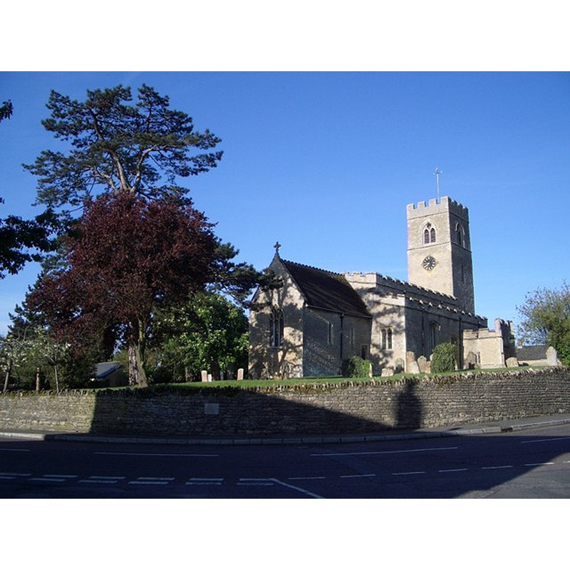
Image copyright © Nigel Stickells, 2007
CC-BY-SA-2.0
Results: 5 records
view of church exterior - northeast view
Scene Description: Source caption: "St Michael's Church, Lavendon. St Michael's Church in the centre of the village is viewed here from the northeast, opposite the informally named Church Corner, with the A428 in the foreground and Castle Road behind camera. The church dates from the 11th century and has some remaining evidence of Saxon work, including a blocked doorway and windows."
Copyright Statement: Image copyright © Nigel Stickells, 2007
Image Source: digital photograph taken 30 April 2007 by Nigel Stickells [www.geograph.org.uk/photo/468253] [accessed 22 February 2016]
Copyright Instructions: CC-BY-SA-2.0
view of church exterior - southeast view
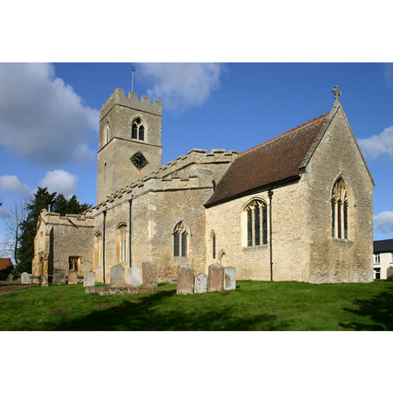
Copyright Statement: Image copyright © Alan Simkins, 2015
Image Source: digital photograph taken 13 March 2015 by Alan Simkins [www.geograph.org.uk/photo/825] [accessed 22 February 2016]
Copyright Instructions: CC-BY-SA-2.0
design element - patterns - tracery

Scene Description: on several panels

design element - motifs - floral - fleur-de-lis
design element - motifs - leaf
INFORMATION
Font ID: 10595LAV
Object Type: Baptismal Font1
Font Century and Period/Style: 15th century (late?), Perpendicular
Church / Chapel Name: Parish Church of St. Michael
Font Location in Church: Inside the church, in the W end of the nave, beneath the tower arch
Church Patron Saint(s): St. Michael [St. Mary the Virgin in Sheahan, the VCH...]
Church Notes: Sheahan and the VCH have dedication of the church as St. Mary
Church Address: Northampton Road, Lavendon, Milton Keynes MK46 4HA
Site Location: Buckinghamshire, South East, England, United Kingdom
Directions to Site: Located off (S) the A428, 4-5 km NE of Olney, at the northern tip of the county, 13 km WNW of Bedford
Ecclesiastic Region: Diocese of Oxford
Historical Region: Hundred of Bunsty [in Domesday] -- Hundred of Newport
Additional Comments: disappeared font? (from the early-11thC church)
Font Notes:
Click to view
There are ten entries for Lavendon [variant spelling] in the Domesday survey [http://opendomesday.org/place/SP9153/lavendon/] [accessed 22 February 2016], none of which mentions cleric or church in it. Lysons (1806-1833) note an octagonal baptismal font decorated with Gothic tracery. In Parker (1850): "The font is octagonal with panelled tracery and flowers on the sides of the basin." Ditto in Sheahan (1862) probably after Parker. The Victoria County History (Buckingham, vol. 4, 1927) notes: "Though no mention of the church occurs in the Domesday Survey, [...] it is evident that it was appurtenant to the fee in Lavendon held of the honour of Huntingdon. At the close of the 12th century the advowson of the church of the Blessed Mary was given to the abbey of Lavendon by Hugh de St. Medard [...] The nave and tower and the western part of the chancel date from the early 11th century. The church appears to have been left unaltered till early in the 13th century, when the chancel was rebuilt and both aisles were added. No further structural alterations were made until late in the 15th century, when a clearstory was added to the nave, north and south porches were built, several windows were inserted in the aisles, which, with the nave, were reroofed and provided with embattled parapets, and an additional stage was added to the tower. The whole fabric was restored in 1859. [...] The font is octagonal and dates from the late 15th century; the bowl has shallow sunk panels enriched with delicate tracery and foliage, while in the panel at the south-west is a shield of France modern." [NB: the VCH (ibid.) has the dedication of the church to St. Mary the Virgin. Crockford's and others have St. Michael]. Pevsner (1960) writes: "Font. Perp, with a variety of tracery patterns, also one panel with fleur-de-lis, and one with leaf." [NB: we have no information on the font of the 11th-century church here].
COORDINATES
UTM: 30U 659913 5782936
Latitude & Longitude (Decimal): 52.1737, -0.6614
Latitude & Longitude (DMS): 52° 10′ 25.32″ N, 0° 39′ 41.04″ W
MEDIUM AND MEASUREMENTS
Material: stone
Font Shape: octagonal, mounted
Basin Interior Shape: round
Basin Exterior Shape: octagonal
REFERENCES
- Victoria County History [online], University of London, 1993-. URL: https://www.british-history.ac.uk.
- Lysons, Daniel, Magna Britannia, being a concise topographical account of the several counties of Great Britain, London: Printed for T. Cadell and W. Davies, 1806-1822, vol. I: p. 489
- Parker, John Henry, The Ecclesiastical and architectural topography of England: Oxfordshire, Oxford, London: Published under the sanction of the Central Commitee of the Archaeological Institute of Great Britain and Ireland [by] John Henry Parker, 1850, [entry no.] 115
- Pevsner, Nikolaus, Buckinghamshire, Harmondsworth: Penguin, 1960, p. 185
- Sheahan, James Joseph, History and topography of Buckinghamshire, comprising a general survey of the county, preceded by an epitome of the early history of Great Britain, London; Pontefract: Longman, Green, Longman, and Roberts; William Edward Bonas [...], 1862, p. 555