Hardmead No. 2 / Hardmed / Haremede / Harewemede / Harlemede / Harmede / Herouldmede / Herulfmede / Horelmede / Hormead
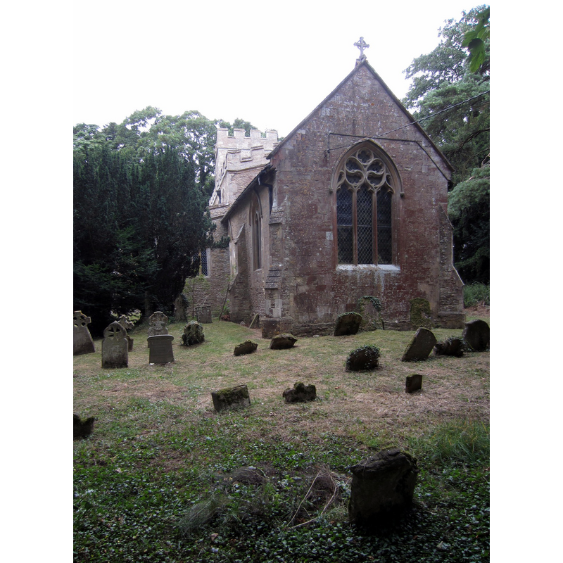
Image copyright © Philip Jeffrey, 2013
CC-BY-SA-2.0
Results: 4 records
view of church exterior - southeast view
Copyright Statement: Image copyright © Philip Jeffrey, 2013
Image Source: digital photograph taken 14 August 2013 by Philip Jeffrey [www.geograph.org.uk/photo/3599811] [accessed 22 February 2016]
Copyright Instructions: CC-BY-SA-2.0
design element - patterns - tracery

Scene Description: on the panels of the basin

design element - motifs - floral - rosette
Scene Description: on some of the panels of the underbowl chamfer
design element - architectural - arch - Ogee
Scene Description: several, on the sides of the stem of the base
INFORMATION
Font ID: 10593HAR
Object Type: Baptismal Font1
Font Century and Period/Style: 15th century, Perpendicular
Church / Chapel Name: Parish Church of the Assumption of the Blessed Virgin Mary [aka St. Mary's]
Font Location in Church: Inside the church
Church Patron Saint(s): The Assumption of St. Mary
Church Notes: This church has been under the care of the Friends of Friendless Churches since 1982
Church Address: Hardmead, Milton Keynes MK16 9JY
Site Location: Buckinghamshire, South East, England, United Kingdom
Directions to Site: Located off (N) the A422, 7 km SE of Olsney, 9 km NE of Newton-Pagnell
Ecclesiastic Region: Diocese of Oxford
Historical Region: Hundred of Mulsoe [in Domesday] -- Hundred of Newport
Additional Comments: recycled font / re-cut font
Font Notes:
Click to view
There are two entries for Hardmead [variant spelling] in the Domesday survey [http://opendomesday.org/place/SP9347/hardmead/] [accessed 22 February 2016], one of which mentions a church in it. Sheahan (1862) notes: "the font is large and ancient". The Victoria County History (Buckingham, vol. 4, 1927) notes: "The octagonal font is of the 15th century" [NB: cf. Index entry for Harmead No. 1 for the fragment of an earlier font in this church] . Noted in Pevsner (1960): "Font. Perp, with elaborate tracery, rosette, etc., patterns, much re-cut." The Friends of Friendless Churches site [www.friendsoffriendlesschurches.org.uk] informs: "The font is medieval and carved in clunch (hard chalk)".
COORDINATES
UTM: 30U 661859 5776977
Latitude & Longitude (Decimal): 52.1196, -0.6358
Latitude & Longitude (DMS): 52° 7′ 10.56″ N, 0° 38′ 8.88″ W
MEDIUM AND MEASUREMENTS
Material: stone, limestone (clunch)
Font Shape: octagonal, mounted
Basin Interior Shape: round
Basin Exterior Shape: octagonal
LID INFORMATION
Date: modern
Material: wood
Apparatus: no
REFERENCES
- Victoria County History [online], University of London, 1993-. URL: https://www.british-history.ac.uk.
- Pevsner, Nikolaus, Buckinghamshire, Harmondsworth: Penguin, 1960, p. 156