Hardwick nr. Cambridge / Harduic
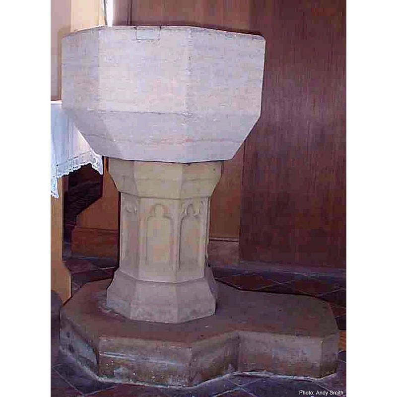
Image copyright © Andy Smith [2005?]
CC-BY-SA-3.0
Results: 5 records
view of font
Copyright Statement: Image copyright © Andy Smith [2005?]
Image Source: www.hardwick-cambs.org.uk/church/history.htm
Copyright Instructions: CC-BY-SA-3.0
view of church exterior - southeast view
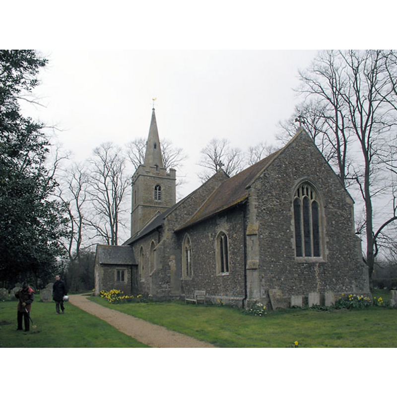
Copyright Statement: Image copyright © Mark Ynys-Mon, 2004
Image Source: digtal photograph by Mark Ynys-Mon, 2004, in Cambridgeshire Churches [http://www.druidic.org/camchurch/churches/hardwick.htm] [accessed 27 October 2007]
Copyright Instructions: Standing permission
view of font in context
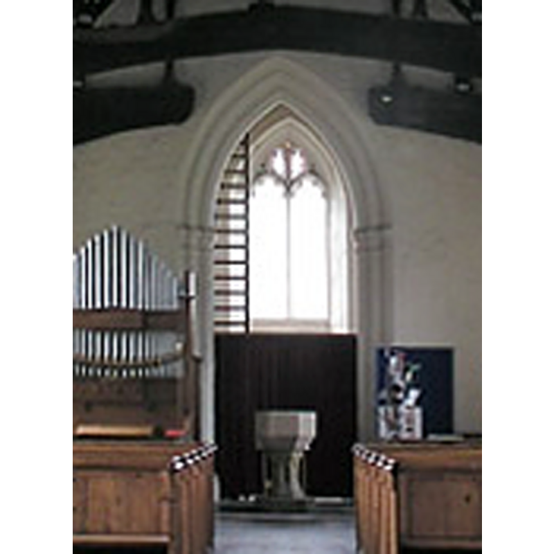
Copyright Statement: Image copyright © Mark Ynys-Mon, 2004
Image Source: detail of a digtal photograph by Mark Ynys-Mon, 2004, in Cambridgeshire Churches [http://www.druidic.org/camchurch/churches/hardwick.htm] [accessed 27 October 2007]
Copyright Instructions: Standing permission
view of church interior - nave - looking west
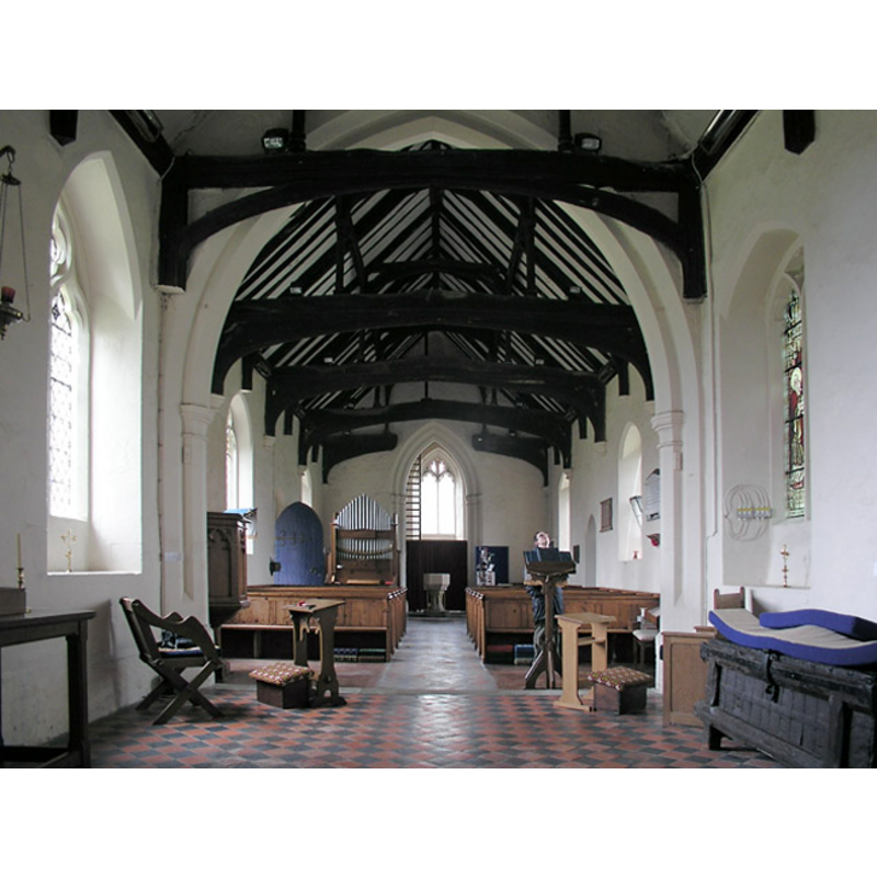
Copyright Statement: Image copyright © Mark Ynys-Mon, 2004
Image Source: digtal photograph by Mark Ynys-Mon, 2004, in Cambridgeshire Churches [http://www.druidic.org/camchurch/churches/hardwick.htm] [accessed 27 October 2007]
Copyright Instructions: Standing permission
design element - architectural - window - trefoiled - 8
Copyright Statement: Image copyright © Andy Smith [2005?]
Image Source: www.hardwick-cambs.org.uk/church/history.htm
Copyright Instructions: CC-BY-SA-3.0
INFORMATION
Font ID: 10485HAR
Object Type: Baptismal Font1
Font Century and Period/Style: 13th century [basin only] [re-tooled] [composite font], Medieval [composite]
Church / Chapel Name: Parish Church of St. Mary
Font Location in Church: Inside the church, in the W end of the nave
Church Patron Saint(s): St. Mary the Virgin
Church Address: Main Street, Hardwick, Cambridgeshire CB3 7QS
Site Location: Cambridgeshire, East, England, United Kingdom
Directions to Site: Located off (S) the A428, 9 km W of Cambridge
Ecclesiastic Region: Diocese of Ely
Historical Region: Hundred of Longstowe
Additional Comments: recycled font? / re-tooled basin surface? (is the base modern?)
Font Notes:
Click to view
There is an entry for this Hardwick [variant spelling] in the Domesday survey [http://opendomesday.org/place/TL3758/hardwick/] [accesse 12 May 2016], but it mentions neither cleric nor church in it. Paley's Guide (1844) notes: "The font is octagonal and tolerably good." The RCHM (1968) notes: "Octagonal bowl with splayed underside, possibly 13th-century, retooled, on modern base." The Victoria County History (Cambridge..., vol. 5, 1973) notes: "A church at Hardwick was recorded in 1217 [...] All except the vestry, which is modern, are to a unified design of c. 1400, which incorporated one early-14th-century window, presumably from an earlier church on the site, in the south wall of the chancel"; no font is mentioned in the VCH entry. The present font is described and illustrated in the Parish web site [www.hardwick-cambs.org.uk/church/history.htm] ("following information [...] largely taken, with permission, from a booklet 'A Brief History of the Parish Church of St Mary's Hardwick', by Martin Hay, which is available in the church"): "The font of an octagonal bowl with splayed [chamfered] underside is possibly 13th century. It used to have a richly carved wooden surround." The baptismal font consists of an octagonal basin with vertical sides and chamfered underbowl, both plain; there is a repair to the upper rim side, which indicates damage due probably to an old cover staple, and the surface of the basin may have been re-tooled, especially when its condition is compared to that of the base; the stem of the base has an upper part that almost replicates the shape of the basin, followed down by an octagonal pillar decorated with a tall trefoil window on each panel; the splaying lower base is octagonal and plain. Octagonal plinth with kneeling stone extension on one of the sides.
Credit and Acknowledgements: We are grateful to Chris Ford, of St Mary's Parish, and to Mark Ynys-Mon, of Cambridgeshire Churches, for the photographs of church and font.
COORDINATES
UTM: 31U 295474 5788458
Latitude & Longitude (Decimal): 52.20855, 0.006496
Latitude & Longitude (DMS): 52° 12′ 30.78″ N, 0° 0′ 23.39″ E
MEDIUM AND MEASUREMENTS
Material: stone
Font Shape: octagonal, mounted
Basin Interior Shape: round
Basin Exterior Shape: octagonal
REFERENCES
- Victoria County History [online], University of London, 1993-. URL: https://www.british-history.ac.uk.
- Great Britain. Royal Commission on Historical Monuments (England), An inventory of historical monuments in the County of Cambridge, Woking; London: Printed in England for Her Majesty's Stationary Office by Unwin Brothers Unlimited, 1968, vol. 1: 129
- Paley, Frederick Apthorp, The Ecclesiologist's guide to the churches within a circuit of seven miles round Cambridge, with introductory remarks, London; Cambridge: J. van Voorst; Metcalfe and Palmer, 1844, p. 17