Packwood
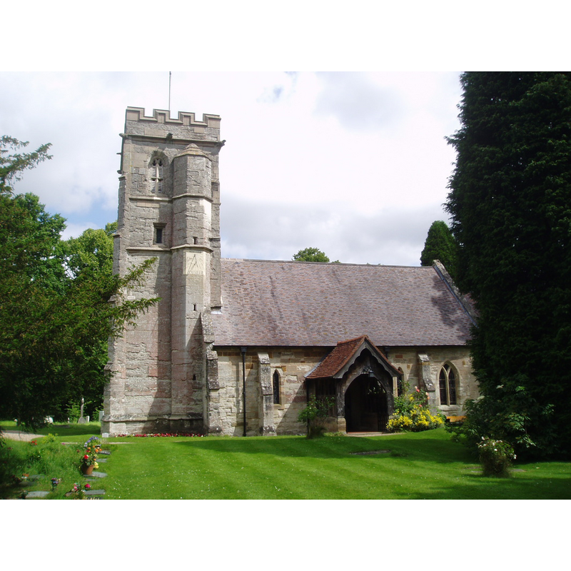
Image copyright © Aidan McRae Thomson, 2015
Standing permission
Results: 2 records
view of church exterior - south view
Scene Description: PHOTOS digital photograph taken by Aidan McRae Thomson [http://warwickshirechurches.weebly.com/packwood---st-giles.html] [accessed 12 January 2015]
Copyright Statement: Image copyright © Aidan McRae Thomson, 2015
Image Source: digital photograph taken by Aidan McRae Thomson [http://warwickshirechurches.weebly.com/packwood---st-giles.html] [accessed 12 January 2015]
Copyright Instructions: Standing permission
view of church interior - nave - looking east
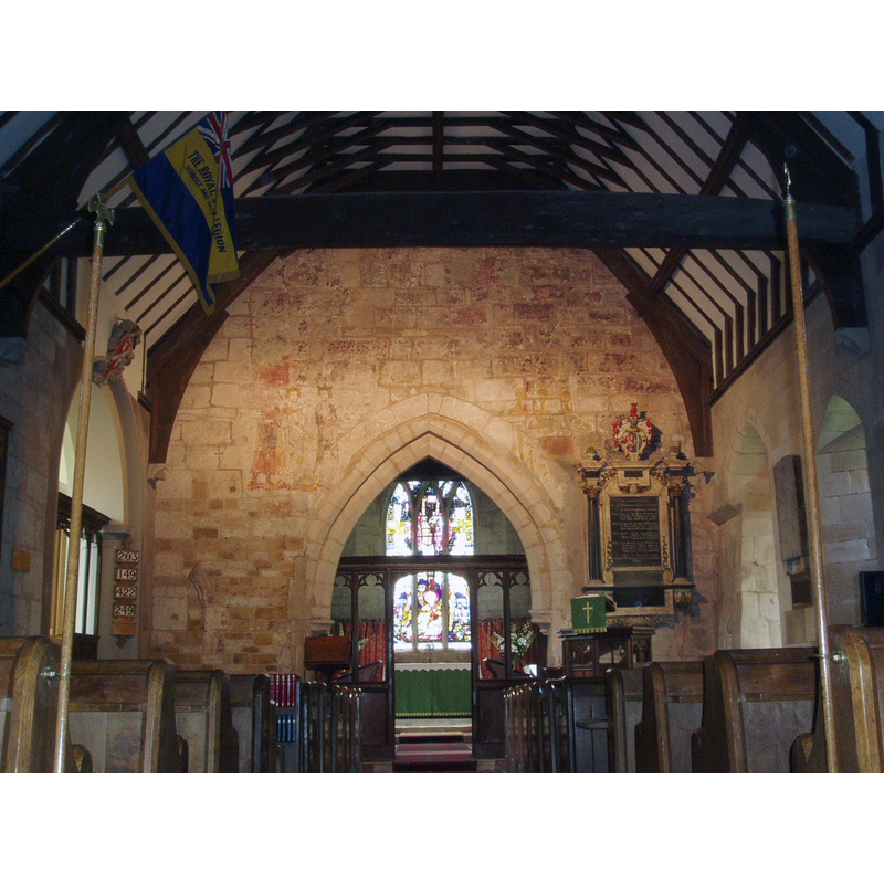
Copyright Statement: Image copyright © Aidan McRae Thomson, 2015
Image Source: digital photograph taken by Aidan McRae Thomson [http://warwickshirechurches.weebly.com/packwood---st-giles.html] [accessed 12 January 2015]
Copyright Instructions: Standing permission
INFORMATION
Font ID: 10444PAC
Object Type: Baptismal Font1
Font Century and Period/Style: 13th century (late?) [basin only] [composite font], Medieval [composite]
Church / Chapel Name: Parish Church of St. Giles
Font Location in Church: Inside the church, at the W end of the nave
Church Patron Saint(s): St. Giles [aka Aegidus, Egidus, Gilles]
Church Address: Glasshouse Lane, Packwood, Solihull, Packwood, West Midlands, B94 6PU
Site Location: Warwickshire, West Midlands, England, United Kingdom
Directions to Site: Located 8 km NE of Henley-in-Arden
Ecclesiastic Region: Diocese of Birmingham
Historical Region: Hundred of Kington
Additional Comments: altered font (only basin is original; stem and base are modern replacements] -- re-cycled font: served as water trough in local farmyard MUST USE
Font Notes:
Click to view
We found no entry for Packwood in the Domesday survey. The Victoria County History (Warwick, vol. 5, 1949) notes: "The church of Packwood was a chapel of Wasperton, served by a priest, for whose salary the small tithes and certain glebe lands were assigned. [...] In 1535 it was called a parish church, the stipendiary priest then receiving £5 yearly [...] The nave and chancel date from the end of the 13th century and the west tower was added late in the 15th century [...] The font, probably of the late 13th century, has a tapering round bowl with a rim mould round the top. The octagonal stem and base are modern." David Ross [www.britainexpress.com/attractions.htm?attraction=5072] [accessed 12 January 2015] writes: "At the west end of the nave is a simple 12th century font on a Victorian base. This font is almost certainly older than the church itself. It was found serving as a watering trough for animals in local farmyard and rescued!"
COORDINATES
UTM: 30U 585000 5801046
Latitude & Longitude (Decimal): 52.353105, -1.751978
Latitude & Longitude (DMS): 52° 21′ 11.18″ N, 1° 45′ 7.12″ W
MEDIUM AND MEASUREMENTS
Material: stone
Font Shape: round, mounted
Basin Interior Shape: round
Basin Exterior Shape: round
REFERENCES
- Victoria County History [online], University of London, 1993-. URL: https://www.british-history.ac.uk.