Whitchurch nr. Haverdfordwest / Tregroes nr. Solva
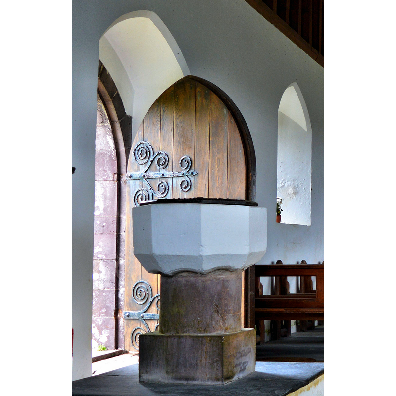
Image copyright © Philip Pankhurst, 2015
CC-BY-SA-2.0
Results: 4 records
view of font and cover
Scene Description: the composite baptismal font: a late-medieval basin raised on a modern pedestal base
Copyright Statement: Image copyright © Philip Pankhurst, 2015
Image Source: edited detail of a digital photograph taken 16 July 2015 by Philip Pankhurst [www.geograph.org.uk/photo/4586767] [accessed 27 August 2018]
Copyright Instructions: CC-BY-SA-2.0
view of church exterior - northwest view
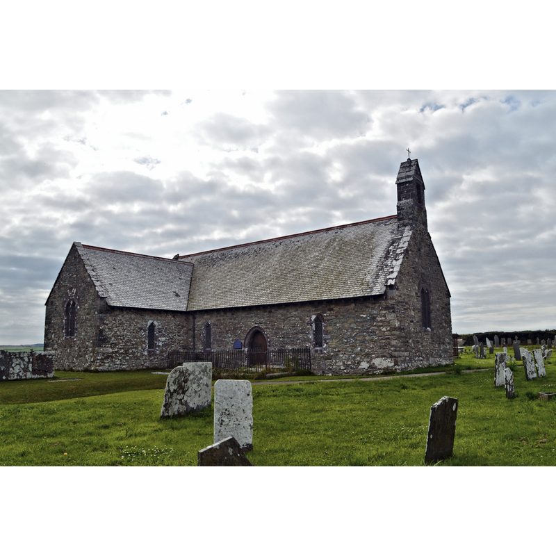
Scene Description: Source caption: "St David, Whitchurch. Small and beautifully kept, this which was the original parish church of Solva. It was rebuilt between 1872 and 1874 by C.E. Buckeridge, who died before it was finished. The work was completed by John Loughborough Pearson, no less."
Copyright Statement: Image copyright © Philip Pankhurst, 2015
Image Source: digital photograph taken 16 July 2015 by Philip Pankhurst [www.geograph.org.uk/photo/4586831] [accessed 27 August 2018]
Copyright Instructions: CC-BY-SA-2.0
view of church exterior - southwest view
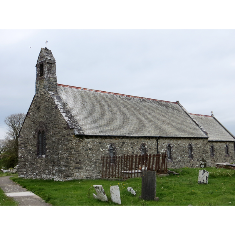
Copyright Statement: Image copyright © Peter Wod, 2013
Image Source: digital photograph taken 20 May 2013 by Peter Wood [www.geograph.org.uk/photo/3468665] [accessed 27 August 2018]
Copyright Instructions: CC-BY-SA-2.0
view of church interior - nave - looking east
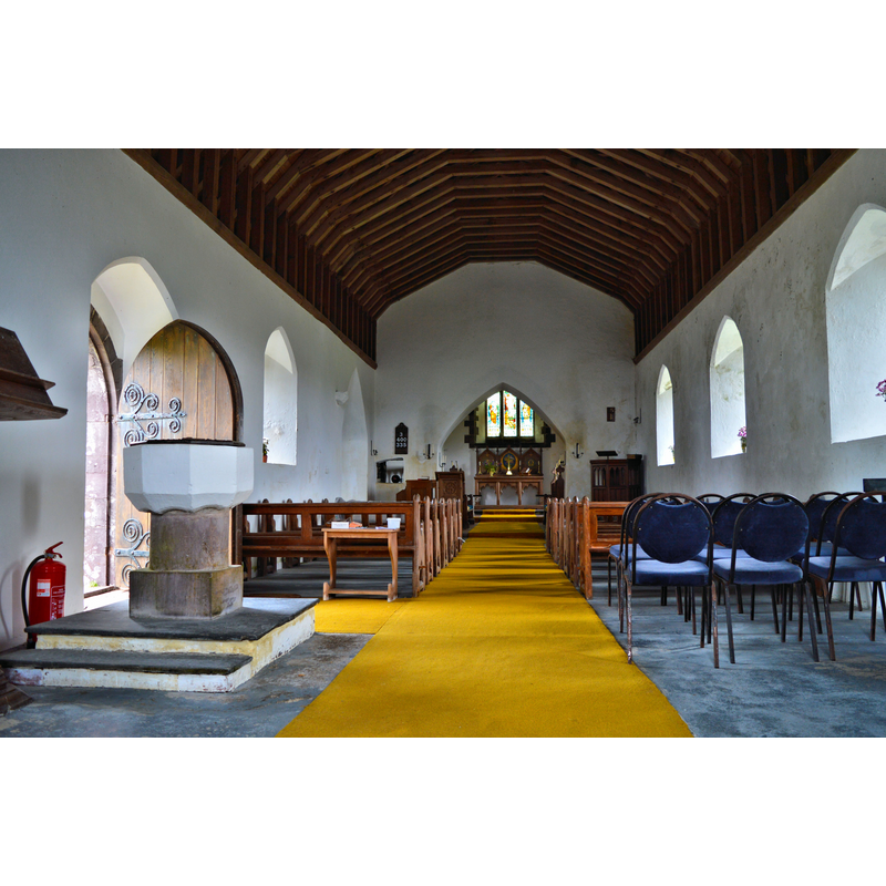
Scene Description: with the composite baptismal font in the foreground, by the north doorway
Copyright Statement: Image copyright © Philip Pankhurst, 2015
Image Source: digital photograph taken 16 July 2015 by Philip Pankhurst [www.geograph.org.uk/photo/4586767] [accessed 27 August 2018]
Copyright Instructions: CC-BY-SA-2.0
INFORMATION
Font ID: 10306WHI
Object Type: Baptismal Font1
Font Century and Period/Style: 15th - 16th century[basin only] [composite font], Late Medieval [composite]
Church / Chapel Name: Parish Church of St. David
Font Location in Church: Inside the church, at the W end of the nave, N side
Church Patron Saint(s): St. David [aka David of Wales, Davidus, Dewy]
Church Notes: original medieval church re-built in the 19thC
Church Address: Whitchurch, Solva. Haverfordwest SA62 6UB, UK
Site Location: Pembrokeshire, Wales, United Kingdom
Directions to Site: A hamlet located just N of Solva, 19 km WNW of Haverdfordwest
Historical Region: Hundred of Dewisland
Additional Comments: recycled font: late medieval basin on 19th-century base; the basin has been whitewashed
Font Notes:
Click to view
Noted n the RCAHMW (Pembroke, 1925). Described in Lloyd, etc. (2001): "Font. Plain octagonal late medieval bowl on C19 base." The plain octagonal basin, now whitewashed, stands on a round pedestal stem and quadrangular lower base, the last too modern. The wooden cover is also modern.
COORDINATES
UTM: 30U 348574 5749979
Latitude & Longitude (Decimal): 51.884048, -5.198280
Latitude & Longitude (DMS): 51° 52′ 48″ N, 5° 12′ 0″ W
MEDIUM AND MEASUREMENTS
Material: stone
Font Shape: octagonal, mounted
Basin Exterior Shape: octagonal
LID INFORMATION
Date: modern
Material: wood
Apparatus: no
Notes: flat, with metal decoration; modern
REFERENCES
- Great Britain. Royal Commission on Ancient Monuments and Constructions in Wales and Monmouthshire, An inventory of the ancient and historical monuments of the County of Pembroke, London: H.M. Stationary Office, 1925, no. 1172
- Lloyd, Thomas, Pembrokeshire, New Haven and London: Yale University Press, 2004, p. 494